Marker Logo HMdb.org THE HISTORICAL
MARKER DATABASE
“Bite-Size Bits of Local, National, and Global History”


After filtering for Hawaii, 8 entries match your criteria.  


Notable Places Topic

 
Houola Marker image, Touch for more information
By Bill Kirchner, May 22, 2013
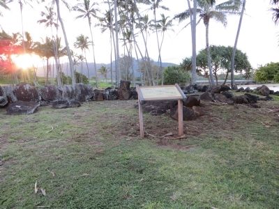
Houola Marker
1 Hawaii, Kauai County, Kapaa — Houola
On Nalu Road, 0.4 miles east of Leho Drive when traveling north.
2 Hawaii, Kauai County, Kapaa — Maunakapu and Wailua RiverWailua Heritage Trail — Preserving the culture and history of the Wailua River Valley —
Near Hawaii Route 580, 1.7 miles west of Hawaii Route 56, on the left when traveling west.
3 Hawaii, Kauai County, Kapaa — Poli'auh Heiau
On Route 580, 1.4 miles west of Hawaii Route 56, on the left when traveling west.
4 Hawaii, Kauai County, Kapaa — Wai'ale'aleWailua Heritage Trail — Preserving the culture and history of the Wailua River Valley —
Near Hawaii Route 580, 1.7 miles west of Hawaii Route 56, on the left when traveling west.
5 Hawaii, Kauai County, Poipu — 3 — Hanaka‘ape Bay & Kōloa LandingKōloa Heritage Trail — Ka Ala Hele Waiwai Ho‘olina o Kōloa — Preserving the Heritage of Po‘ipū & Kōloa —
On Hoonani Road east of Lawai Road, on the right when traveling east.
6 Hawaii, Kauai County, Poipu — 7 — Keoneloa BayKōloa Heritage Trail — Ka Ala Hele Waiwai Ho‘olina o Kōloa — Preserving the Heritage of Po‘ipū & Kōloa —
Near Pe‘e Road south of Poipu Road, on the left when traveling south.
7 Hawaii, Kauai County, Poipu — 7 — Sacred Fishing Grounds
Near Pe‘e Road south of Poipu Road, on the left when traveling south.
8 Hawaii, Maui County, Kula — Haleakalā National ParkSummit District
On Crater Road.
 
 
CeraNet Cloud Computing sponsors the Historical Marker Database.
This website earns income from purchases you make after using our links to Amazon.com. We appreciate your support.
Paid Advertisement
May. 18, 2024