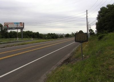
On Wilkes-Barre Township Boulevard (Business Pennsylvania Route 309) at East Northampton Street, on the right when traveling north on Wilkes-Barre Township Boulevard.
Laid out 1770 by a group of Connecticut settlers, on land claimed by that state. Seat of "County of Westmoreland," erected 1776. Near here took place the Wyoming Massacre, 1778, and the "Pennamite Wars" of 1769-72 and 1784. — — Map (db m32163) HM
On River Street north of Ransom Street, on the right when traveling north.
This church was erected
in the year 1804
It was restored in 1922
by the
Luzerne County Committee
of the
Pennsylvania Society
of
Colonial Dames of America . . . — — Map (db m105278) HM
On Main Street (U.S. 11) east of Center Avenue, on the left when traveling east.
In 1742
on or near this site
Christianity was first preached to
the Indians of Wyoming Valley
by
Count Nicholas Louis Zinzendorf
a Moravian missionary
Erected October 19, 1940 — — Map (db m261366) HM
On River Street at Chestnut Street, on the right when traveling north on River Street.
This stone marks
the first permanent settlement
in Wyoming Valley
in the summer of 1762 by a
company of pioneers from Connecticut. — — Map (db m151681) HM
On Wyoming Avenue (U.S. 11) south of Susquehanna Avenue, on the right when traveling north.
America250PA, in partnership with the Pennsylvania Freemasons, plants this certified Liberty Tree in commemoration of the original Liberty Trees, which were gathering places for Sons of Liberty during the American Revolutionary War. Ahead of the . . . — — Map (db m285284) HM
Near Lehigh Avenue (U.S. 209) at Lehigh Gorge Trail.
“Our residents take pride and partner in their heritage — they understand the meaning of what we have and act to preserve it” Delaware & Lehigh National Heritage Corridor and State Heritage Park, Management Action Plan. . . . — — Map (db m153540) HM
On Lehigh Gorge Trail 1.7 miles west of Main Street, on the right when traveling north.
“Our residents take pride and partner in their heritage — they understand the meaning of what we have and act to preserve it” Delaware & Lehigh National Heritage Corridor and State Heritage Park, Management Action Plan. . . . — — Map (db m153538) HM
On Spruce Street at North Washington Street, on the right when traveling west on Spruce Street.
Formed August 13, 1878 from Luzerne County, it was Pennsylvania's 67th and last county created. The name is an Indian word meaning "stream that forks." Scranton, the county seat, was made a city, 1866. It became the anthracite coal mining capital . . . — — Map (db m31950) HM
On East Main Street, on the right when traveling east.
Prominent Pennsylvania Republican politician and public official. Elected Luzerne County District Attorney, 1919-1926; Lieutenant Governor, 1927-1931; and Governor, 1939-1943. Served as a Judge on the Superior Court of the Commonwealth, 1933-1938, . . . — — Map (db m19093) HM
Near Main Street south of Berwick Street ( Route 940) when traveling south.
“Our residents take pride and partner in their heritage — they understand the meaning of what we have and act to preserve it” Delaware & Lehigh National Heritage Corridor and State Heritage Park, Management Action Plan. . . . — — Map (db m114641) HM
Welcome to the Delaware and Lehigh National and State Heritage Corridor, a collection of people, places and events that helped shape our great nation. Come journey through five Pennsylvania counties bursting with heritage and brimming with . . . — — Map (db m114644) HM
On Lord Avenue/Homestead Street north of Reservoir Street, on the left when traveling north.
Crystal Lake circa 1906
Crystal Lake was one of the first settlements of Fell Township. In 1818, Peter F. Ball came from New York state and built a log house near the lake. During the next decade, seven other men established homesteads . . . — — Map (db m104283) HM
On Line Street near Percy Street, on the right when traveling east.
(Left panel)
Born in Luzerne County Pennsylvania - Son of Runaway Slaves - Grew up in Springfield, Pennsylvania and was
privately tutored and mentored by a Presbyterian minister who was active in the anti-slavery movement.
Educated . . . — — Map (db m52037) HM
Alvan Markle (1861-1931) and his wife, Mary D. Markle (1868-1945) bought their "Conyngham Pass Property" from the Lehigh Coal & Land Company in 1915. They commissioned a noted architect, John Russell Pope, to design their thirty-two room home . . . — — Map (db m157494) HM
Entrepreneur Asa Parker founded the Lehigh Valley Railroad (LVRR) in 1853 to more efficiently transport anthracite coal to market. A freight and passenger station was constructed on this site in 1862. The LVRR Slatedale Branch opened in 1870 for the . . . — — Map (db m85695) HM
Welcome to Delaware and Lehigh National and State Heritage Corridor, a collection of people, places and events that helped shape our great nation. Come journey through five Pennsylvania Counties bursting with heritage and brimming with outdoor . . . — — Map (db m114643) HM
On Reynolds Avenue, on the right when traveling north.
(Front):142d Pennsylvania Infantry 1st Brigade 3rd Division 1st Corps (Back Left of Cross): Present at Gettysburg 336 Officers & Men Killed & died of wounds 4 officers 27 men Wounded 10 officers 100 men Captured or missing 2 officers . . . — — Map (db m15251) HM WM
On Hancock Avenue, on the right when traveling north.
(Front):4th Pennsylvania Cavalry 3rd Brigade. 2nd Division. Cavalry Corps. Army of the Potomac. (Back):Detached on the morning of July 2nd. from the Brigade at the junction of White Run and Baltimore Turnpike. Ordered to report to . . . — — Map (db m15843) HM WM
On the Union Public Boat Launch Access Road south of U.S. 11, on the right when traveling south.
Union Township of Luzerne County, formed in July 1813, originally was part of Huntington Township. It borders on the Susquehanna River and two creeks from River Mountain. Sawmills were established in 1790 in the northwest corner by brothers-in-law . . . — — Map (db m119287) HM
On Sullivan Trail (Pennsylvania Route 191) 0.1 miles south of Bangor Road ( Route 191), on the left when traveling south.
“Our residents take pride and partner in their heritage—they understand the meaning of what we have and act to preserve it”
Delaware & Lehigh National Heritage Corridor and State Heritage Park, Management Action Plan.
Welcome to . . . — — Map (db m268093) HM
“Our residents take pride and partner in their heritage—they understand the meaning of what we have and act to preserve it”
Delaware & Lehigh National Heritage Corridor and State Heritage Park, Management Action . . . — — Map (db m114642) HM
On Market Street at Pennsylvania Boulevard, on the left when traveling west on Market Street.
Built by John A. Redington, opened October 11, 1906 at the corner of East Market Street and South Pennsylvania Avenue, the seven-story, lavish hotel was designed by the prominent architectural firm of McCormick and French. The hotel contained many . . . — — Map (db m151566) HM
Near Main Street south of Berwick Street ( Route 940) when traveling south.
"Whitehaven is situated at the head of the Lehigh Navigation, and some eight or ten miles above the commencement of the coal formation. Its trade is therefore confined to the running of lumber; and this, judging from the number of sawmills in the . . . — — Map (db m114617) HM
On River Street north of Jackson Street, on the left when traveling north.
"Every boy represents a human soul; a character forming for eternity. The life for the next few years will decide his future... Many a man who beats his life out behind prison bars is a victim of misdirected energy. Truly, the wealth of a . . . — — Map (db m110495) HM
Patrick J. O'Connor
1903-1958
Patrick J. O'Connor was a distinguished scholar, speaker and attorney. He was valedictorian of his college St. Bonaventure. He was valedictorian and editor-in-chief of the Law Review at Georgetown University . . . — — Map (db m110466) HM
On Pennsylvania Route 487 at Mehoopany Creek, on the left when traveling north on Pennsylvania Route 487.
The town of Ricketts was a major lumber town named after civil war veteran and Gettysburg hero Colonel Robert Bruce Ricketts of Wilkes-Barre. After the war, Ricketts purchased 65,000 acres of virgin forest land in Sullivan, Wyoming and Luzerne . . . — — Map (db m202963) HM
On Sgt Stanley Hoffman Boulevard (U.S. 209) north of North Main Lane, on the right when traveling north.
“Our residents take pride and partner in their heritage—they understand the meaning of what we have and act to preserve it”
Delaware & Lehigh National Heritage Corridor and State Heritage Park, Management Action . . . — — Map (db m116343) HM
On River Drive (Pennsylvania Route 148) at River Drive, on the right when traveling north on River Drive.
“Our residents take pride and partner in their heritage—they understand the meaning of what we have and act to preserve it”
Delaware & Lehigh National Heritage Corridor and State Heritage Park, Management Action . . . — — Map (db m124051) HM
On Woodlawn Avenue (Pennsylvania Route 437) 1.2 miles south of Church Road, on the left when traveling south.
“Our residents take pride and partner in their heritage—they understand the meaning of what we have and act to preserve it”
Delaware & Lehigh National Heritage Corridor and State Heritage Park, Management Action Plan.
Welcome to . . . — — Map (db m289326) HM
On Public Square east of West Market Street, on the right when traveling west.
In Memory of
James J. Burke
(1928 - 2015)
A native son of Wilkes-Barre and a member of the first graduating class of King's College (founded in 1946 to educate the sons of coal miners), Jim later served his beloved alma mater as . . . — — Map (db m252326) HM
On River Street north of Union Street, on the left when traveling north.
To those who served
and those who gave their
lives in South-East Asia during
the Vietnam War 1960 - 1975
[Roll of Honored Dead]
Description of the Sculpture for
the Vietnam Veterans Memorial
This Monument of the Vietnam War Memorial . . . — — Map (db m110430) WM
In 1681 the King of England granted the land, that is presently
Pennsylvania, to William Penn and his family. Although this
transaction had occurred, settlers from areas of Connecticut
established many land claims in the Northeast portion . . . — — Map (db m276892) HM
Thin black lines indicate changes in relevance. Between each pair of lines entries are ordered geographically but all have the same relevance.
* Inflectional forms of words are their plurals, singulars, and possessives as well as gramatical tenses and similar variations.