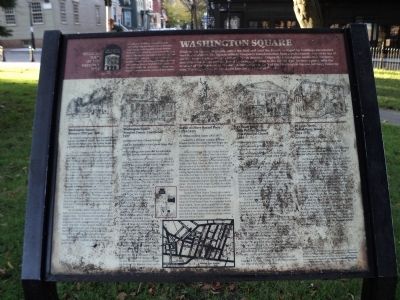
On Washington Square, on the left when traveling east.
Washington Square, originally called the Mall and later the Parade, is ringed by buildings constructed over two centuries. The Square reflects Newport’s transformation from a rudimentary outpost to one of the five major trading posts in colonial . . . — — Map (db m48545) HM
On Bellevue Avenue at Leroy Avenue, on the left when traveling south on Bellevue Avenue.
The buildings surrounding Chateau-sur-Mer capture the spirit of Newport in the High Victorian era. This block preserves one of the greatest concentrations of Victorian architecture and landscape design in Newport from the period 1850 to 1890. The . . . — — Map (db m48609) HM
On Broadway just north of Stone Street, on the left when traveling south.
In Honor of the late Jean E. Hicks
Founder of the New Visions for Newport County, Inc. Community Health Center in 1972
Executive Director of New Visions from 1986 to 1994
In recognition of her outstanding service and commitment to . . . — — Map (db m251398) HM
On Bellevue Avenue north of Rovensky Avenue, on the right when traveling south.
Endowed with spectacular natural scenery and a gentle climate, Newport was a gardener’s paradise. This section of Bellevue Avenue reflects the rich horticultural heritage of the city and centuries of garden design, estate development, and land . . . — — Map (db m48616) HM
On Marlborough Street at Farewell Street, on the left when traveling east on Marlborough Street.
In 1639, Helen and Nicholas Easton, John Clarke, William Coddington and others left Portsmouth, the settlement founded in 1638 by Anne Hutchinson and others on the northern end of Aquidneck Island. They came south and founded Newport. Newport’s . . . — — Map (db m48498) HM
On Washington Square, on the right when traveling east.
Because of its commitment to religious toleration, Newport had no established church during the colonial period. There was no Puritan meeting house on the town square as was the norm elsewhere in New England. Instead, the Colony House and the Brick . . . — — Map (db m48556) HM
On Touro Street at Division Street, on the right when traveling south on Touro Street.
The results of the religious toleration upon which Newport was founded are nowhere more evident than in the houses of worship clustered within a few hundred feet of this location: Touro Synagogue, the Seventh Day Baptist Meeting House, the United . . . — — Map (db m48580) HM
On Mount Vernon Street north of Barney Street, on the right when traveling south.
Site of First Catholic Church in Rhode Island
1828
Final resting place of many of Newport's earliest Irish residents.
The oldest marked burial is 1830, the most recent 1853.
Although Rhode Island is well known for its . . . — — Map (db m223110) HM
Near Battery Lane 0.2 miles west of Beavertail Road, on the right when traveling south.
Conanicut Battery
On Prospect Hill
A National Historic Site
In this National Historic Site are lasting relics of Jamestown's past and America's heritage.
⚓
Circa 1400
Evidence of a native American . . . — — Map (db m312030) HM
Near West Main Road (Rhode Island Route 77) south of Fairfields Drive, on the right when traveling north.
An Apology and a Promise
The Little Compton Historical Society recognizes the harm done to the Wampanoag people by Little Compton's European settlers. We apologize for our part in that harm, and we are working to repair some of the damage . . . — — Map (db m312222) HM
On School Street just north of Mary Street, on the right when traveling north.
School Street runs through land designated by colonial Governor Walter Clarke as "school land," and hence its name. It was gradually filled in with houses during the 19th century. When it was originally built, the Channing House at #24 stood on a . . . — — Map (db m251379) HM
On Pelham Street just east of Touro Park Street West, on the left when traveling east. Reported permanently removed.
Beyond Bellevue Avenue there were several other summer colonies in Newport. The neighborhood to the east of Touro Park attracted the literary, artistic, and scientific minds gathered around one woman—Julia Ward Howe. Howe, the author of the . . . — — Map (db m310979) HM
Thin black lines indicate changes in relevance. Between each pair of lines entries are ordered geographically but all have the same relevance.
* Inflectional forms of words are their plurals, singulars, and possessives as well as gramatical tenses and similar variations.