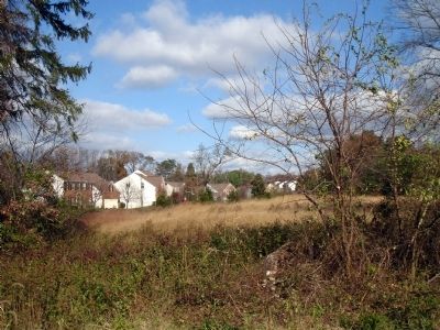
Lorton in Fairfax County, Virginia — The American South (Mid-Atlantic)
Mount Air Historic Site
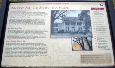
Mount Air: The Story of a Home
Keeping it in the Family
The McCarty’s who built Mount Air, were an important Virginia family. Dennis McCarty patented the land where you stand in 1727. Dennis McCarty served as Sheriff, Justice of the Peace, a vestryman from Truro Parish and was a representative in the Virginia House of Burgesses. He married George Washington’s cousin, Sarah Ball in 1724.
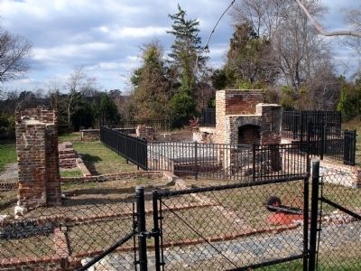
By 1732, the McCarty’s had a house and garden on the property. There was also a public warehouse on his land, used to store produce that would have been shipped to England. Many generations of McCarty descendants continued to live in the house. In about 1850, the house was damaged by fire for the first time. We learned this through archaeology and historical documents. The house was rebuilt or repaired and sold out of the family in 1860.
On the Verge of War
In 1860, Aristides Landstreet, his wife Mary, and his family moved into Mount Air. When the Civil War started, Aristides enlisted with the Confederate Army. For a time his family remained at Mount Air, near the shifting lines of Confederate and Union troops. Finally, the estate was occupied by Union troops, and the family relocated for the duration of the war. The house and the lands suffered greatly as a result of the war. The property value declined over the years and after Aristides died in 1910, his daughters were forced to mortgage and subsequently to sell the property in 1914.
From Home to Historic Site
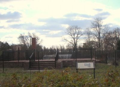
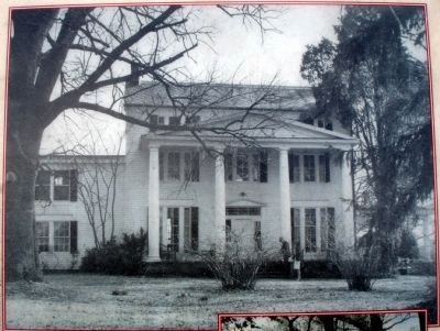
In 1914, George (sic) Shirley Kernan purchased Mount Air. In 1918, Mrs. Kernan made the grounds available as quarters for the Army men who were constructing a railroad to Camp Humphreys (now Fort Belvoir). Abandoned lumber from this encampment was used to panel one of the rooms in the main house and to construct a garage. In 1962, Mrs. Kernan left the estate to her daughter, Elisabeth Enochs. Although Elisabeth traveled extensively in her work for the Children’s Bureau and as a journalist, her home remained at Mount Air. Sometime in the 1960s, Elisabeth began exploring means of preserving Mount Air. In 1969 the main house was registered with the Fairfax County Historic Landmarks Survey. Several weeks after Elisabeth died in May of 1992, the main house at Mount Air was completely consumed by fire.
(Sidebar):
Mount Air: A Journey Through Time
1727 Dennis McCarty is granted a
patent for a 522 acre tract on Accotink Creek.
1732 Bill of lading for plants from England probably for Mount Air (but unknown).
1758 Mount Air deeded to Daniel McCarty.
1792 Property passes to his wife Sinah McCarty.
1798 Property bequeathed to Daniel McCarty the younger.
c.1814 Sarah McCarty Chichester buys Mount Air.
1826 Property bequeathed to Pitt Chichester.
1828 Pitt Chichester deeds Mount Air to wife, Francis Chichester.
1850? House seriously damaged by fire.
1860 Francis Chichester sells Mount Air to Aristides Landstreet.
1862? Mount Air occupied by Union troops; Landstreets relocate.
1910 Mount Air bequeathed to Landstreet daughters.
1914 Mount Air sold to Mrs. George Shirley Kernan.
1918 304th Regiment camps at Mount Air.
1962 Mount Air bequeathed to daughter Elisabeth Enochs.
1984 Mount Air Historic District designated by Office of Comprehensive Planning.
1992 Elisabeth Enochs dies; main house destroyed by fire.
1997 Mount Air Historic Site conveyed to Fairfax County Park Authority.
Erected by Fairfax County Park Authority.
Topics. This historical marker is listed in these topic lists: Colonial Era • Law Enforcement • Settlements & Settlers • War, US Civil. A significant historical month for this entry is May 1992.
Location. 38° 43.427′ N, 77° 10.552′ W. Marker is in Lorton, Virginia, in Fairfax County. Marker can be reached from Fisher Woods Drive. Touch for map. Marker is in this post office area: Lorton VA 22079, United States of America. Touch for directions.
Other nearby markers. At least 8 other markers are within 2 miles of this marker, measured as the crow flies. Mount Air (within shouting distance of this marker); Telegraph Road (approx. 0.4 miles away); John J. Kingman Road Crossing (approx. 0.6 miles away); Newington (approx. ¾ mile away); Facility 2298, Rail Bridge (approx. 1.2 miles away); Old Telegraph Line (approx. 1.3 miles away); a different marker also named Old Telegraph Line (approx. 1.4 miles away); Pohick Church (approx. 1.4 miles away). Touch for a list and map of all markers in Lorton.
More about this marker. The marker features two photographs captioned, Mount Air, ca. 1960 and Mount Air Engulfed in Flames, May 19, 1992.
On the lower right of the marker are credit notes: Much of what we know about Mount Air is the result of the research of Edith Moore Sprouse (1924-2004) which resulted in the publication of Mount Air: Fairfax County Virginia in 1970.
Another source of information is the photographic images and copies of Mount Air before it burned. We are particularly indebted to William Edmund Barrett for his art and technique.
A third source is the result of archaeological research conducted by the staff of, and consultants to, the Resource Management Division of the Fairfax County Park Authority.
Photograph of Mount Air engulfed in flames, May 19, 1992. Photo: Steve and Jackie McNeal. Published in the Fairfax Chronicles, Volume 15, 1993, Page 1.
Also see . . .
1. Mount Air Historic Site. Atlas Obscura website entry (Submitted on February 19, 2024, by Larry Gertner of New York, New York.)
2. Mount Air Historic Overlay District Design Guidelines. Fairfax County PDF. (Submitted on January 18, 2009.)
Credits. This page was last revised on February 19, 2024. It was originally submitted on January 17, 2009. This page has been viewed 5,793 times since then and 207 times this year. Photos: 1, 2, 3, 4, 5. submitted on January 18, 2009. • Craig Swain was the editor who published this page.
