Washington Township near Oregonia in Warren County, Ohio — The American Midwest (Great Lakes)
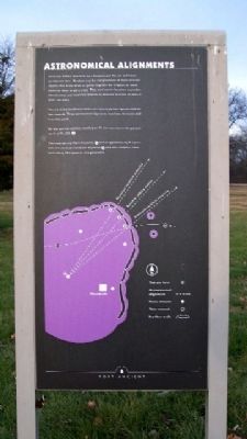
Astronomical Alignments
American Indians who built Fort Ancient used the sun and moon to measure time. By observing the rising location of these celestial objects they knew when to gather together for religious or social events or when to plant crops. They used sunrise locations to predict annual events and moonrise location to measure intervals of several years' duration.
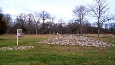
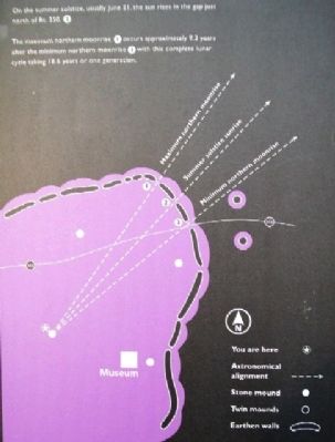
You are at the southwest corner of a nearly perfect square made by four mounds. Three astronomical alignments have been demonstrated from this point.
On the summer solstice, usually June 21, the sun rises in the gap just north of Rt. 350. 2
The maximum northern moonrise 1 occurs approximately 9.3 years after the minimum northern moonrise 3 with this complete lunar cycle taking 18.6 years or one generation.
Erected by The Ohio Historical Society.
Topics. This historical marker is listed in these topic lists: Environment • Man-Made Features • Native Americans • Notable Events • Science & Medicine. A significant historical date for this entry is June 21, 1921.
Location. 39° 24.437′ N, 84° 5.416′ W. Marker is near Oregonia, Ohio, in Warren County. It is in Washington Township. Marker is about 300 feet NW of the museum and about 500 feet SW of the on Fort Ancient State Memorial entrance. Touch for map. Marker is at or near this postal address: 6123 Ohio Route 350, Oregonia OH 45054, United States of America. Touch for directions.
Other nearby markers. At least 8 other markers are within walking distance of this marker. Interpretive Stations - Trail Guide - Other Points Of Interest (about 400 feet away, measured in a direct line); Middle Fort Ditch Construction (approx. 0.2 miles away); Twin Mounds & Parallel Walls (approx. ¼ mile away); Stages of Construction / Crescent Mounds (approx. 0.4 miles away); Changes at Fort Ancient (approx. half a mile away); Fort Ancient (approx. 0.6 miles away); The Great Gateway (approx. 0.6 miles away); The Civilian Conservation Corps (approx. 0.6 miles away). Touch for a list and map of all markers in Oregonia.
Also see . . .
1. Fort Ancient Earthworks. Ohio History central website entry (Submitted on February 26, 2010, by William Fischer, Jr. of Scranton, Pennsylvania.)
2. Fort Ancient State Park. Ohio State parks website entry (Submitted on July 23, 2022, by Larry Gertner of New York, New York.)
Credits. This page was last revised on February 6, 2023. It was originally submitted on February 26, 2010, by William Fischer, Jr. of Scranton, Pennsylvania. This page has been viewed 943 times since then and 8 times this year. Photos: 1, 2, 3. submitted on February 26, 2010, by William Fischer, Jr. of Scranton, Pennsylvania.


