Pisté in Tinum, Yucatán, Mexico — The Southeast (Yucatan Peninsula)
Sacbeob 5 & 15
Roadways 5 and 15
Photographed by J. Makali Bruton, January 17, 2017
1. Sacbeob 5 & 15 Marker

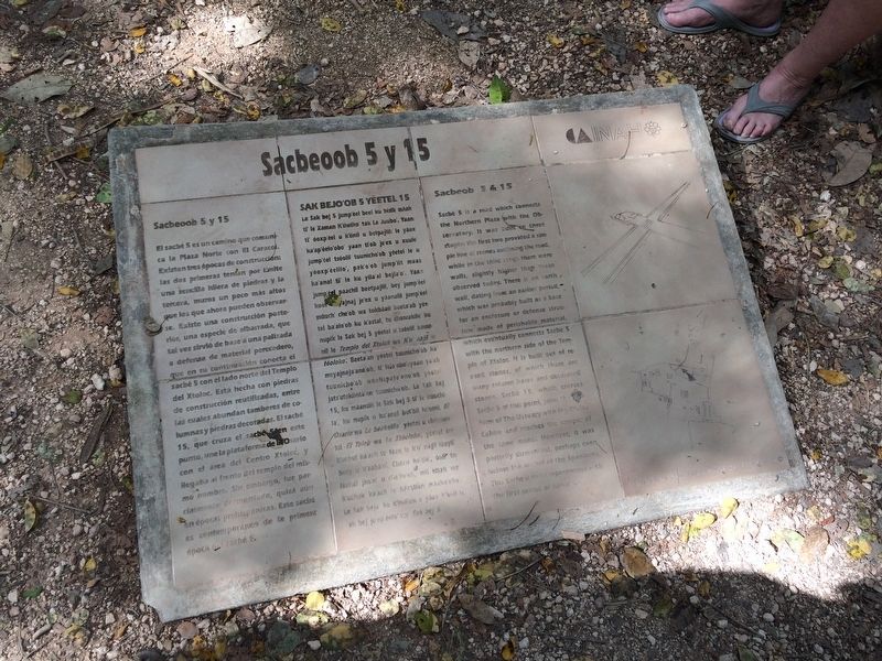
Sacbeoob 5 y 15
El sacbé 5 es un camino que comunica la Plaza Norte con el El Caracol. Existen tres épocas de construcción: las dos primeras tenían por límite una sencilla hilera de piedras y la tercera, muros un poco más altos que los ahora pueden observarse. Existe una construcción posterior, una especie de albarrada, que tal vez sirvió de base a una palizada o defensa de material perecedero, que en su continuación conecta el sacbé 5 con el lado norte del Templo de Xtoloc. Está hecha con piedras de construcción reutilizadas, entre las cuales abundan tambores de columnas y piedras decoradas. El sacbé 15, que cruza el sacbé 5 en este punto, une la plataforma de El Osario con el área del Centro Xtoloc, y llegaba al frente del templo del mismo nombre. Sin embargo, fue parcialmente desmontado, quizá aún en épocas prehispánicas. Este sacbé es contemporáneo de la primera época del sacbé 5.
Maya-Yucateco:
Le Sak bej 5 jump’éel beel ku bisik máak ti’ le Xaman K’iiwiko’ tak Le Juubo’. Yaan ti’ óoxp’éel u k’iinil u betpajlil: le yáax ka’ap’éelo’obo’ yaan ti’ob je’ex u xuule’ jump’éel tsóolil tuunicho’ob
this page online
English:
Sacbeob 5 & 15
Photographed by J. Makali Bruton, January 17, 2017
2. Sacbeob 5 & 15 Marker
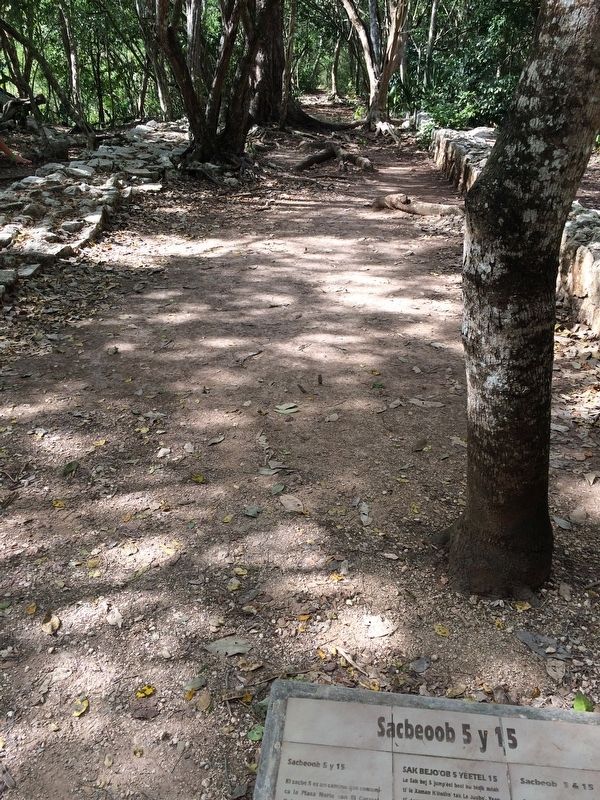
This view is towards the west and The Ossuary.
Erected by Instituto Nacional de Antropología e Historia (INAH).
Topics. This historical marker is listed in these topic lists: Anthropology & Archaeology • Indigenous Peoples and Communities • Man-Made Features • Roads & Vehicles.
Location. 20° 40.851′ N, 88° 34.136′ W. Marker is in Pisté, Yucatán, in Tinum. It can be reached from Carretera Costera de Golfo (Route 180). The marker is very near to the Temple of Xtoloc at Chichén Itzá Archaeological Site. Touch for map. Marker is in this post office area: Pisté YU 97751, Mexico. Touch for directions.

Regionally, this marker is in the Mexican Gulf Coast, in the Maya Heartland, and on the Yucatán Peninsula. Globally, it is in North America, Mesoamerica, a Gulf of Mexico state, and the Western Hemisphere. Historically, it finds itself in what was once New Spain and also a Spanish colony.
Other nearby markers. At least 8 other markers are within walking distance of this marker: Temple of Xtoloc (a few steps from this marker); Platform of the Tombs (about 120 meters away, measured in a direct line); Platform of Venus and Round Platform (about 150 meters away); The Ossuary or Tomb of the Great Priest (about 180 meters away); The Market (about 180 meters away); House of the Grinding Stones & House of the “Mestizas” (about 240 meters away); The Southeastern Colonnade (approx. 0.2 kilometers away); The Plaza of the Thousand Columns (approx. 0.2 kilometers away). Touch for a list and map of all markers in Pisté.
Credits. This page was last revised on October 19, 2022. It was originally submitted on March 12, 2017, by J. Makali Bruton of Washington, District of Columbia. This page has been viewed 386 times since then and 21 times this year. Photos: 1, 2. submitted on March 12, 2017, by J. Makali Bruton of Washington, District of Columbia.
