Near Sausalito in Marin County, California — The American West (Pacific Coastal)
The Bay Transformed
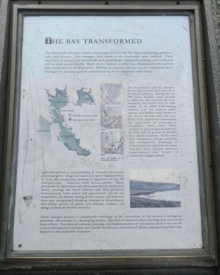
For thousands of years Native Americans lived in the Bay Area harvesting animals, salt, and acorns. The changes they made to the landscape were limited. They used fire to shape oak woodlands and grasslands. cultivated plants, and collected salt in tidal marsh ponds. More recent human activity has dramatically altered the bay ecosystem to its detriment. Efforts to protect and restore the ecosystem have emerged as we have gained understanding of its immeasurable value.
The Sacramento and San Joaquin Rivers carry eroded rock and soil to the bay as sediment. During the last 200 years humans have greatly accelerated this natural process, shrinking the overall area of tidal marsh. In the late 1800's Gold mining washed over 765 million cubic meters (one billion cubic yards) of Sierra Nevada into the bay. Early State legislation encouraged the conversion of wetlands to farmlands, while cities filled marshes to expand their boundaries. By 1950, only 25 percent of historic tidal marsh remained. At the same time, inadequate sewage treatment and unregulated dumping of industrial waste polluted the water. Together these changes seriously compromised the heath of California's largest estuary.
Attitudes shifted as understanding of wetland's invaluable processes grew. Images of reeds and egrets replaced those of mud and mosquitoes, leading to regulation of bay fill and pollution. However, other threats persist. Water diversion for agriculture and urban uses disrupt fresh water flows, altering the bay's salinity and flow patterns. Contaminants from urban and agricultural run-off are washed into the estuary during winter storms, and pollution from past unregulated dumping remains in its sediments. Non-native species of plants and animals, erosion, and rising sea level are further concerns.
These changes present a considerable challenge to the restoration of the estuary's ecological processes. Restoration is a developing science, and much is unknown about the long-term success of these efforts. Coordinated research, planning, and implementation of restoration projects are crucial to find environmental solutions that benefit the diverse community of plants, animals and people that depend on this invaluable ecosystem.
Topics. This historical marker is listed in these topic lists: Environment • Native Americans • Natural Features • Waterways & Vessels.
Location. 37° 49.938′ N, 122° 28.786′ W. Marker is near Sausalito, California, in Marin County. Marker can be reached from U.S. 101, on the right when traveling north. Touch for map. Marker is in this post office area: Sausalito CA 94965, United States of America. Touch for directions.
Other nearby markers. At least 8 other markers are within 2 miles of this marker, measured as the crow flies. The Golden Gate Bridge (a few steps from this marker); H. Dana Bowers Memorial Vista Point (within shouting distance of this marker); The Lone Sailor (within shouting distance of this marker); Strengthening an Icon (about 600 feet away, measured in a direct line); Battery Spencer (approx. ¼ mile away); Construction 129 (approx. 1.1 miles away); The Golden Gate (approx. 1.1 miles away); Battery Construction No. 129 (approx. 1.1 miles away). Touch for a list and map of all markers in Sausalito.
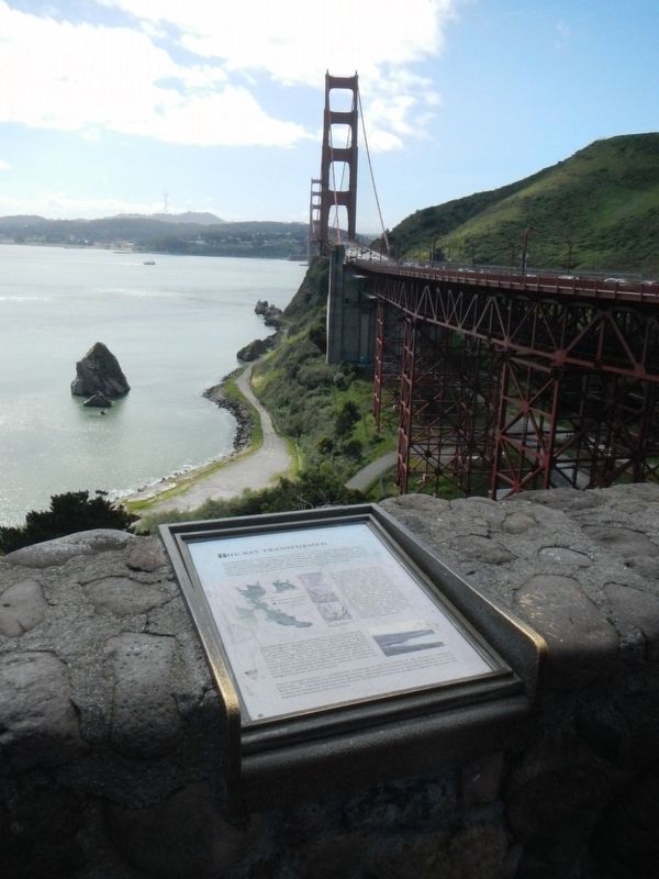
More about this marker. This marker is located at the Vista Point a the north-end of the Golden Gate Bridge.
Credits. This page was last revised on April 29, 2022. It was originally submitted on April 1, 2017, by Barry Swackhamer of Brentwood, California. This page has been viewed 350 times since then and 15 times this year. Last updated on April 4, 2017, by Alan M. Perrie of Unionville, Connecticut. Photos: 1. submitted on April 1, 2017, by Barry Swackhamer of Brentwood, California. 2. submitted on April 28, 2022, by Adam Margolis of Mission Viejo, California. 3, 4. submitted on April 1, 2017, by Barry Swackhamer of Brentwood, California. • Bill Pfingsten was the editor who published this page.


