Presidio of San Francisco in San Francisco City and County, California — The American West (Pacific Coastal)
Wetlands Renaissance
Photographed by Joel Seewald, April 4, 2019
1. Wetlands Renaissance Marker
Original "Wasteland" Filled
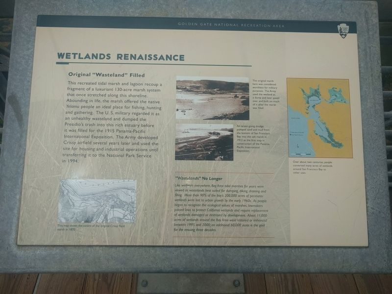
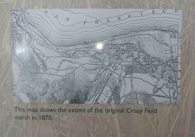
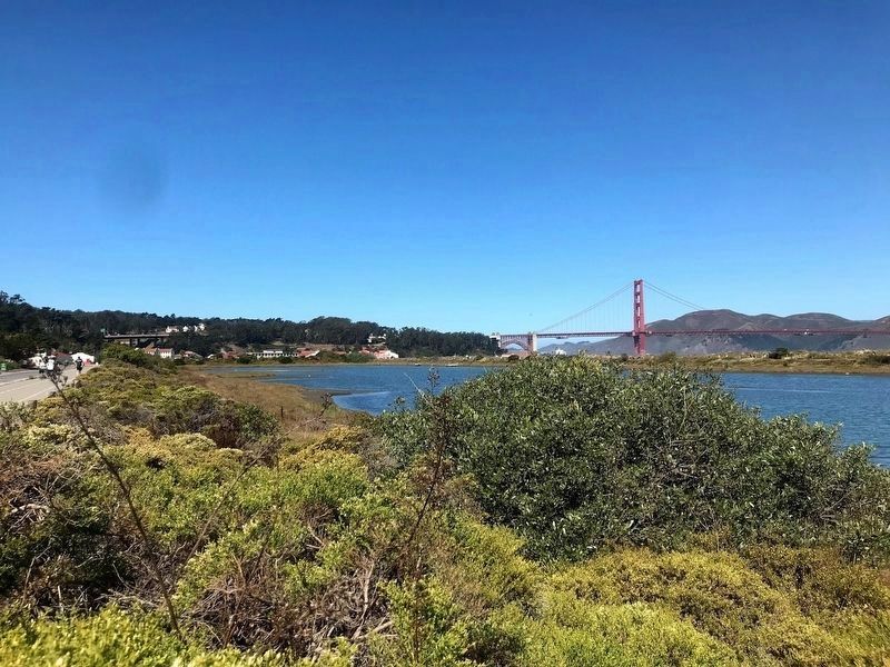
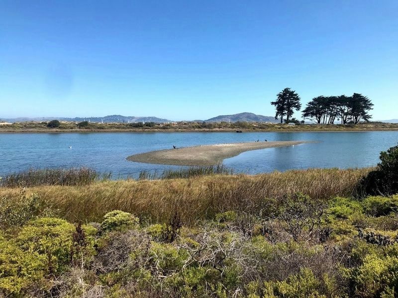
This recreated tidal marsh and lagoon recoup a fragment of a luxuriant 130-acre marsh system that once stretched along this shoreline. Abounding in life, the marsh offered the native Yelamu people an ideal place for fishing, hunting and gathering. The U.S. military regarded it as an unhealthy wasteland and dumped the Presidio's trash into this rich estuary before it was filled for the 1915 Panama-Pacific International Exposition. The Army developed Crissy airfield several years later and used the site for housing and industrial operations until transferring it to the National Park Service in 1994.
"Wastelands" No Longer
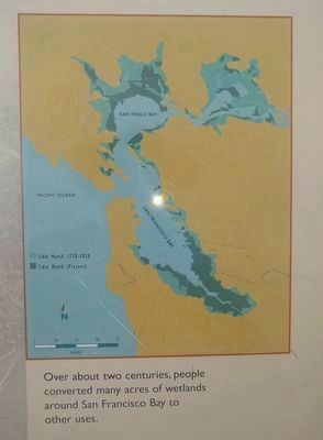
Like wetlands everywhere, Bay Area tidal marshes for years were viewed as wastelands best suited for dumping, diking, draining and filling. More than 90% of the bay's 200,000 acres of perimeter wetlands were lost to urban growth by the early 1960s. As people began to recognize the ecological values of marshes, lawmakers passed laws to protect California wetlands and require replacement of wetlands damaged or destroyed by development. About 11,000 acres of wetlands around
this page online
Erected by Golden Gate National Recreation Area, National Park Service.
Topics. This historical marker is listed in these topic lists: Environment • Indigenous Peoples and Communities • Natural Features • Waterways & Vessels. A significant historical year for this entry is 1915.
Location. 37° 48.278′ N, 122° 27.251′ W. Marker is in San Francisco, California, in San Francisco City and County. It is in Presidio of San Francisco. It is at the intersection of Mason Street and Halleck Street, on the right when traveling west on Mason Street. Marker is near the street at a bridge over the tidal marsh/lagoon. Touch for map. Marker is in this post office area: San Francisco CA 94129, United States of America. Touch for directions.

Regionally, this marker is on the Coast Ranges. It is also on the American Pacific Coast. Globally, it is in North America, on the Ring of Fire, on the Pacific Rim, in the Western Hemisphere, in the Western World, and in the Anglosphere. Historically, it
2. Left image
This map shows the extent of the original Crissy Field marsh in 1870.
Other nearby markers. At least 8 other markers are within walking distance of this marker: Homeland of the Yelamu (about 400 feet away, measured in a direct line); From Post to Park (approx. 0.2 miles away); Old and New: Presidio Fire Station (approx. ¼ mile away); Western Defense Command Headquarters (approx. ¼ mile away); Bringing A Creek Back to Life: Thompson Reach (approx. ¼ mile away); First Women in the Army: U.S. Army Nurse Corps (approx. ¼ mile away); Presidio of San Francisco (approx. ¼ mile away); French 24-Pounder (approx. ¼ mile away). Touch for a list and map of all markers in San Francisco.
Also see . . .
1. Crissy Field. Wikipedia article (Submitted on April 18, 2019, by Joel Seewald of Madison Heights, Michigan.)
2. Crissy Marsh. Article on The Presidio website. (Submitted on April 18, 2019, by Joel Seewald of Madison Heights, Michigan.)
3. Upper middle image
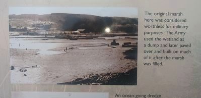
The original marsh here was considered worthless for military purposes. The Army used the wasteland as a dump and later paved over and built on much of it after the marsh was filled.
4. Lower middle image
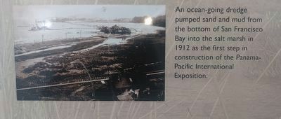
An ocean-going dredge pumped sand and mud from the bottom of San Francisco Bay into the salt marsh in 1912 as the first step in construction of the Panama-Pacific International Exposition.
5. Right image
Over about two centuries, people converted many acres of wetlands around San Francisco Bay to other uses.
Photographed by Diane Phillips
6. Crissy Field Marsh
Photographed by Diane Phillips
7. Crissy Field Marsh
Credits. This page was last revised on February 7, 2023. It was originally submitted on April 18, 2019, by Joel Seewald of Madison Heights, Michigan. This page has been viewed 356 times since then and 20 times this year. Photos: 1, 2, 3, 4, 5. submitted on April 18, 2019, by Joel Seewald of Madison Heights, Michigan. 6, 7. submitted on August 16, 2020, by Diane Phillips of Pittsburg, California.
Editor’s want-list for this marker. Far view of the marker. In other words - A wide view photo of the marker and its surroundings showing its location in context. • Can you help?
