Manchester in Richmond, Virginia — The American South (Mid-Atlantic)
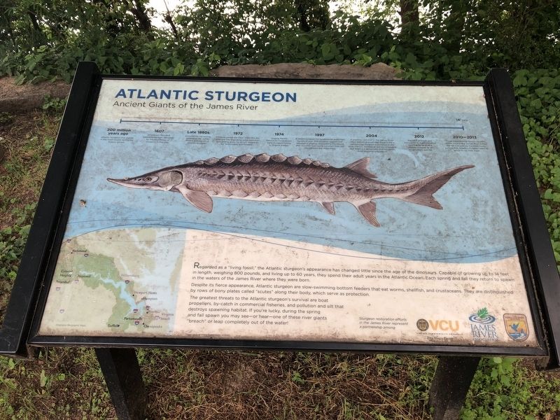
Atlantic Sturgeon
Ancient Giants of the James River
Regarded as a "living fossil," the Atlantic Sturgeon's appearance has changed little since the age of the dinosaurs. Capable of growing up to 14 feet in length, weighing 800 pounds, and living up to 60 years, they spend their adult years in the Atlantic Ocean. Each spring and fall they return to spawn in the waters of the James River where they were born.
Despite its fierce appearance, Atlantic sturgeon are slow-swimming bottom feeders that eat worms, shellfish, and crustaceans. They are distinguished by rows of bony plates called "scutes" along their body, which serve as protection.
The greatest threats to the Atlantic sturgeon's survival are boat propellers, by-catch in commercial fisheries, and pollution and silt that destroys spawning habitat. If you're lucky, during the spring and fall spawn you may see—or hear—one of these river giants "breach" or leap completely out of the water!
200 million years ago
Atlantic sturgeon first appear in the fossil record during the Triassic period.
1607
Jamestown founded. Settlers saved from starvation by the abundance of sturgeon in the river.
Late 1880s
Commercial harvesting decimates the James River's population of Atlantic sturgeon.
1972
Congress passes the Clean Water Act, the principal law regulating water pollution and setting goals for all U.S. waters to be "swimmable and fishable."
1974
Virginia Marine Resources Commission bans sturgeon fishing in Virginia waters.
1997
A reward program for commercial watermen results in over 300 sturgeon tagged and released in Virginia, discrediting the theory that sturgeon had nearly vanished from the Chesapeake Bay watershed.
2004
A yearling captured in the James River offers definitive proof that there is still a reproducing sturgeon population in the river. The U.S. Geological Survey concluded that there is a genetically distinct James River sturgeon population.
2012
National Oceanic and Atmospheric Administration lists the James River's Atlantic sturgeon as an endangered species.
2010-2013
Three experimental spawning reefs constructed in the James River below the fall line provide the clean rocky surface that Atlantic sturgeon need on which to lay their eggs.
Erected by Virginia Commonwealth University Rice Rivers Center; James River Association; U.S. Fish & Wildlife Service, U.S. Department of the Interior.
Topics. This historical marker is listed in these topic lists: Animals
Location. 37° 31.218′ N, 77° 25.111′ W. Marker is in Richmond, Virginia. It is in Manchester. Marker can be reached from Brander Street east of Manchester Road, on the left when traveling south. Touch for map. Marker is at or near this postal address: 1200 Brander Street, Richmond VA 23224, United States of America. Touch for directions.
Other nearby markers. At least 8 other markers are within walking distance of this marker. Up-River Venture (within shouting distance of this marker); Ancarrow's Landing (within shouting distance of this marker); People-Technology-Commerce-Warfare (about 300 feet away, measured in a direct line); Crossing the Atlantic (about 400 feet away); Rocketts Landing (about 500 feet away); Mechanics of Slavery (about 700 feet away); Despair of Slavery (approx. 0.2 miles away); Union Army Enters Richmond (approx. 0.2 miles away). Touch for a list and map of all markers in Richmond.
Credits. This page was last revised on February 19, 2023. It was originally submitted on May 13, 2019, by Devry Becker Jones of Washington, District of Columbia. This page has been viewed 328 times since then and 30 times this year. Photos: 1, 2. submitted on May 13, 2019, by Devry Becker Jones of Washington, District of Columbia.

