Near Ringgold in Catoosa County, Georgia — The American South (South Atlantic)
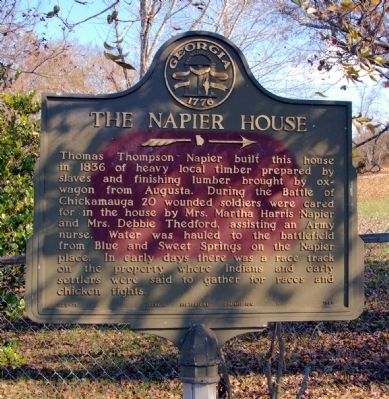
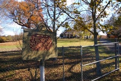
The Napier House
Erected 1955 by Georgia Historical Commission. (Marker Number 023-11.)
Topics and series. This historical marker is listed in these topic lists: African Americans • Industry & Commerce • Native Americans • Parks & Recreational Areas • Science & Medicine • Settlements & Settlers • Sports • War, US Civil • Women. In addition, it is included in the Georgia Historical Society series list. A significant historical year for this entry is 1836.
Location. 34° 52.452′ N, 85° 13.601′ W. Marker is near Ringgold, Georgia, in Catoosa County. Marker is on Burning Bush Road, 0.3 miles north of Red Belt Road / Three Notch Road, on the right when traveling north. Touch for map . Marker is at or near this postal address: 4033 Burning Bush Road, Ringgold GA 30736, United States of America. Touch for directions.
Other nearby markers. At least 8 other markers are within 3 miles of this marker, measured as the crow flies. Clarissa Hunt Plantation (approx. 1.8 miles away); Henderson Plantation (approx. 2 miles away); Peavine Church (approx. 2 miles away); Cheatham’s Division – Polk’s Corps (approx. 2 miles away); Gracie’s Brigade (approx. 2.1 miles away); Jeffress’ Virginia Battery (approx. 2.1 miles away); 65th Georgia Infantry (approx. 2.1 miles away); Preston’s Division (approx. 2.1 miles away).
Additional commentary.
1. Napier House and Indian Racetrack site
The remains of the Indian Race track are still in tact and visible and mostly undisturbed for just short of 300 years. Many artifacts remain in and around the site. It is about 1 mile oval track that was used as the Georgia Historical marker states. it would be interesting to see some interest in this area being preserved for future studies. It was also the site of several events in the War Between The States during the Battle of Chickamauga, Ga. Battlefield. Note To Editor only visible by Contributor and editor
— Submitted August 18, 2020, by Lynne Napier Rhinehart of Ringgold, 11.
Credits. This page was last revised on August 22, 2020. It was originally submitted on November 26, 2008, by David Seibert of Sandy Springs, Georgia. This page has been viewed 2,664 times since then and 62 times this year. Photos: 1, 2. submitted on November 26, 2008, by David Seibert of Sandy Springs, Georgia. • Craig Swain was the editor who published this page.

