Near Granite City in Madison County, Illinois — The American Midwest (Great Lakes)
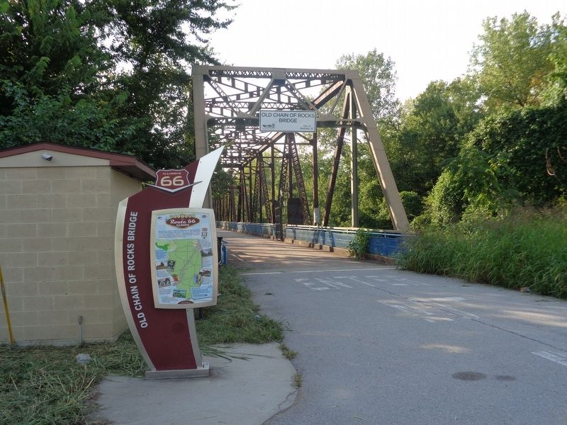
Old Chain of Rocks Bridge
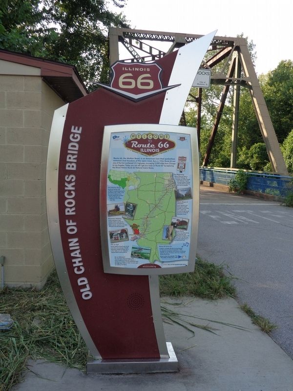
Welcome to Route 66 Illinois
Route 66, the Mother Road, is an American icon that symbolizes romance and freedom of the open road. Born in 1926, Route 66 was one of the first numbered U.S. highways, journeying 2,500 miles from Chicago to Los Angeles. Today, you can still "get your kicks on Route 66" by exploring the Illinois Historic Route 66 National Scenic Byway.
The Mother Road
Route 66 was the road of flight for people escaping the Dust Bowl in the 1930s. It was the route of adventure for families seeking the wonders of the Southwest and California in the 1950s and '60s.
Roadside Oddities
Quirky attractions lured travelers off the road with the promise of fun and adventure. Explore giants, museums, and other attractions that still exist today.
Fill 'er Up?
Service stations along Route 66 did more than just pump gas. Friendly attendants assisted travelers with a smile. Today, you can rediscover several historic service stations.
On to Missouri
The Old Chain of Rocks Bridge is the scenic endpoint of Route 66 in Illinois. It served as a crossing over the Mississippi River for traffic from 1936 to 1955. It is now open for walking and biking.
The Beginning
Historic Route 66 starts in downtown Chicago, the business and cultural capital of the Midwest. It travels through bustling Chicago suburbs before reaching the rural countryside.
Main Street of America
Grain elevators and fields greet modern travelers, much as they did in earlier eras. Journey through prairie farmland and friendly Midwestern towns.
Good Eatin'
Diners and cafes sprang up along the road catering to people on the move. You can still enjoy home style cooking from a time before fast food.
Route 66 Lives On
Unable to compete with fast-moving freeways, U.S. Route 66 was decommissioned in 1985. Nostalgia for hometowns and America's landscape, fueled by movies, TV shows, and music, keeps the Mother Road alive.
(reverse, top:)
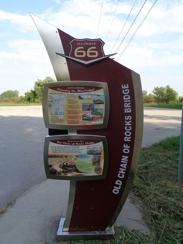
Crossing the Mississippi
Confluence of Rivers
North America's two greatest rivers, the Mississippi and the Missouri, meet in the heart of the St. Louis Area. For centuries, people have been drawn to this confluence and its abundant resources. From here you can explore a network of interconnected trails and attractions along the Mississippi linking Illinois and Missouri.
Route 66 Bridges - Multiple Crossings
Overs its 50 year history, Route 66 crossed the Mississippi River a five different locations. Increasing traffic forced the highway to ever larger bridges for safety and convenience.
1. McKinley Bridge: 1926-1929 (Optional 66 1929-1937)
The McKinley Bridge (named for the builder) opened in 1910 as a toll bridge operated by the City of Venice. Visit the "Salute to Steel" sculpture at the McKinley Bridge Roadside Park. A kiosk interprets the region's cities, transportation, geography, and industry. The bridge is open to traffic and has a pedestrian lane.
2. MacArthur/Municipal "Free" Bridge: 1929-1935 (City 66 1936-1955)
Built in 1909, this bridge wasn't opened for traffic until 1917 due to lack of funds to complete the approaches. In 1928, the bridge was also opened to trains. It was closed to cars in 1981, but trains still use it.
3. Old Chain of Rocks Bridge: 1936-1955 (Bypass 66: 1955-1965)
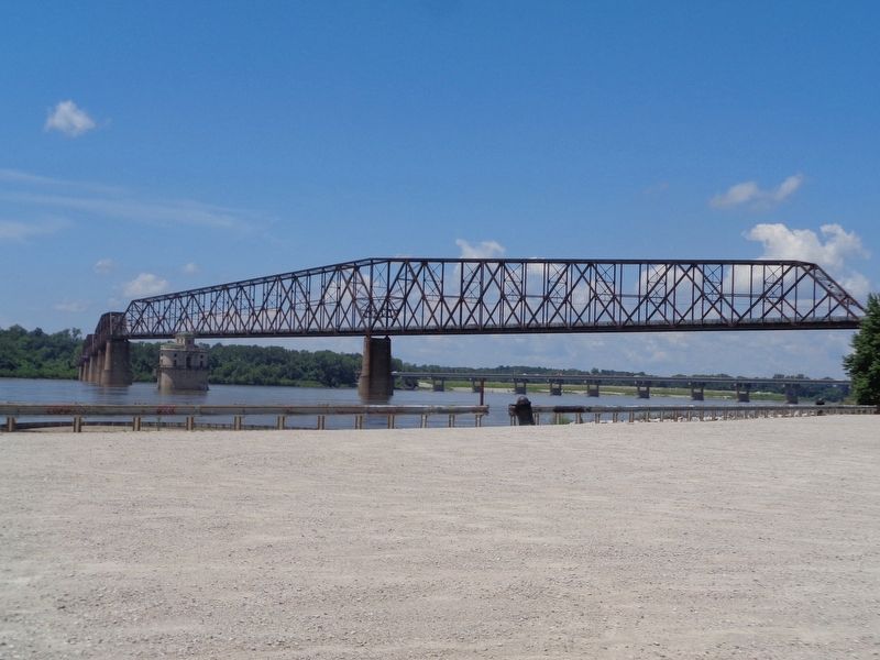
Built as a private toll bridge in 1929, it was later turned over to the city of Madison, Illinois. It served as a Route 66 crossing for 30 years, the longest of any bridge. In 1967, the New Chain of Rocks Bridge was built immediately to the north and the old bridge was closed to traffic.
4. Martin Luther King, Jr. Memorial Bridge: 1950-1967 (Business 66: 1967-1969)
Originally named the Veterans Memorial Bridge when built in 1951, it opened as a toll bridge. The bridge carries Interstate Highway traffic
today.
5. Poplar Street Bridge: 1967-1977
Opened in 1967, the last bridge that Route 66 crossed still carries Interstate Highway traffic. It spans the south end of "Bloody Island," so called because several Missouri politicians fought duels here. Robert E. Lee connected the island to the mainland with landfill in the 1850s.
(reverse, bottom:)
Gateway to the West - Old Chain of Rocks Bridge
A soaring "mile long" crossing over the Mississippi was a memorable passage for Route 66 motorists. This unique bridge served as a Route 66 crossing from 1936-1965. As travelers waited to pay the toll, anticipation grew for the breathtaking view and rounding the sharp bend in the middle.
What's in a Name?
A treacherous stretch of rapids here is formed by underwater rock lodges described as a "chain of rocks."
The bridge was built in 1929 as a toll bridge. The distinctive 22-degree bend in the middle resulted from the need to build on sold rock footings.
A Travel Destination
This river crossing was a milestone for long distance travelers. Four hundred elm trees lined the Illinois approach to the bridge. Brightly lit restaurants and motels sprang up on the river bank to welcome the hungry and tired. Just over the bridge, families enjoyed the Chain of Rocks
Amusement Park.
Today, you can relive this excitement by walking or biking on one of the longest pedestrian bridges in the world (5,454 feet long).
Erected by Illinois Route 66 Scenic Byway.
Topics and series. This historical marker is listed in these topic lists: Agriculture • Bridges & Viaducts • Industry & Commerce • Parks & Recreational Areas • Roads & Vehicles • Waterways & Vessels. In addition, it is included in the U.S. Route 66 series list. A significant historical year for this entry is 1926.
Location. 38° 45.429′ N, 90° 9.91′ W. Marker is near Granite City, Illinois, in Madison County. Marker is on Chain of Rocks Road. Marker is located at the end of Chain of Rocks Road, which is a parking lot. It is on Chouteau Island, which can be accessed by Chain of Rocks Road from Illinois Route 3. The island is open from dawn to dusk every day. Touch for map. Marker is at or near this postal address: 4207 Chain of Rocks Road, Granite City IL 62040, United States of America. Touch for directions.
Other nearby markers. At least 8 other markers are within 4 miles of this marker, measured as the crow flies. A different marker also named Old Chain of Rocks Bridge (approx. one mile away in Missouri); V.F.W. Post 1300 Veterans Memorial (approx. 2.6 miles away); North Riverfront Park (approx. 2.9 miles away in Missouri); The Twillman House (approx. 3.4 miles away in Missouri); The City of Granite City (approx. 3.4 miles away); Spanish Lake (approx. 3.6 miles away in Missouri); Columbia Bottom Conservation Area (approx. 3.8 miles away in Missouri); In Honor of Our Heroes (approx. 3.9 miles away). Touch for a list and map of all markers in Granite City.
More about this marker. This is one of 14 "experience hubs" that are all over Illinois along the old Route 66. The Chain of Rocks hub is the last one before approaching Missouri. All experience hub markers have the same front text, but have different reverse signs on the back. This one also has a map to hiking trails in Illinois' Madison and St. Clair counties.
Also see . . . Chain of Rocks Bridge. Wikipedia page for the old bridge, not the new one (that is I-270) (Submitted on January 16, 2020, by Jason Voigt of Glen Carbon, Illinois.)
Credits. This page was last revised on June 19, 2023. It was originally submitted on January 16, 2020, by Jason Voigt of Glen Carbon, Illinois. This page has been viewed 360 times since then and 47 times this year. Photos: 1, 2, 3, 4. submitted on January 16, 2020, by Jason Voigt of Glen Carbon, Illinois. • Devry Becker Jones was the editor who published this page.


