Great Cacapon in Morgan County, West Virginia — The American South (Appalachia)
Great Cacapon
Washington Heritage Trail
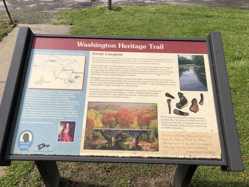
The tiny hamlet of Great Cacapon is situated on the western side of Cacapon Mountain on the Potomac River just upstream from its juncture with the Cacapon River. Artifacts of a Native American town circa 1300 AD have been found along the Potomac in this area.
George Washington records stopping at "Great Cacapehon" during his original surveying trip of this area in 1748. He returned to survey the area in 1750 and 51 including 270 acres of frontage along the joining of the rivers that included the location of today's town. A structure built there by Isaac Dawson was fortified during the French and Indian War and served as one of a line of forts under Washington's command.
Washington owned prized Potomac riverfront land nearby and mentioned it in his diaries as one of his motives for visiting often. He was particularly impressed with the lush black walnut growth on the 240-acre tract which he valued in his will at $3600. Today, Washington's acreage is inaccessible except by river and is in private hands.
Attractions in Great Cacapon include a sportsman access to the wild and scenic Cacapon River just before entering
this page online
WV9's path west along the winding, bending Cacapon River for nearly 20 miles from Great Cacapon to Paw Paw is among the most scenic roads in the state. Three river access points are available and marked.
It lyes on Potomac River about 12 miles above the Town of Bath (or Warm Springs) and is in the shape of a horseshoe, the river running almost around it.
George Washington's Will, 1799
[Aside:]
The Washington Heritage Trail in West Virginia
The Washington Heritage Trail is a 136-mile national scenic byway inspired by the prominent footsteps of George Washington through the three historic counties of West Virginia's Eastern Panhandle. Compelling history, spectacular scenery, geologic wonders, recreation and year round activities and festivals are highlighted by 45 historical sites. The trail meanders across mountains and rivers, through forests, farms and orchards as it connects five 18th century towns that remain the center of life today and offer comfortable lodging,
Photographed by Devry Becker Jones (CC0), April 25, 2020
2. Great Cacapon Marker
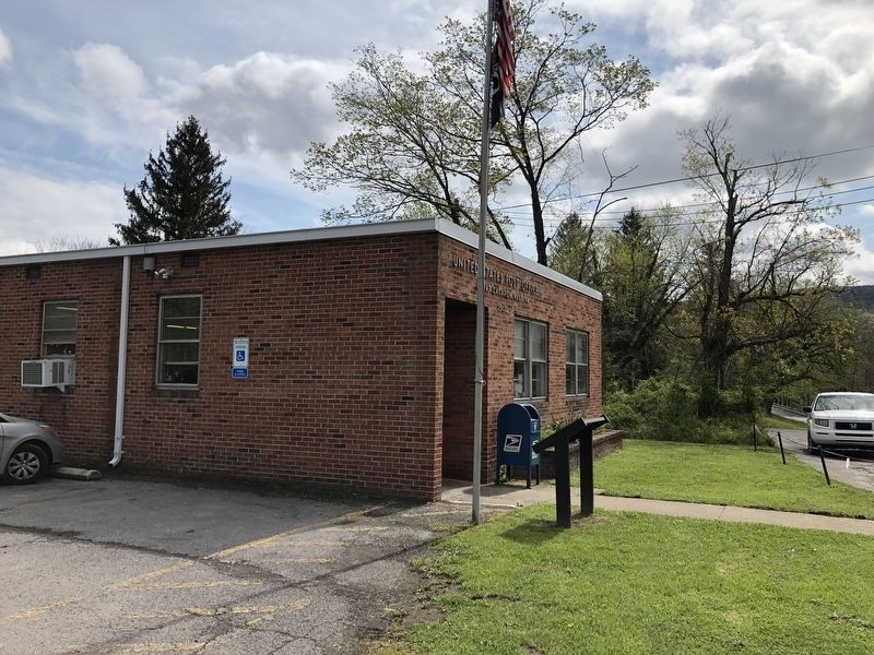
The marker is near the entrance to the Great Cacapon, West Virginia, Post Office.
Topics and series. This historical marker is listed in these topic lists: Anthropology & Archaeology • Bridges & Viaducts • Colonial Era • Exploration • Forts and Castles • Indigenous Peoples and Communities • Railroads & Streetcars • Settlements & Settlers • War, French and Indian. In addition, it is included in the Baltimore and Ohio Railroad (B&O), the Former U.S. Presidents: #01 George Washington, and the West Virginia, Washington Heritage Trail series lists. A significant historical year for this entry is 1300.
Location. 39° 37.126′ N, 78° 17.115′ W. Marker is in Great Cacapon, West Virginia, in Morgan County. It is on Central Avenue (West Virginia Route 9) just east of Stinebaugh Lane, on the right when traveling east. Touch for map. Marker is at or near this postal address: 5010 Central Ave, Great Cacapon WV 25422, United States of America. Touch for directions.

Regionally, this marker is in the Eastern Panhandle. It is also in the American South, specifically in the Upper South, in Appalachia, and specifically in Northern Appalachia. Globally, it is in North America, the Western Hemisphere, the Western World, and the Anglosphere. Historically, it finds itself in what was once the territory of the Mississippian Culture.
Other nearby markers. At least 8 other markers are within 3 miles of this marker, measured as the crow flies: Tuscarora (Clinton) Sand (approx. 1.4 miles away); Prospect Peak (approx. 1.4 miles away); Engagement at Great Cacapon (approx. 1.4 miles away); Panorama Overlook (approx. 1.4 miles away); Sir John's Run (approx. 2.8 miles away); The Apple Industry (approx. 2.8 miles away in Maryland); Frederick Duckwall, Jr. (approx. 3 miles away); Daniel of St. Thomas Jenifer / Robert Townsen Hose (approx. 3 miles away). Touch for a list and map of all markers in Great Cacapon.
Credits. This page was last revised on September 23, 2021. It was originally submitted on April 25, 2020, by Devry Becker Jones of Washington, District of Columbia. This page has been viewed 1,485 times since then and 137 times this year. Photos: 1, 2. submitted on April 25, 2020, by Devry Becker Jones of Washington, District of Columbia.
