Near Louisville in Jefferson County, Georgia — The American South (South Atlantic)
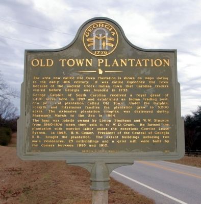
Old Town Plantation
George Galphin of South Carolina received a royal grant of 1,400 acres here in 1767 and established an Indian trading post, cow pens and plantation called Old Town. Under the Galphin, Forsyth and Fitzsimons families the plantation grew to 5,000 acres. The extensive plantation complex was destroyed during Sherman’s March to the Sea in 1864.
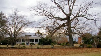
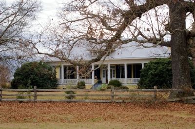
The land was jointly owned by Linton Stephens and W.W. Simpson from 1860-1876 when they sold it to W.D. Grant. He farmed the plantation with convict labor under the notorious Convict Lease System. In 1895, H.M. Comer, President of the Central of Georgia R.R., bought the plantation. The extant buildings including two main residences, 25 outbuildings and a grist mill were built by the Comers between 1895 and 1910.
Erected 1980 by Georgia Department of Natural Resources. (Marker Number 081-16.)
Topics and series. This historical marker is listed in these topic lists: Agriculture • Colonial Era • Native Americans • Settlements & Settlers • War, US Civil. In addition, it is included in the Georgia Historical Society, and the Sherman’s March to the Sea series lists. A significant historical year for this entry is 1733.
Location. 32° 54.832′ N, 82° 18.566′ W. Marker is near Louisville, Georgia, in Jefferson County. Marker is on Georgia Route 17, 1˝ miles north of Malloy Road (County Route 172), on the left when traveling south. Touch for map. Marker is in this post office area: Louisville GA 30434, United States of America. Touch for directions.
Other nearby markers. At least 8 other markers are within 9 miles of this marker, measured as the crow flies. Bark Camp Church (approx. 6.3 miles away); The 20th Corps (approx. 6.4 miles away); a different marker also named Bark Camp Church (approx. 6.6 miles away); Sherman at Midville (approx. 7.9 miles away); The Savannah Road (approx. 8.2 miles away); Site of Capitol Building (approx. 8.2 miles away); To Commemorate the Site of the First Permanent Capitol of Georgia (approx. 8.2 miles away); "Yazoo Fraud" (approx. 8.2 miles away). Touch for a list and map of all markers in Louisville.
Credits. This page was last revised on January 4, 2020. It was originally submitted on January 31, 2009, by David Seibert of Sandy Springs, Georgia. This page has been viewed 3,998 times since then and 1,284 times this year. Photos: 1, 2, 3. submitted on January 31, 2009, by David Seibert of Sandy Springs, Georgia. • Craig Swain was the editor who published this page.


