Strasburg in Shenandoah County, Virginia — The American South (Mid-Atlantic)
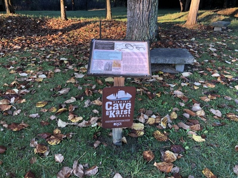
Trail Head
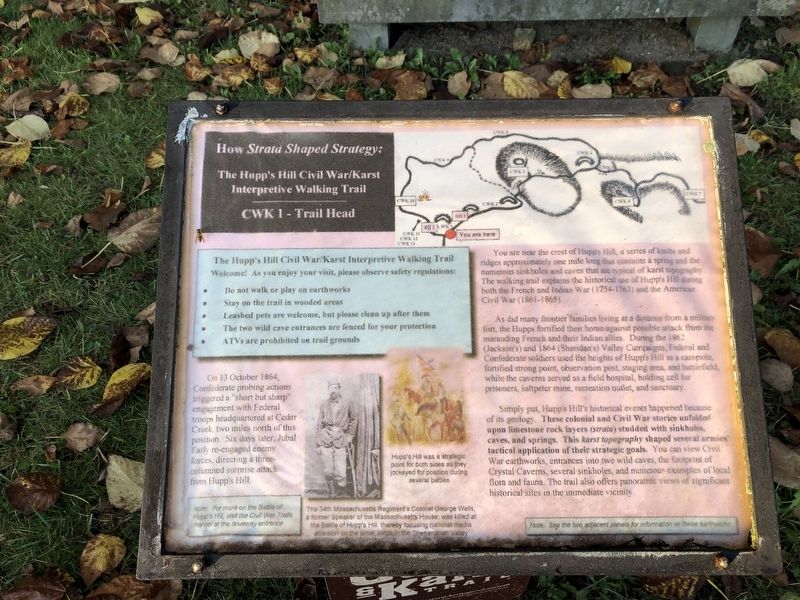
How Strata Shaped Strategy: The Hupp's Hill Civil War/Karst Interpretive Walking Trail
On 13 October 1864, Confederate probing actions triggered a "short but sharp" engagement with Federal troops headquartered at Cedar Creek, two miles north of this position. Six days later, Jubal Early re-engaged enemy forces, directing a three-columned surprise attack from Hupp's Hill.
You are near the crest of Hupp's Hill, a series of knobs and ridges approximately one mile long that contains a spring and the numerous sinkholes and caves that are typical of karst topography. The walking trail explains the historical use of Hupp's Hill during both the French and Indian War (1754-1763) and the American Civil War (1861-1865).
As did many frontier families living at a distance from a military fort, the Hupps fortified their home against possible attack from the marauding French and their Indian allies. During the 1862 (Jackson's) and 1864 (Sheridan's) Valley Campaigns, Federal and Confederate soldiers used the heights as a campsite, fortified strong points, observation post, staging area, and battlefield, while the caverns served as a field hospital, holding cell for prisoners, saltpeter mine, recreation outlet, and sanctuary.
Simply put, Hupp's Hill's historical events happened because of its geology. These colonial and Civil War stories unfolded upon limestone rock layers (strata) studded with sinkholes, caves, and springs. This karst topography shaped several armies' tactical applications of their strategic goals. You can view Civil War earthworks, entrances into two wild caves, the footprint of Crystal Caverns, several sinkholes, and numerous examples of local flora and fauna. The trail also offers panoramic views of significant historical sites in the immediate events.
[Captions and sidebars:]
Note: For more on the Battle of Hupp's Hill, visit the Civil War Trails marker at the driveway entrance
Hupp's Hill was a strategic point for both sides as they jockeyed for position during several battles
The 34th Massachusetts Regiment's Colonel George Wells, a former Speaker of the Massachusetts House, was killed at the Battle of Hupp's Hill, thereby focusing national media attention on the small battle in the Shenandoah Valley
Note: See the two adjacent panels for information on these earthworks
Erected by Cedar Creek Battlefield Foundation. (Marker Number CWK 1.)
Topics and series. This historical marker is listed in these topic lists: Colonial Era • Natural Features • War, French and Indian
Location. 39° 0.03′ N, 78° 20.973′ W. Marker is in Strasburg, Virginia, in Shenandoah County. Marker can be reached from Old Valley Pike (U.S. 11) 0.1 miles west of Signal Knob Drive, on the right when traveling west. Touch for map. Marker is at or near this postal address: 33229 Old Valley Pike, Strasburg VA 22657, United States of America. Touch for directions.
Other nearby markers. At least 8 other markers are within walking distance of this marker. Field Fortifications (here, next to this marker); Hupp’s Hill (here, next to this marker); The Shenandoah Valley / Battle of Cedar Creek, October 19, 1864 (here, next to this marker); A Natural Bombproof (within shouting distance of this marker); Signal Knob (within shouting distance of this marker); Strasburg (within shouting distance of this marker); Crystal Caverns Mine (within shouting distance of this marker); Hupp's "Little Gem" (within shouting distance of this marker). Touch for a list and map of all markers in Strasburg.
Credits. This page was last revised on November 7, 2020. It was originally submitted on November 1, 2020, by Devry Becker Jones of Washington, District of Columbia. This page has been viewed 141 times since then and 13 times this year. Photos: 1, 2. submitted on November 1, 2020, by Devry Becker Jones of Washington, District of Columbia.

