Joy in Livingston County, Kentucky — The American South (East South Central)
The Real Story of Mantle Rock
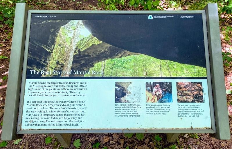
Mantle Rock Preserve
— Trail of Tears National Historic Trail, National Trails System —
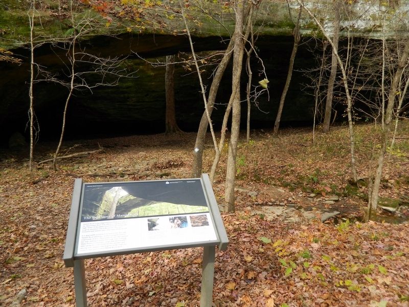
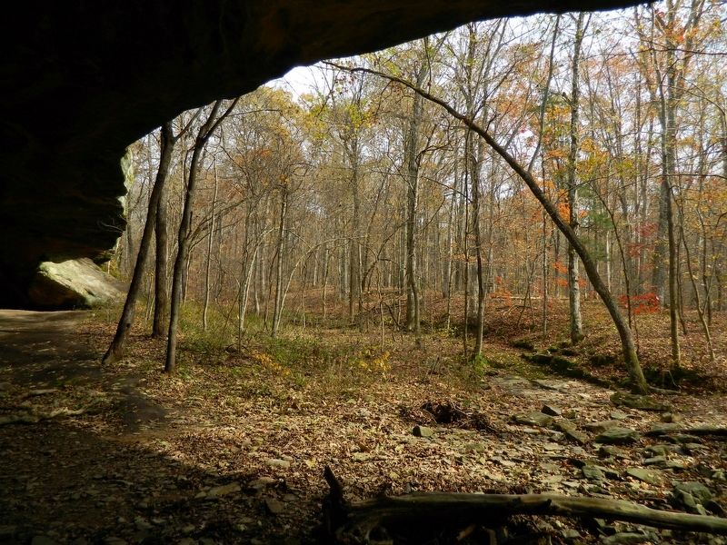
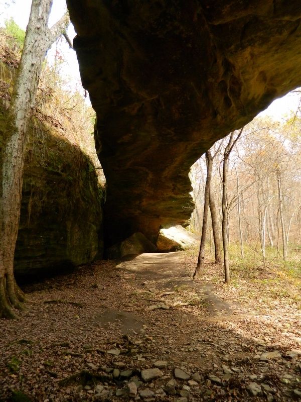
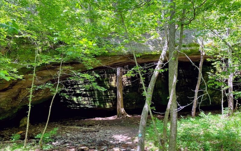
Mantle Rock is the largest freestanding arch east of the Mississippi River. It is 188 feet long and 30 feet high. Some of the plants found here are not known to grow anywhere else in Kentucky. This very beautiful and historic place has many stories to tell.
It is impossible to know how many Cherokee saw Mantle Rock when they walked along the historic road north of here. Thousands of Cherokee passed this way, waiting in winter for a safe river crossing. Many lived in temporary camps that stretched for miles along the road. Exhausted by journey, and staying near supplies and wagons on the road, it is unlikely that many visited Mantle Rock itself.
[Captions:]
Some stories tell that the Cherokee camped under Mantle Rock. There were far too many Cherokee to camp under the arch, and historical descriptions describe a long, linear camp along the road.
Other stories suggest that there were burials under Mantle Rock. The Trail of Tears claimed many lives, but there is no evidence of burials at Mantle Rock.
The sandstone glade on top of the arch is one of the highest quality glades in the state. It has been estimated that less than one percent of these habitats remain, but here they are protected.
Erected by The Nature Conservancy; National Park Service, U.S. Department of the Interior.
Topics and series. This historical marker is listed in these topic lists: Anthropology & Archaeology • Native Americans • Natural Features • Parks & Recreational Areas. In addition, it is included in the Trail of Tears series list.
Location. 37° 21.369′ N, 88° 25.622′ W. Marker is in Joy, Kentucky, in Livingston County. Marker can be reached from County Route 133, 1.2 miles west of County Route 1436, on the right when traveling south. This marker is a .3 mile hike from the small parking area. Part of the hike is along the same roadbed used by the Cherokee during the Trail of Tears. Touch for map. Marker is in this post office area: Hampton KY 42047, United States of America. Touch for directions.
Other nearby markers. At least 8 other markers are within walking distance of this marker. Protect / Transform / Inspire (approx. 0.2 miles away); Walk in Their Footsteps… (approx. 0.3 miles away); Exploring Mantle Rock (approx. 0.3 miles away); A Changed Landscape (approx. 0.3 miles away); They Passed This Way (approx. 0.3 miles away); Witness to History (approx. 0.3 miles away); Mantle Rock (1/2 Mile) (approx. 0.4 miles away); A Winter Camp (approx. 0.4 miles away). Touch for a list and map of all markers in Joy.
Also see . . .
1. Nature Conservancy. (Submitted on November 12, 2020, by Thomas Onions of Olathe, Kansas.)
2. Trail of Tears National Historic Trail. (Submitted on November 12, 2020, by Thomas Onions of Olathe, Kansas.)
Additional commentary.
1. Mantle Rock National Register Application
Mantle Rock consists of a natural sandstone arch, woodlands, several springs, and a section of the original Salem-Golconda Road. The property is located southwest of State Route 133 in Livingston County, Kentucky, approximately one mile east of the Ohio River. Mantle Rock is located in a shallow valley in the watershed of McGilligan Creek at an elevation of approximately 450' above sea level. The property encompasses approximately 215 acres, and is now owned and protected by the Kentucky Nature Conservancy.
Mantle Rock is reached by a gravel road directly off State Route 133, west of the small crossroads community of Joy. Adjacent to the gravel road along State Route 133 is a state historic marker containing text describing the historic significance of Mantle Rock during the Trail of Tears. This freestanding marker is included as a non-contributing object to the property. The driveway leads to a gravel parking lot and a dirt trail leads from the parking lot to Mantle Rock. Approximately 600' from the parking lot the trail crosses the roadbed of the historic Salem-Golconda Road. Within the boundary of the Mantle Rock property this roadbed extends approximately 450'. The roadbed is ten to twelve feet in width and has embankments ranging up to five feet in height. This roadbed is well defined and the roadbed itself contains bushes and small trees. This roadbed was utilized by the Lt. B.B. Cannon party in 1837 and by the various detachments of the Cherokee on the Northern Route in 1838 and 1839. The roadbed is included as a contributing site to the property.
Following the roadbed, the trail passes a wood wayside marker erected within the past twenty years which describes the geology and history of Mantle Rock. This wayside exhibit is included as a non-contributing structure to the property. The trail then leads to Mantle Rock which is a natural rock formation. Mantle Rock is a 30 foot high sandstone arch which spans 188 feet in length. It is one of the longest natural arches in Kentucky and provides an ample amount of shelter beneath. In addition to Mantle Rock itself, the property contains other natural rock outcroppings and features. Several springs emerge near the base of Mantle Rock and flow into nearby McGilligan Creek. The remainder of the Mantle Rock property is covered with a hardwood forest and is accessible via hiking trails. No buildings or other structures are within the boundary of the Mantle Rock property.
— Submitted November 12, 2020, by Thomas Onions of Olathe, Kansas.
Credits. This page was last revised on June 6, 2021. It was originally submitted on November 12, 2020, by Thomas Onions of Olathe, Kansas. This page has been viewed 566 times since then and 48 times this year. Photos: 1. submitted on June 4, 2021, by Shane Oliver of Richmond, Virginia. 2, 3, 4. submitted on November 12, 2020, by Thomas Onions of Olathe, Kansas. 5. submitted on June 4, 2021, by Shane Oliver of Richmond, Virginia. • Devry Becker Jones was the editor who published this page.
