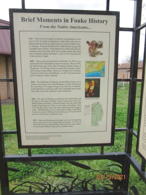
Brief Moments in Fouke History
From the Native Americans…
1541 - When Desoto brought his Spanish conquistadores to this area in 1541, he found an industrious Caddo Indian tribe who inhabited and enjoyed the area that was later to become Miller County, Arkansas. Along the Red River the Caddo farmed, laying aside incredible stores of grain. In the uplands the Caddo had numerous campsites along the many fresh water streams where they spent time in hunting, fishing and leisure. Later in 1542 it became part of the territory of Spain.
1800 - France came into possession of this land. In 1803, it was purchased by the United States as part of Louisiana, Then, in 1818, the land became part of the state of Arkansas and the county of Hempstead. In 1820 this land was named after Arkansas territorial Governor, James Miller. However, it actually lay in territory claimed by both Texas and Oklahoma. In 1827, the land became port of Lafayette County, Arkansas.
1820 - The legislature of Arkansas created Miller County out of territory now laying in Texas and Oklahoma. In 1829, a bill passed the lower house of Congress fixing as the west line of Arkansas south of Red Rive, a line due south to the 33rd degree from a point forty miles west of the southwest corner of Missouri.
1861 - The state of Arkansas seceded from the United States and the land we now know as
Miller County became part of the Confederate States of America. At that time there were only about 3000 people living in this area. There was no Fouke or Texarkana. There were only the woods, rivers, and creeks where people had begun to settle. Although there were no major battles fought in the Miller County area, nearly 1000 men between the ages of 16 and 45 from this area served in the Confederate Army.
1874 - When the War between the States was over the land once again became part of the United States of America. In 1974, all land south and west of the Red River and east of the Texas-Arkansas line became Miller County, and so it remains today.
Topics. This historical marker is listed in these topic lists: Agriculture • Colonial Era • Native Americans • Parks & Recreational Areas. A significant historical year for this entry is 1541.
Location. 33° 15.69′ N, 93° 53.066′ W. Marker is in Fouke, Arkansas, in Miller County. Marker is on East Main (County Road 9) just west of Snell Street, on the right when traveling west. Touch for map. Marker is at or near this postal address: 106 Main St, Fouke AR 71837, United States of America. Touch for directions.
Other nearby markers. At least 8 other markers are within 15 miles of this marker, measured as the crow flies. A different marker also named Brief Moments in Fouke History (here, next to this marker); History of The Spring Bank Ferry (approx.
Credits. This page was last revised on May 23, 2021. It was originally submitted on May 19, 2021, by Jason Armstrong of Talihina, Oklahoma. This page has been viewed 218 times since then and 28 times this year. Photos: 1, 2. submitted on May 19, 2021, by Jason Armstrong of Talihina, Oklahoma. • Devry Becker Jones was the editor who published this page.

