Coupeville in Island County, Washington — The American West (Northwest)
A Canoe Crossroads
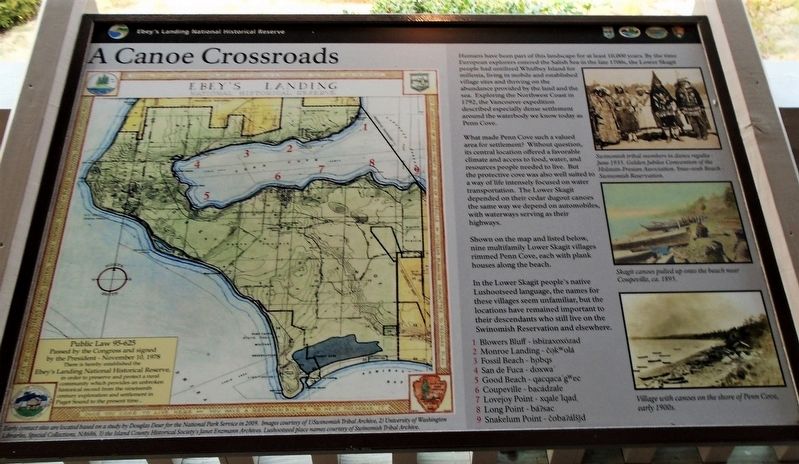
Humans have been part of this landscape for at least 10,000 years. By the time European explorers entered the Salish Sea in the late 1700s, the Lower Skagit people had [utilized] Whidbey Island for millenia, living in mobile and established village sites and thriving on the abundance provided by the land and the sea. Exploring the Northwest Coast in 1792, the Vancouver expedition described especially dense settlement around the waterbody we know today as Penn Cove.
What made Penn Cove such a valued area for settlement? Without question, its central location offered a favorable climate and access to food, water, and resources people needed to live. But the protective cove was also well suited to a way of life intensely focused on water transportation. The Lower Skagit depended on their cedar dugout canoes the same way we depend on automobiles, with waterways serving as their highways.
Shown on the map and listed below, nine multifamily Lower Skagit villages rimmed Penn Cove, each with plank houses along the beach.
In the Lower Skagit people's native Lushootseed language, the names for these villages seem unfamiliar, but the locations have remained important to their descendants who still live on the Swinomish Reservation and elsewhere.
1 Blowers Bluff - isbizaxoxózad
2 Monroe Landing - čəkʷolá
3 Fossil Beach - hobqs
4 San de Fuca - doxwa'
5 Good Beach - qacqaca'gʷec
6 Coupeville - bacádzale
7 Lovejoy Point - xqale'lqad
8 Long Point - báʔsac
9 Snakelum Point - čobaʔálšǰd
[Photo captions, clockwise from top right, read]
• Swinomish tribal members in dance regalia - June 1935. Golden Jubilee Convention of the Holstein-Fresian Association. Snee-oosh Beach - Swinomish Reservation.
• Skagit canoes pulled up onto the beach near Coupeville, ca. 1895.
• Village with canoes on the shore of Penn Cove, early 1900s.
• [Map of] Ebey's Landing National Historical Reserve. Early contact sites are located based on a study by Douglas Deur for the National Park Service in 2009.
Erected by National Park Service, Island County, and Town of Coupeville.
Topics. This historical marker is listed in these topic lists: Anthropology & Archaeology • Environment • Native Americans • Waterways & Vessels. A significant historical year for this entry is 1792.
Location. 48° 13.272′ N, 122° 41.322′ W. Marker is in Coupeville, Washington, in Island County. Marker is at the intersection of NW Alexander
Street and Front Street NW, on the right when traveling south on NW Alexander Street. Marker is at the Island County Historical Museum. Touch for map. Marker is at or near this postal address: 908 NW Alexander Street, Coupeville WA 98239, United States of America. Touch for directions.
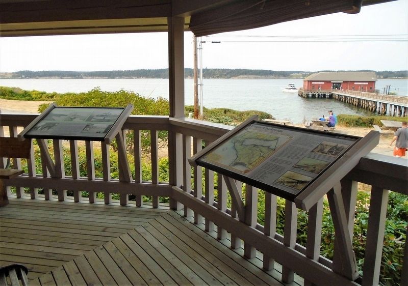
Other nearby markers. At least 8 other markers are within walking distance of this marker. Water Highways (here, next to this marker); In Home Port After Eight Decades (a few steps from this marker); Cross Built for Father Blanchet's Visit (within shouting distance of this marker); Ebey's Landing National Historical Reserve (within shouting distance of this marker); Explore the Reserve (within shouting distance of this marker); Keeping the Alexander Blockhouse alive!!! (within shouting distance of this marker); Welcome (within shouting distance of this marker); Original Home of Seattle’s Best Coffee (within shouting distance of this marker). Touch for a list and map of all markers in Coupeville.
Also see . . .
1. Ebey's Landing National Historical Reserve (NPS). (Submitted on August 11, 2021, by William Fischer, Jr. of Scranton, Pennsylvania.)
2. Island County Historical Society. (Submitted on August 11, 2021, by William Fischer, Jr. of Scranton, Pennsylvania.)
Credits. This page was last revised on August 11, 2021. It was originally submitted on August 11, 2021, by William Fischer, Jr. of Scranton, Pennsylvania. This page has been viewed 121 times since then and 12 times this year. Photos: 1, 2. submitted on August 11, 2021, by William Fischer, Jr. of Scranton, Pennsylvania.

