Williamsburg, Virginia — The American South (Mid-Atlantic)
Quarterpath Road
Historic Avenue
| — | 1862 Peninsula Campaign | — |
Photographed by Bill Coughlin, August 10, 2008
1. Quarterpath Road Marker
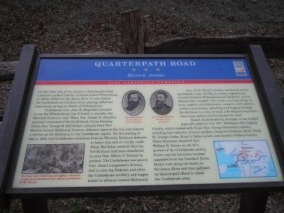
Confederate Gen. John B. Magruder intended to use the Williamsburg Line if forced to abandon the Warwick-Yorktown Line. When Gen. Joseph E. Johnston assumed command of the Confederate forces blocking Union Gen. George B. McClellan’s advance from Fort Monroe toward Richmond, however, Johnston ignored the line and ordered a retreat up the Peninsula to the Confederate capital. On the evening of May 3, 1862, the Confederates withdrew from the Warwick-Yorktown defenses in heavy rain and on muddy roads. When McClellan realized that the fortifications had been abandoned, he sent Gen. Edwin V. Sumner in pursuit. The Confederate rear guard, Gen. James Longstreet’s division, had to slow the Federals and allow the Confederate artillery and wagon trains to advance toward Richmond.
Gen. J.E.B. Stuart’s cavalry watched for pursuing Federal troops. On May 4, cavalry engagements
this page online
Stuart concentrated his strength on the Confederate left under Lt. Col. W.C. Wickham’s 4th Virginia Cavalry, which clashed with Union Gen. George Stoneman’s cavalry, including four batteries of horse artillery, along the Yorktown Road. Philip St. George Cooke, Stuart’s father-in-law, commanded a Federal battery. When Stoneman detached Gen. William H. Emory to cut off a portion of the Confederate cavalry, Stuart and his horsemen became separated from the Southern forces. Stuart rode along the beach on the James River and then galloped up Quarterpath Road to rejoin the Confederate army.
Erected by Virginia Civil War Trails.
Topics and series. This historical marker is listed in these topic lists: Notable Events • Notable Places • War, US Civil. In addition, it is included in the Virginia Civil War Trails
Photographed by Bill Coughlin, August 10, 2008
2. Marker in Redoubt Park
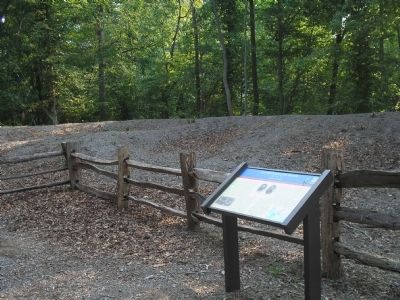
Location. 37° 15.243′ N, 76° 41.154′ W. Marker is in Williamsburg, Virginia. It can be reached from Quarterpath Road, on the left when traveling south. Marker is located in Redoubt Park on Quarterpath Road in Williamsburg. Touch for map. Marker is in this post office area: Williamsburg VA 23185, United States of America. Touch for directions.

Regionally, this marker is on Virginia’s Peninsula, in Coastal Virginia, and in the Hampton Roads Metropolitan Area. It is also in the American South, specifically in the Upper South, in the Tidewater, and on the Eastern Seaboard. Globally, it is in the North Atlantic Region, North America, the Western Hemisphere, the Western World, and the Anglosphere. Historically, it finds itself in what was once the territory of the Mississippian Culture, one of the original Thirteen Colonies, one of the Confederate States of America, and the Antebellum South.
Other nearby markers. At least 8 other markers are within walking distance of this marker: Battle of Williamsburg (a few steps from this marker); Redoubt 1 (within shouting distance
Photographed by Bill Coughlin, August 10, 2008
3. Marker with Earthworks
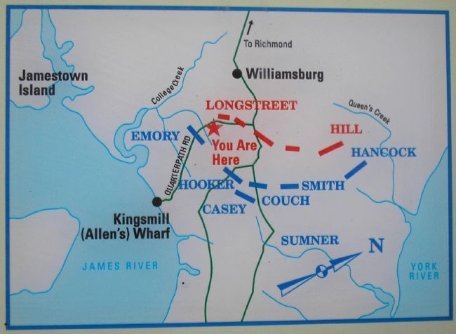
More about this marker. The marker contains photographs of Gen. J.E.B. Stuart, courtesy of the Museum of the Confederacy, and Gen. George Stoneman, courtesy Library of Congress. The bottom left of the marker features a picture of “The Union army ‘splashing and bogging … in a river of mud’ up the Peninsula, from Official and Illustrated War Record. The bottom right features battle map showing troop positions.
Related markers. Click here for a list of markers that are related to this marker. Markers on the walking trail of Williamsburg’s Redoubt Park.
Also see . . .
1. Battle of Williamsburg, 5 May 1862. Williamsburg was the first large battlefield encounter between Union and
Photographed by Bill Coughlin, August 10, 2008
4. Trail through the Williamsburg Line
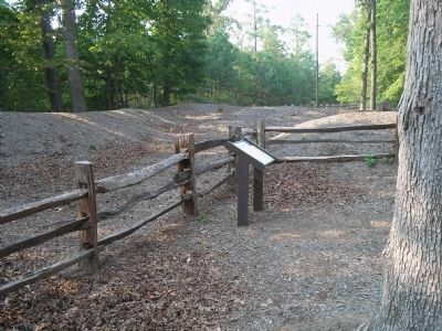
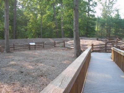
The marker is located in the middle of Confederate fortifications of the Third Defensive Line. Quarterpath Road is located on the other side of the earthworks.
2. The Peninsula Campaign of 1862. (Submitted on August 20, 2008, by Bill Coughlin of Woodland Park, New Jersey.)
3. Tidewater Virginia, The 1862 Peninsula Campaign. Civil War Traveler. (Submitted on August 20, 2008, by Bill Coughlin of Woodland Park, New Jersey.)
Photographed by Bill Coughlin, August 10, 2008
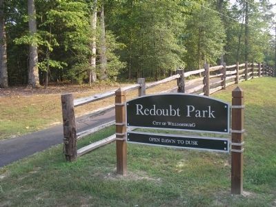
5. Williamsburg's Redoubt Park
This park on Quarterpath Road contains a walking path that traverses the Confederate fortifications of the "Williamsburg Line." Several Civil War Trails signs are found along the path.
Photographed by Bill Coughlin, August 10, 2008
6. Battle Map from Marker
Credits. This page was last revised on October 20, 2021. It was originally submitted on August 20, 2008, by Bill Coughlin of Woodland Park, New Jersey. This page has been viewed 2,728 times since then and 98 times this year. Last updated on October 19, 2021, by Bradley Owen of Morgantown, West Virginia. Photos: 1, 2, 3, 4, 5, 6. submitted on August 20, 2008, by Bill Coughlin of Woodland Park, New Jersey. • Bernard Fisher was the editor who published this page.
