Kennebunk in York County, Maine — The American Northeast (New England)
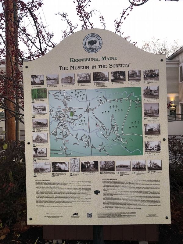
Kennebunk, Maine
— The Museum in the Streets —
Welcome to Kennebunk
The Native American word “Kennebunk” means “long cut bank” and likely refers to Great Hill at the mouth of the Mousam River which would have been an important landmark to those traveling the coast in their ocean going canoes. Archaeological excavations indicate that PaleoIndian hunters traveled here seasonally from as early as 11,000 years ago.
It is not certain when the first Europeans began visiting the shores of Southern Maine. It is known that a number of European fishermen did arrive here during the sixteenth century but did not settle here.
In 1602, Bartholomew Gosnold, an English lawyer, explorer, and privateer, made landfall on the coast of Maine. Other explorers began arriving soon after. In 1603, Martin Pring, an explorer from Bristol England, made his own voyage and explored the mouth of the Kennebunk River. In 1604, Samuel de Champlain explored the coast of Maine and visited Cape Porpoise harbor, naming it “Le Port aux Isles” (Island Harbor). A map drawn in 1610 for London’s Virginia Company clearly shows Cape Porpoise. One of the first, permanent settlers in Wells (of which Kennebunk was a part until 1820) was John Sanders who built a home near the mouth of the Mousam River circa 1640.
Hostilities between the indigenous Abenaki people and the European settlers began and by 1690 most settlers were temporarily driven out. These uprisings continued until 1760. By 1750, a large permanent settlement was finally established on the Mousam River at the Larrabee Garrison. Development of other areas, including the Kennebunk Landing and Alewive, soon followed.
As local timber was abundant, sawmills and shipyards sprang up on both the Mousam and Kennebunk Rivers. Between 1755 and 1918, shipbuilding was the principal industry in Kennebunk. Many of the homes on the Museum in the Streets, Kennebunk installation, were owned by those involved in the shipping industry. Additionally, during this period, the Mousam River was used for grist mills, papermills, twine manufacture, leather-board manufacture, matting factories, shoe factories and more.
Tourism became the secondary industry near the turn of the last century as hotels and railroads were built. It is now the largest industry of the Kennebunks.
It is our hope that you will enjoy this self-guided tour through our charming community.
Le terme amérindian « Kennebunk » signifie « érosion le long de la berge
Les premières incursions européennes sur la côte sud du Maine ne sont pas datées avec certitude mais il est certain que des pêcheurs venus d’Europe y séjournent au cours du XVI° siècle san s’y établir.
En 1602, Bartholomew Gosnold, un avocat, explorateur et corsaire anglais, débarque sur la côte du Maine, suive de près par d’autres. En 1603, Martin Pring, explorateur venu de Bristol en Angleterre, lance sa propre expédition pour venir explorer l’embouchure du fleuve Kennebunk.
En 1604, Samuel de Champlain explore la côte du Maine et visite le porte de Cape Porpoise (Cap du Marsouin) et le baptiste « Port aux Isles ». Une carte dressée en 1610 pour la Virginia Company de Londres montrer précisément ce Cape Purpoise. L’en des premiers colons à s’établir à Wells (dont Kennebunk fait partie jusqu’en 1820) est John Sanders qui se construit une demeure près de l’embouchure du fleuve Mousam autour de 1640.
Cette période marque le début des hostilités entre autochtones Abénakis et colons européens et en 1690 la plupart des colons fuient les lieux. Les hostilités se prolongent jusqu’en 1760. Mais, à partir de 1750, une colonie assez importante s’installe près du fleuve Mousam au Fort Larrabee. D’autres sites ne tardent pas à se développer comme Kennebunk Landing et Alewive.
Vu l’abondance du bois dans la région, des scieries et chantiers navals naissent le long des fleuves Mousam et Kennebunk. Entre 1755 et 1918, la construction de bateaux est l’activité principale de Kennebunk. De nombreux propriétaires des demeures du Musée dans la rue à Kennebunk out des activités liées au commerce maritime. De plus, pendant cette période, le fleuve Mousam est utilisé pp pour de nombreuses autres activités industrielles : filatures, moulins à farine, usines à papier, corderies, fabriques des chaussures et de cuir artificiel…
Le tourisme devient le deuxième secteur d’activité à la fin du dix-neuvième siècle avec la construction d’hôtels et de ligues de chemin de fer. C’est aujourd’hui le premier secteur d’activité de la région.
Nous espérons que vous apprécierez ce circuit-découverte dans notre belle communauté.
Erected by The Museum in the Streets. (Marker Number Map.)
Topics and series. This historical marker is listed in these topic lists: Anthropology & Archaeology • Colonial Era • Industry & Commerce • Native Americans • Settlements & Settlers • Waterways & Vessels. In addition, it is included in the The Museum in the Streets®: Kennebunk, Maine series list. A significant historical year for this entry is 1602.
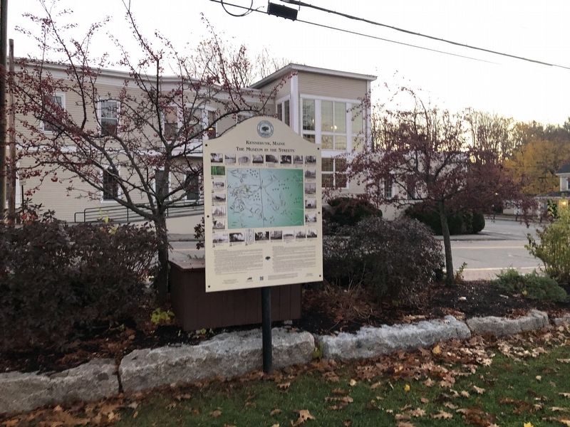
Location. 43° 23.114′ N, 70° 32.516′ W. Marker is in Kennebunk, Maine, in York County. Marker is at the intersection of Main Street (Route 1) and Water Street, on the left when traveling west on Main Street. Touch for map. Marker is at or near this postal address: 25B Main St, Kennebunk ME 04043, United States of America. Touch for directions.
Other nearby markers. At least 8 other markers are within walking distance of this marker. The Lafayette Center / Le Centre Lafayette (here, next to this marker); Kennebunk Rotary Club (a few steps from this marker); The Mousam River / Le Fleuve Mousam (within shouting distance of this marker); The Ross Block and The Kennebunk Inn / Le Bâtiment Ross et l'Auberge de Kennebunk (about 400 feet away, measured in a direct line); Waterhouse Center (about 600 feet away); The Storer Residence / La Résidence Storer (about 600 feet away); Lafayette Elm Site (about 600 feet away); The Bourne Mansion / La Résidence Bourne (approx. 0.2 miles away). Touch for a list and map of all markers in Kennebunk.
Credits. This page was last revised on September 12, 2023. It was originally submitted on November 20, 2021, by Devry Becker Jones of Washington, District of Columbia. This page has been viewed 145 times since then and 15 times this year. Photos: 1, 2. submitted on November 20, 2021, by Devry Becker Jones of Washington, District of Columbia.

