Near Richmond in Henrico County, Virginia — The American South (Mid-Atlantic)
Deep Bottom Park
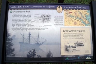
Captain John Smith’s Adventures on the James
— www.johnsmithtrail.org —
Marshes producing plants with edible tubers and seeds are often found in the vicinity of oxbows, like the breadbasket marsh along the mouth of Fourmile Creek. This marsh may have supplied arrow arum, spatterdock and wild rice for the Arrohateck Indians who lived nearby.
Capt. John Smith’s Trail
John Smith knew the James River by its Algonquian name: Powhatan, the same as the region’s paramount chief. Smith traveled the river many times between 1607 and 1609, trading with Virginia Indians to ensure survival at Jamestown. What he saw of Virginia’s verdant woodlands and pristine waters inspired him to explore the greater Chesapeake Bay, chronicling its natural wonders.
(sidebar)
Deep Water Pockets
Deep Bottom was named for the many unusual, deep water pockets scattered in the James River here, one of which has a depth of 35 feet. Fourmile Creek’s flow helps form a rich river delta that supports sycamore, oak and pine trees. Birdlife abounds, with common species ranging from blue grosbeaks to bald eagles. The tiny, bright yellow prothonotary warbler also finds its home in tree cavities here.
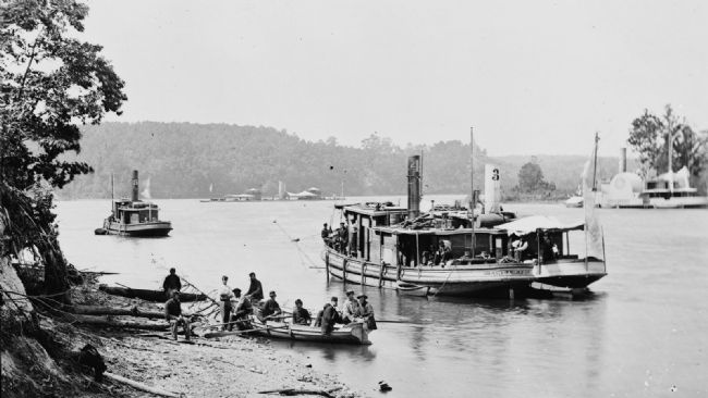
During the Civil War, a pontoon bridge here linked Federal troops located north and south of the James River. Its steady use began in June 1864, and the Union’s Army of the James continued to use this key river crossing until the end of the war.
Erected by Captain John Smith’s Trail, James River Association, Virginia Department of Conservation and Recreation, Chesapeake Bay Gateways Network. (Marker Number 11.)
Topics. This historical marker is listed in these topic lists: Exploration • Native Americans • War, US Civil • Waterways & Vessels. A significant historical month for this entry is June 1864.
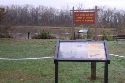
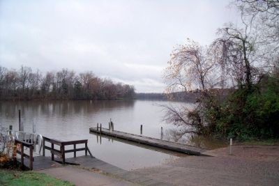
Location. This marker has been replaced by another marker nearby. It was located near 37° 24.446′ N, 77° 18.31′ W. Marker was near Richmond, Virginia, in Henrico County. Marker was on Deep Bottom Road, 0.3 miles east of James Street, on the left when traveling south. This marker is located near the Deep Bottom Boat Ramp on the James River. Touch for map. Marker was at or near this postal address: 9525 Deep Bottom Road, Henrico VA 23231, United States of America. Touch for directions.
Other nearby markers. At least 8 other markers are within 2 miles of this location, measured as the crow flies. John Smith Explores the Chesapeake (here, next to this marker); Deep Bottom Landing (a few steps from this marker); First Battle of Deep Bottom (approx. 0.9 miles away); Pleasants v. Pleasants (approx. 1.3 miles away); New Market Heights (approx. 1.3 miles away); New Market Road (approx. 1.4 miles away); a different marker also named New Market Heights (approx. 1½ miles away); a different marker also named New Market Heights (approx. 1½ miles away). Touch for a list and map of all markers in Richmond.
More about this marker. On the lower left is a depiction of the exploration of the James River by English colonist. The photo carries the caption, "“The New World” © MMV, New Line Productions, Inc. All rights reserved. Photo by Merie Wallace. Photo appears courtesy of New Line Productions, Inc."
On the upper center is a sketch of an English shore party with the caption, "Drawing by Marc Castelli for the James Smith Four Hundred Project. © 2006”
On the upper right is a map of Captain John Smith's Trail with the caption, "Capt. John Smith’s Trail on the James is a 40-site water trail and auto tour for modern explorers."
On the bottom of the sidebar is a photograph with the caption, “Transport Linda of Philadelphia and a monitor on the James River. Photo courtesy of the Library of Congress."
Related marker. Click here for another marker that is related to this marker. New Marker At This Location titled "John Smith Explores the Chesapeake".
Credits. This page was last revised on November 28, 2021. It was originally submitted on November 25, 2009, by Bernard Fisher of Richmond, Virginia. This page has been viewed 2,144 times since then and 100 times this year. Last updated on November 25, 2021, by Bradley Owen of Morgantown, West Virginia. Photos: 1, 2, 3, 4. submitted on November 25, 2009, by Bernard Fisher of Richmond, Virginia.


