Martineztown in Albuquerque in Bernalillo County, New Mexico — The American Mountains (Southwest)
Crossroads at Martineztown

Photographed by Bill Wingate, January 2, 2022
1. Crossroads at Martineztown Marker

Martineztown is at the crossroads of El Camino Real de Tierra Adentro and Tijeras Canyon Trail, two important trade routes begun by Native Americans. The trail though Tijeras Canyon linked the Rio Grande Valley to the plains east of the Sandia Mountains, while the Camino Real primarily followed the river and became the Spanish trade route that brought European culture here beginning in 1598. Edith Boulevard follows the Camino Real and Dr. Martin Luther King, Jr. Avenue, the Tijeras Canyon Trail. Today’s Martineztown was a paraje, a stopping off point for travelers on both trails, and still is a place where community, commerce, and culture come together.
Martineztown se encuentra al cruce del Camino Real de Tierra Adentro y la Senda del Cañón de Tijeras, dos rutas comerciales importantes comenzadas por Americanos Nativos. La senda a través del Cañón de Tijeras conectaba el Valle del Río Grande a los llanos al este de las Montañas de Sandía, mientras el Camino Real primordialmente seguía el río y se convirtió en la ruta Española de comercio que trajo aquí la cultura europea, a partir de
this page online
Erected by New Mexico Historic Preservation Division.
Topics. This historical marker is listed in these topic lists: Colonial Era • Hispanic Americans • Indigenous Peoples and Communities • Industry & Commerce • Roads & Vehicles. A significant historical year for this entry is 1598.
Location. 35° 5.169′ N, 106° 38.494′ W. Marker is in Albuquerque, New Mexico, in Bernalillo County. It is in Martineztown. It is on Edith Boulevard Northeast just north of Dr. Martin Luther King Jr. Avenue Northeast, on the right when traveling north. The marker stands just north of the intersection, outside of Martineztown Park. Touch for map. Marker is at or near this postal address: 405 Edith Blvd NE, Albuquerque NM 87102, United States of America. Touch for directions.

Regionally, this marker is in the American Southwest. Globally,
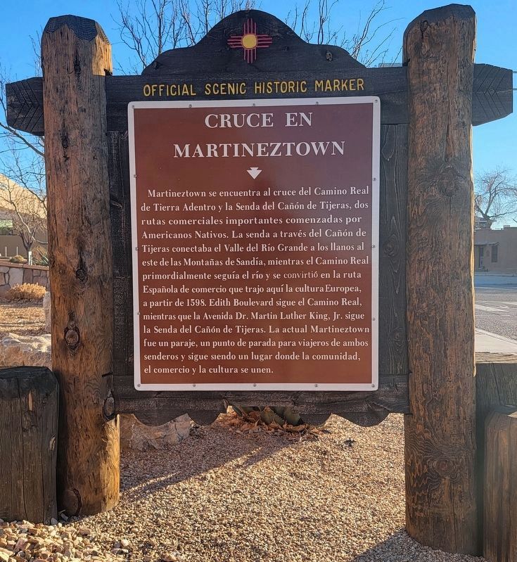
Photographed by Bill Wingate, January 2, 2022
2. Cruce en Martineztown Marker
Other nearby markers. At least 8 other markers are within walking distance of this marker: Albuquerque Landmark (approx. 0.2 miles away); Mary Strong House (approx. 0.4 miles away); Hotel Alvarado (approx. 0.4 miles away); Albuquerque Electric Streetcar System (approx. 0.4 miles away); Railroad Avenue and Front Street (approx. 0.4 miles away); Gold Avenue (approx. 0.4 miles away); Harvey Girls / Mary Elizabeth Jane Colter, 1869 - 1958 (approx. 0.4 miles away); Central Bank Building (approx. half a mile away). Touch for a list and map of all markers in Albuquerque.

Photographed by Bill Wingate, January 2, 2022
3. View North on Edith Boulevard of Crossroads at Martineztown Marker
Credits. This page was last revised on May 8, 2025. It was originally submitted on January 3, 2022, by Bill Wingate of Albuquerque, New Mexico. This page has been viewed 629 times since then and 42 times this year. Photos: 1, 2, 3. submitted on January 3, 2022, by Bill Wingate of Albuquerque, New Mexico. • Devry Becker Jones was the editor who published this page.
