Schuylkill Banks in Philadelphia in Philadelphia County, Pennsylvania — The American Northeast (Mid-Atlantic)
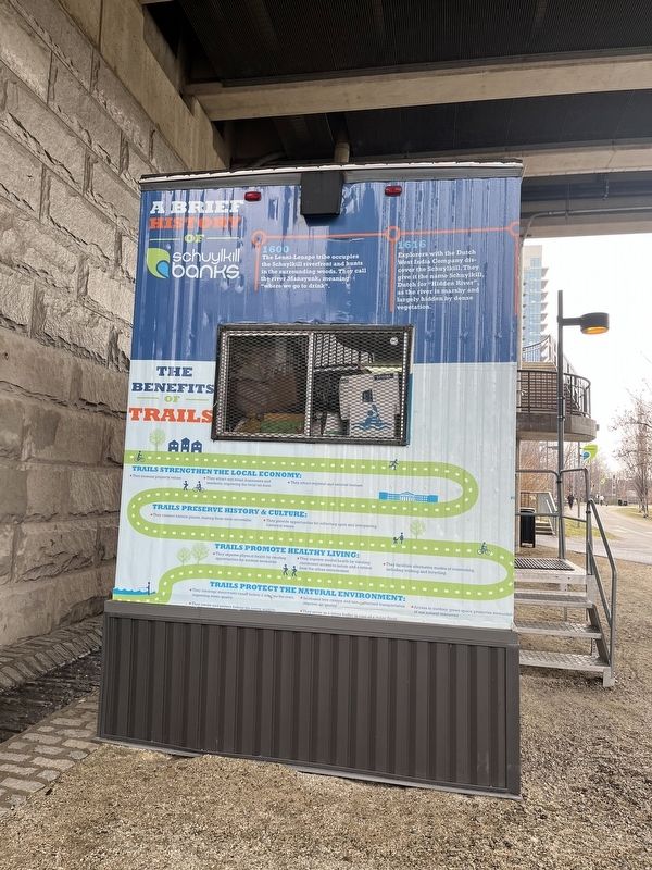
A Brief History of Schuylkill Banks
Photographed by Devry Becker Jones (CC0), February 25, 2022
1. A Brief History of Schuylkill Banks Marker
1600: The Lenni-Lenape tribe occupies the Schuylkill riverfront and hunts in the surrounding woods. They call the river Manayunk, meaning "where we go to drink".
1616: Explorers with the Dutch West India Company discover the Schuylkill. They give it the name Schuylkill, Dutch for "Hidden River", as the river is marshy and largely hidden by dense vegetation.
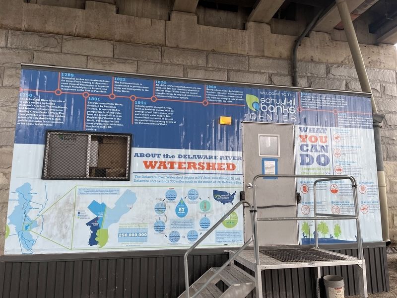
1750: The Schuylkill River is the site of country estates including Bartram's Garden, The Woodlands, and Lemon Hill, and taverns including Gray's Ferry Tavern. The river provides a beautiful outdoor retreat for city dwellers to fish, paddle and swim in the summer, or ice skate in the winter.
1789: Triumphal arches are constructed over the Grays Ferry floating bridge to welcome General Washington as he passes through Philadelphia on his way to be inaugurated as the first US President.
1801: The Fairmount Water Works, designed by Benjamin Latrobe, is constructed to pump fresh drinking water from the Schuylkill. It is an Engineering Wonder of the World, becoming the 2nd most popular tourist destination in the mid-19th century.
1822: The Fairmount Dam is
this page online
1844: Industry grows along the riverfront as business owners take advantage of rail lines, cheap coal and a ready water supply. Fairmount Park is created to protect the quality of water being drawn at the Fairmount Water Works.
1876: All of the city's slaughterhouses are consolidated into one riverfront abattoir at Market Street. Waste from the central slaughterhouse is emptied into the river, compromising water quality.
1900: Heavy industry lines both banks of the river. Industrial waste, animal carcasses, human excrement and city trash are dumped onto wharves or directly into the river.
1917: The Schuylkill is a dead river, overcome by waste and unable to support aquatic life. Most workers drink city or bottled water, and avoid using river water for industrial use or even putting out fires.
1950: After a 40-year delay caused by the Great Depression and two World Wars, the City builds three sewage treatment plants to intercept sewage before it reaches the river.
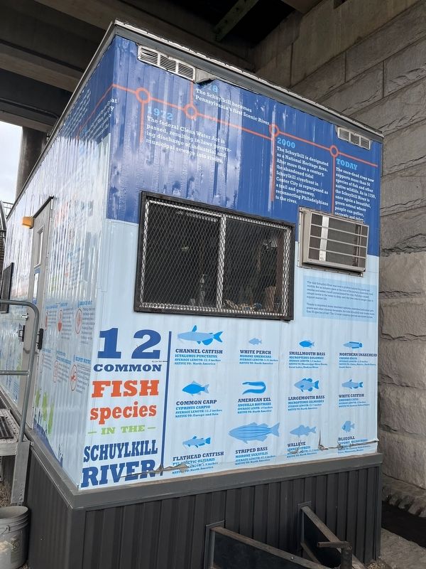
1972: The federal Clean Water Act is passed, resulting in laws governing discharge of
Photographed by Devry Becker Jones (CC0), February 25, 2022
2. A Brief History of Schuylkill Banks Marker
1978: The Schuylkill becomes Pennsylvania's first Scenic River.
2000: The Schuylkill is designated as a National Heritage Area. After more than a century, the abandoned tidal Schuylkill riverfront in Center City is repurposed as a trail and greenway, reconnecting Philadelphians to the river.
Today: The once-dead river now supports more than 50 species of fish and other native wildlife. As in 1750, the Schuylkill River is once again a beautiful, green retreat where people can gather, recreate and relax.
Erected by Schuylkill Banks.
Topics and series. This historical marker is listed in these topic lists: Bridges & Viaducts • Colonial Era • Environment • Indigenous Peoples and Communities • Industry & Commerce • Settlements & Settlers • Waterways & Vessels. In addition, it is included in the Former U.S. Presidents: #01 George Washington series list. A significant historical year for this entry is 1600.
Location. 39° 57.093′ N, 75° 10.857′ W. Marker is in Philadelphia, Pennsylvania, in Philadelphia County. It is in Schuylkill Banks. It is at the intersection
Photographed by Devry Becker Jones (CC0), February 25, 2022
3. A Brief History of Schuylkill Banks Marker

Regionally, this marker is in Southeast Pennsylvania. It is also in the American Northeast and in the Mid-Atlantic. Globally, it is in North America, the Western Hemisphere, the Western World, and the Anglosphere. Historically, it finds itself in what was once the Haudenosaunee (Iroquois) Confederacy, New Netherland, and one of the original Thirteen Colonies.
Other nearby markers. At least 8 other markers are within walking distance of this marker: Creating the Greenway (about 300 feet away, measured in a direct line); Rolling Along (about 400 feet away); Schuylkill River Park (about 800 feet away); In 1870, St. James Episcopal Church filled this corner. (approx. 0.2 miles away); Industry (approx. 0.2 miles away); Wharves (approx. 0.2 miles away); Schuylkill Expressway (approx. 0.2 miles away); First Troop Philadelphia City Cavalry (approx. 0.2 miles away). Touch for a list and map
Photographed by Devry Becker Jones (CC0), February 25, 2022
4. A Brief History of Schuylkill Banks Marker
Credits. This page was last revised on February 2, 2023. It was originally submitted on February 27, 2022, by Devry Becker Jones of Washington, District of Columbia. This page has been viewed 854 times since then and 28 times this year. Photos: 1, 2, 3, 4. submitted on February 27, 2022, by Devry Becker Jones of Washington, District of Columbia.
