Manahawkin in Stafford Township in Ocean County, New Jersey — The American Northeast (Mid-Atlantic)
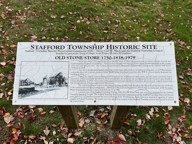
Old Stone Store 1750-1838-1979
Stafford Township Historic Site
Before the advent of the supermarkets and specialty stores of today, the general store provided a diversity of goods and a gathering place for the local population. This store was originally built about 1750 by Captain Reuben Randolph in the vicinity of his saw mills and grist mill. The building was purchased by Benjamin Oliphant, who reinforced the exterior with native sandstone in 1838.
Over the years, the store changed ownership several times and served as a township meeting place, a Civil War military recruiting office, and a private residence before finally being abandoned sometime after WW II. Arson finally destroyed the building in 1964.
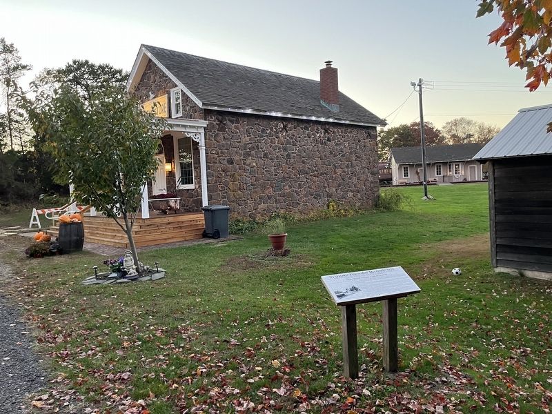
During the initial unsuccessful restoration project, the building was taken down and the stones stored for future restoration. After much time and effort by local townspeople, the structure was reconstructed by the Ocean County Board of Chosen Freeholders in 1979. Since many of the original stones had crumbled or been lost, the recovered, original stones were laid on edge instead of flat in order to cover the outside.
The current building is located on the original location on Old South Broadway, the Shore Road that became US Route 9, the north/south road since colonial times. This loop of the road was bypassed in 1920 by the reconstruction of NJ 4 (current Route 9) and isolated by the construction of Route 72 in 1966.
Currently part of the Stafford Township Heritage Park, the Old Stone Store now serves as a museum for the Stafford Township Historical Society. The Stafford Township Environmental Commission and the Stafford Township Historical Society participated in a project that donated the trees in Heritage Park. The Kwanzan cherry trees were planted in memory of various citizens of Stafford Township. The maple trees were planted in memory of the Stafford Township patriots who served in wars of the United States.
Erected 2006 by Stafford Township Historic Preservation Commission, Mayor Carl W. Block and the Stafford Township Council; installed as a part of the Troop 65 Eagle Scout Project by Jerry S. Gambino.
Topics. This historical marker is listed in these topic lists: Colonial Era • Industry & Commerce • Parks & Recreational Areas • Roads & Vehicles • War, US Civil. A significant historical year for this entry is 1750.
Location. 39° 41.72′ N, 74° 15.663′ W. Marker is in Stafford Township, New Jersey, in Ocean County. It is in Manahawkin. Marker is on West Bay Avenue, 0.1 miles west of South Main Street (U.S. 9), on the left when traveling west. Touch for map. Marker is at or near this postal address: 152 Old S Broadway, Manahawkin NJ 08050, United States of America. Touch for directions.
Other nearby markers. At least
Credits. This page was last revised on February 7, 2023. It was originally submitted on November 3, 2022, by Devry Becker Jones of Washington, District of Columbia. This page has been viewed 132 times since then and 29 times this year. Photos: 1, 2. submitted on November 3, 2022, by Devry Becker Jones of Washington, District of Columbia.

