Near Chillicothe in Ross County, Ohio — The American Midwest (Great Lakes)
Mica Splendor
Hopewell Culture National Historical Park — Mound City Group
— National Park Service, U.S. Department of the Interior —
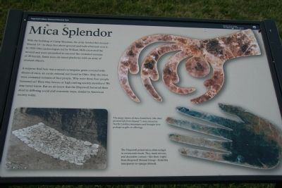
With the building of Camp Sherman, the army leveled this mound-Mound 13-to three feet above ground and built a barrack over it. In 1920 Ohio archeologists led by William Mills excavated the mound and were astonished to uncover the cremated remains of 20 burials. Some were on raised platforms with an array of usual objects.
A surprise find here was a raised-rectangular grave covered with sheets of mica, an exotic mineral not found in Ohio. Atop the mica were cremated remains of four people. Why were these four people honored so? Were they heroes or high ranking society members? We may never know. But we do know that the Hopewell honored their dead in differing social and economical ways, similar to American society today.
Erected by National Park Service, U.S. Department of the Interior.
Topics. This historical marker is listed in these topic lists: Anthropology & Archaeology • Cemeteries & Burial Sites • Native Americans. A significant historical year for this entry is 1920.
Location. 39° 22.59′ N, 83° 0.343′ W. Marker is near Chillicothe, Ohio, in Ross County. Marker can be reached from Ohio Route 104, 1.7 miles north of U.S. 35. This historical marker is located in the, "Hopewell Culture, National Historical Park." It is one of several historical markers used by the National Park Service to help explain the significance of this historical site, as well as the Hopewell culture. Upon ones arrival at the park, it is recommended that you go to the park visitor center and obtain a free site map showing all of the park's mound sites. Touch for map. Marker is at or near this postal address: 16062 State Route 104, Chillicothe OH 45601, United States of America. Touch for directions.
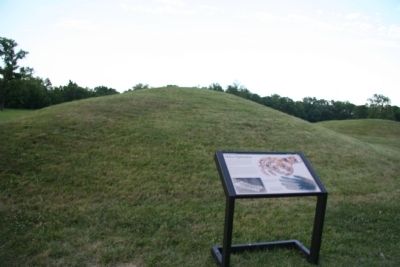
Other nearby markers. At least 8 other markers are within walking distance of this marker. Mound 7 (here, next to this marker); A Sacred Purpose (within shouting distance of this marker); Squash (about 300 feet away, measured in a direct line); Sunflower (about 300 feet away); Goosefoot (about 300 feet away); Maygrass (about 300 feet away); Marshelder, Sumpweed (about 300 feet away); Rustic Tobacco (about 300 feet away). Touch for a list and map of all markers in Chillicothe.
Also see . . .
1. Hopewell Culture National Historical Park. This web link was both published and made available by, "Touring Ohio." (Submitted on July 21, 2009, by Dale K. Benington of Toledo, Ohio.)
2. Mound City Group. This link is published and made available by, "Ohio History Central," an online encyclopedia of Ohio History. (Submitted on July 21, 2009, by Dale K. Benington of Toledo, Ohio.)
3. Mound City Group. This web link is provided by the National Park Service. (Submitted on July 21, 2009, by Dale K. Benington of Toledo, Ohio.)

Photographed By Devry Becker Jones (CC0), June 24, 2022
3. Mica Splendor Marker
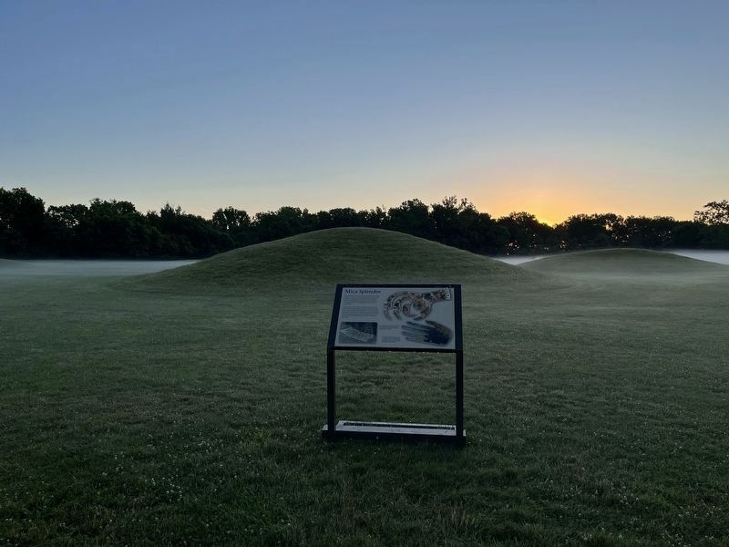
A photo of the marker in context at sunrise. The mounds are visible with fog hanging along the ground.
Credits. This page was last revised on August 9, 2022. It was originally submitted on July 21, 2009, by Dale K. Benington of Toledo, Ohio. This page has been viewed 1,325 times since then and 21 times this year. Photos: 1, 2. submitted on July 21, 2009, by Dale K. Benington of Toledo, Ohio. 3. submitted on June 27, 2022, by Devry Becker Jones of Washington, District of Columbia. 4. submitted on July 21, 2009, by Dale K. Benington of Toledo, Ohio. • Craig Swain was the editor who published this page.


