New Orleans East Area in Orleans Parish, Louisiana — The American South (West South Central)
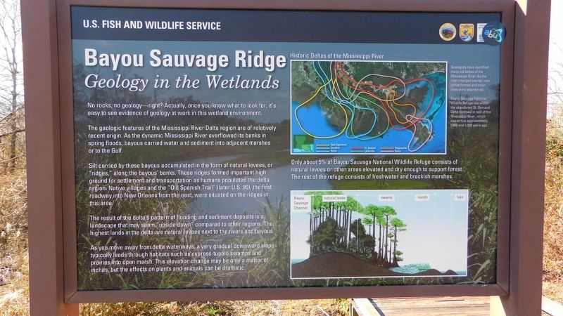
Bayou Sauvage Ridge
Geology in the Wetlands
No rocks, no geology-right? Actually, once you know what to look for, it's easy to see evidence of geology at work in this wetland environment.
The geologic features of the Mississippi River Delta region are of relatively recent origin. As the dynamic Mississippi River overflowed its banks in spring floods, bayous carried water and sediment into adjacent marshes or to the Gulf.
Silt carried by these bayous accumulated in the form of natural levees, or "ridges," along the bayous' banks. These ridges formed important high ground for settlement and transportation as humans populated the delta region. Native villages and the "Old Spanish Trail" (later U.S. 90), the first roadway into New Orleans from the east, were situated on the ridges in this area.
The result of the delta's pattern of flooding and sediment deposits is a landscape that may seem "upside down" compared to other regions. The highest lands in the delta are natural levees next to the rivers and bayous.
As you move away from delta waterways, a very gradual downward slope typically leads through habitats such as cypress-tupelo swamps and prairies into open marsh. This elevation change may be only a matter of inches, but the effects on plants and animals can be dramatic.
Erected by U.S. Fish and Wildlife Service.
Topics. This historical marker is listed in these topic lists: Environment • Natural Features • Parks & Recreational Areas • Waterways & Vessels.
Location. 30° 3.264′ N, 89° 52.726′ W. Marker is in New Orleans, Louisiana, in Orleans Parish. It is in the New Orleans East Area. Marker can be reached from Chef Menteur Highway (U.S. 90) near Recovery Road. Touch for map. Marker is in this post office area: New Orleans LA 70129, United States of America. Touch for directions.
Other nearby markers. At least 8 other markers are within 10 miles of this marker, measured as the crow flies. Prehistoric Inhabitants of Bayou Sauvage (about 300 feet away, measured in a direct line); Hurricane Katrina (about 600 feet away); Henriette Delille (approx. 8.2 miles away); Jumonville Plantation (approx. 9.1 miles away); Plantation of Jacques Philippe Villere (approx. 9˝ miles away); Lacoste Plantation (approx. 9.7 miles away); Denis de La Ronde Site (approx. 9.7 miles away); The Chalmette Plantations (approx. 9.7 miles away). Touch for a list and map of all markers in New Orleans.
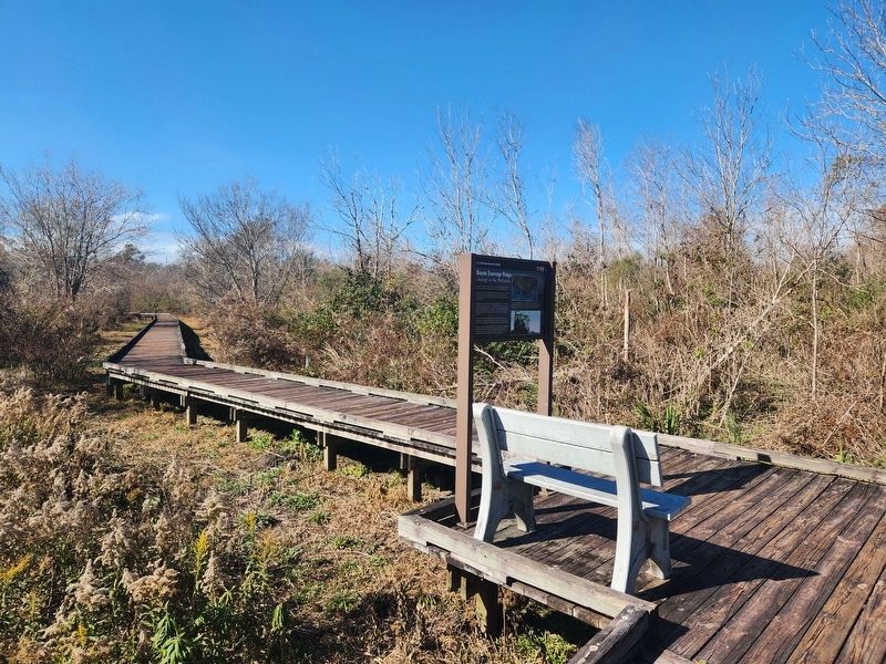
More about this marker. Located on the Bayou Sauvage N.W.R Boardwalk.
Credits. This page was last revised on February 12, 2023. It was originally submitted on January 1, 2023, by Cajun Scrambler of Assumption, Louisiana. This page has been viewed 149 times since then and 30 times this year. Photos: 1, 2. submitted on January 1, 2023, by Cajun Scrambler of Assumption, Louisiana.

