Downtown in San Antonio in Bexar County, Texas — The American South (West South Central)
San Pedro Creek: A Crossroads of Cultures
Photographed by James Hulse, December 30, 2022
1. San Pedro Creek: A Crossroads of Cultures Marker
Inscription.
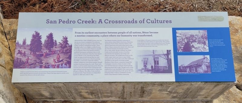
San Pedro Creek: A Crossroads of Cultures. . From its earliest encounters between people of all nations, Béxar became a mestizo community, a place where our humanity was transformed., Geological Time Dwarfs human time but, the two are closely intertwined. For millennia San Pedro Springs have risen to the surface from a deep, purifying underground aquifer. These abundant waters once formed a swiftly flowing creek that sustained myriad indigenous peoples for 12,000 years before the Spanish arrived to establish a permanent settlement here in 1718. Following the settlement of families from Spain's Canary Islands in 1731, land along San Pedro Creek was apportioned among them by royal land grants for farming and collective grazing. Gradually a community of Spanish soldiers, civilians, indigenous, and diverse mestizo (mixed) residents developed along the creek. These early settlers would be joined, beginning in the 1820s, by colonists from the United States and Europe who came seeking land and opportunity in Texas, then still part of Mexico. The influx of new residents accelerated after Texas became an independent republic in 1836 and a state in 1845., San Antonio became a frontier community of many nations where Native Americans, Mexicans, Germans, French, Poles, Lebanese, Italians, and African Americans lived and worked side by side. Many of these communities mixed with others, and San Antonio became increasingly mestizo. But as other ethnic divides widened, San Pedro Creek would eventually become a boundary line between the emerging city's Anglo and Mexican enclaves. The neighborhood here on the creek's upper reach was home to many Italian immigrants who sold produce and other traditional specialties at the nearby municipal market. Members of this vibrant community formed the Christopher Columbus Italian Society in 1890 and built San Francesco di Paola Church and the adjoining parish hall in 1927. Though much of this neighborhood was demolished when expressways were constructed beginning in the 1940s, this area along San Pedro Creek is considered to be the center of San Antonio's Italian community., Captions , Left: Indigenous people hunted, fished, and camped along area streams for thousands of years before Spanish explorers arrived in the late 1600s. Camp of the Lipan depicts a similar scene outside of San Antonio in the late 19th century. , Painting: Theodore Gentilz. , Courtesy: Witte Museum, San Antonio. , Upper Middle Right: Large numbers of European immigrants arrived in San Antonio in the mid-to-late 1800s seeking new opportunities. Many settled along and near San Pedro Creek including French artist Theodore Gentile and his wife Marie, seen here in front of their home on North Flores Street just east of the creek. , Courtesy: DRT Collection at Texas A&M at San Antonio., Upper Right: Italian merchants operated stores nearby and sold vegetables and other goods at San Antonio's municipal market, a short distance south of here. , Marilyn Magaro, San Antonio. , Lower Right: In the 1800s the main thoroughfare west of the creek was Laredo Street, and the area became informally known as Laredito. La Esperanza Grocery No. 3 near San Pedro Creek on North Laredo Street was typical of the the businesses operated by area's residents. , Courtesy: DRT Collection at Texas A&M at San Antonio.
From its earliest encounters between people of all nations, Béxar became a mestizo community, a place where our humanity was transformed.
Geological Time Dwarfs human time but, the two are closely intertwined. For millennia San Pedro Springs have risen to the surface from a deep, purifying underground aquifer. These abundant waters once formed a swiftly flowing creek that sustained myriad indigenous peoples for 12,000 years before the Spanish arrived to establish a permanent settlement here in 1718. Following the settlement of families from Spain's Canary Islands in 1731, land along San Pedro Creek was apportioned among them by royal land grants for farming and collective grazing. Gradually a community of Spanish soldiers, civilians, indigenous, and diverse mestizo (mixed) residents developed along the creek. These early settlers would be joined, beginning in the 1820s, by colonists from the United States and Europe who came seeking land and opportunity in Texas, then still part of Mexico. The influx of new residents accelerated after Texas became an independent republic in 1836 and a state in 1845.
San Antonio became
Click or scan to see this page online
a frontier community of many nations where Native Americans, Mexicans, Germans, French, Poles, Lebanese, Italians, and African Americans lived and worked side by side. Many of these communities mixed with others, and San Antonio became increasingly mestizo. But as other ethnic divides widened, San Pedro Creek would eventually become a boundary line between the emerging city's Anglo and Mexican enclaves. The neighborhood here on the creek's upper reach was home to many Italian immigrants who sold produce and other traditional specialties at the nearby municipal market. Members of this vibrant community formed the Christopher Columbus Italian Society in 1890 and built San Francesco di Paola Church and the adjoining parish hall in 1927. Though much of this neighborhood was demolished when expressways were constructed beginning in the 1940s, this area along San Pedro Creek is considered to be the center of San Antonio's Italian community.
Captions Left: Indigenous people hunted, fished, and camped along area streams for thousands of years before Spanish explorers arrived in the late 1600s. Camp of the Lipan depicts a similar scene outside of San Antonio in the late 19th century. Painting: Theodore Gentilz. Courtesy: Witte Museum, San Antonio.
Upper Middle Right: Large numbers of European immigrants arrived in San Antonio in the mid-to-late 1800s seeking new opportunities. Many settled along and near San Pedro Creek including French artist Theodore Gentile and his wife Marie, seen here in front of their home on North Flores Street just east of the creek. Courtesy: DRT Collection at Texas A&M at San Antonio.
Upper Right: Italian merchants operated stores nearby and sold vegetables and other goods at San Antonio's municipal market, a short distance south of here. Marilyn Magaro, San Antonio.
Lower Right: In the 1800s the main thoroughfare west of the creek was Laredo Street, and the area became informally known as Laredito. La Esperanza Grocery No. 3 near San Pedro Creek on North Laredo Street was typical of the the businesses operated by area's residents. Courtesy: DRT Collection at Texas A&M at San Antonio.
Erected 2018
Photographed by James Hulse, December 30, 2022
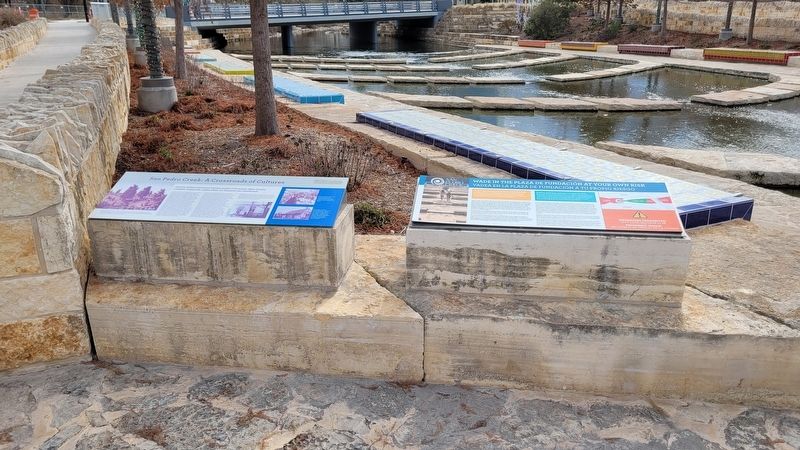
2. The San Pedro Creek: A Crossroads of Cultures Marker is the marker on the left of the two markers
by San Pedro Creek Culture Park. (Marker Number 3.)
Location. 29° 25.889′ N, 98° 29.873′ W. Marker is in San Antonio, Texas, in Bexar County. It is in Downtown. It can be reached from the intersection of Camaron Street and North Santa Rosa Street. The marker is located on the northeast section of the San Pedro Creek Culture Park on a stone block. Touch for map. Marker is at or near this postal address: 715 Camaron Street, San Antonio TX 78207, United States of America. Touch for directions.
Regionally, this marker is in South Texas. It is also in the American South. Globally, it is in North America, a Gulf of Mexico state, the Western Hemisphere, the Western World, and the Anglosphere. Historically, it finds itself in what was once New Spain, the Republic of Texas, and one of the Confederate States of America.
Other nearby markers. At least 8 other markers are within walking distance of this marker:
Photographed by James Hulse, December 30, 2022
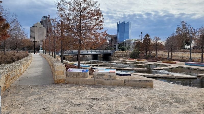
3. The view of the San Pedro Creek: A Crossroads of Cultures Marker in the park
Also see . . . Where beauty meets purpose. San Pedro Creek Culture Park (Submitted on January 6, 2023, by James Hulse of Medina, Texas.)
Credits. This page was last revised on February 2, 2023. It was originally submitted on January 6, 2023, by James Hulse of Medina, Texas. This page has been viewed 236 times since then and 17 times this year. Photos:1, 2, 3. submitted on January 6, 2023, by James Hulse of Medina, Texas.