Nacogdoches in Nacogdoches County, Texas — The American South (West South Central)
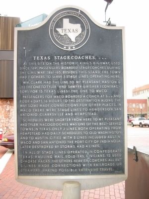
Texas Stagecoaches, C.S.A.
Wm. Clark had the line to Mt. Pleasant, Haston & Lee the one to Tyler, and Sawyer & Risher (contractors for 15 Texas lines) the one to Waco.
Passengers for Waco boarded a coach at 6 a.m., and rode 4 days, 16 hours to the destination. Along the way some made connections for other places. In Waco there were stage lines to Henderson, San Antonio, Clarksville and Hempstead.
Schedules were shorter from here to Mt. Pleasant and Tyler. Nacogdoches was one of the best-served towns in Texas. Only 2 lines, both operating from Hempstead, had daily schedules, to Old Washington and to Austin. Cities with 5 lines included Austin, Waco and San Antonio. The port city of Indianola, later destroyed by storms, had 4 lines.
In all 31 stage lines operated in Confederate Texas, hauling mail, soldiers, civilians. 15 used 2-horse hacks, the others heavier coaches. All but 5 lines made connections with railroads or steamers, making possible extensive travel.
Erected 1964 by State Historical Survey Committee. (Marker Number 9400.)
Topics and series. This historical marker is listed in these topic lists: Hispanic Americans • Native Americans • Settlements & Settlers • War, US Civil. In addition, it is included in the El Camino Real de los Tejas National Historic Trail series list. A significant historical year for this entry is 1691.
Location. 31° 36.18′ N, 94° 39.268′ W. Marker is in Nacogdoches, Texas, in Nacogdoches County. Marker is at the intersection of East Main Street and North Fredonia Street, on the right when traveling west on East Main Street. Touch for map. Marker is in this post office area: Nacogdoches TX 75961, United States of America. Touch for directions.
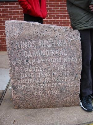
Other nearby markers. At least 8 other markers are within walking distance of this marker. On This Site Stood for a Century an Old Stone House (here, next to this marker); Kings Highway Camino Real — Old San Antonio Road (a few steps from this marker); The Mayer & Schmidt Building (a few steps from this marker); The Fredonia Rebellion (within shouting distance of this marker); Antonio Gil Y’Barbo (within shouting distance of this marker); Battle of Nacogdoches (within shouting distance of this marker);
Morgan Malcolm "Mack" Stripling (within shouting distance of this marker); Pillar Street (within shouting distance of this marker). Touch for a list and map of all markers in Nacogdoches.
Also see . . . Old San Antonio Road. Wikipedia article on Old San Antonio Road, or "The King's Highway" (Submitted on August 7, 2009, by Richard Denney of Austin, Texas.)
Additional commentary.
1.
The "King's Highway" is also known as El Camino Real, Old San Antonio Road, or sometimes just "OSR"
— Submitted August 7, 2009, by Richard Denney of Austin, Texas.
Additional keywords. El Camino Real, Old San Antonio Road, Old Stone House, Old Stone Fort
Photographed By Richard Denney, February 2, 2002
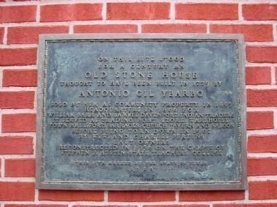
5. Old Stone House Marker
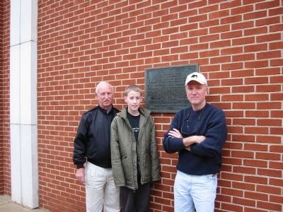
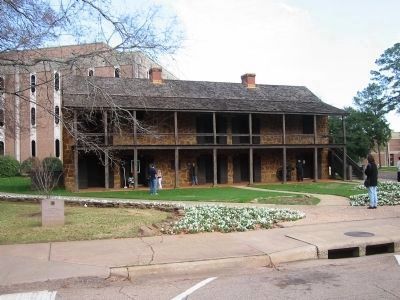
A marker on the bank wall describes the historic building originally at this location, before, during and after the stagecoach days. It reads
"On this site stood for a century an OLD STONE HOUSE thought to have been built in 1779 by ANTONIO GIL YBARBO, Sold by him as community property in 1805, Headquarters in 1806 for William Barr and Samuel Davenport, Indian traders, it served as trading post, store, warehouse, town hall, fort, barracks, church, tavern and saloon before being torn down in 1902 by W.W. and Charles Perkins, last owners.
Reconstructed in 1936 on the campus of Stephen F. Austin State Teachers College.
This site marked by the State of Texas 1956"
Credits. This page was last revised on April 12, 2021. It was originally submitted on August 7, 2009, by Richard Denney of Austin, Texas. This page has been viewed 2,355 times since then and 61 times this year. Photos: 1, 2, 3, 4, 5, 6. submitted on August 7, 2009, by Richard Denney of Austin, Texas. • Craig Swain was the editor who published this page.
