Sayre in Bradford County, Pennsylvania — The American Northeast (Mid-Atlantic)
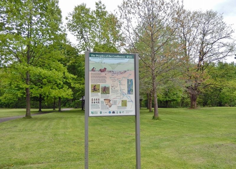
The Peoples of the Confluence
12,000 Years Along the Chemung and Susquehanna Rivers
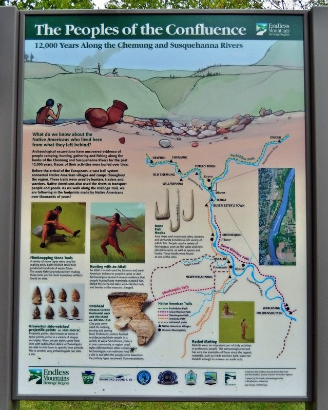
What do we know about the Native Americans who lived here from what they left behind?
Archaeological excavations have uncovered evidence of people camping, hunting, gathering and fishing along the banks of the Chemung and Susquehanna Rivers for the past 12,000 years. Traces of their activities were buried over time.
Before the arrival of the Europeans, a vast trail system connected Native American villages and camps throughout the region. These trails were used by hunters, traders and warriors. Native Americans also used the rivers to transport people and goods. As we walk along the Diahoga Trail, we are following in the footprints made by Native Americans over thousands of years!
Flintknapping Stone Tools
A variety of stone types were used for making tools. Each finished stone tool produced hundreds of waste flakes. The waste flake by-products from making these tools are the most numerous artifacts found on sites.
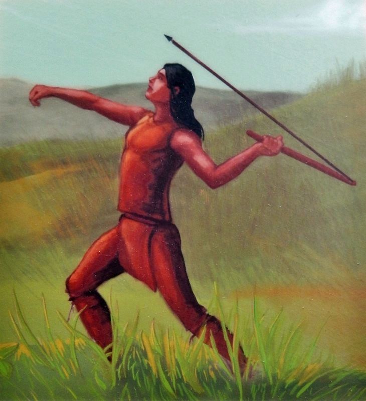
Hunting with an Atlatl
An atlatl is a stick used by Eskimos and early American Indians to propel a spear or dart. Archaeological research reveals evidence that people hunted large mammals, trapped furs, fished the rivers and lakes and collected nuts and berries as the seasons changed.
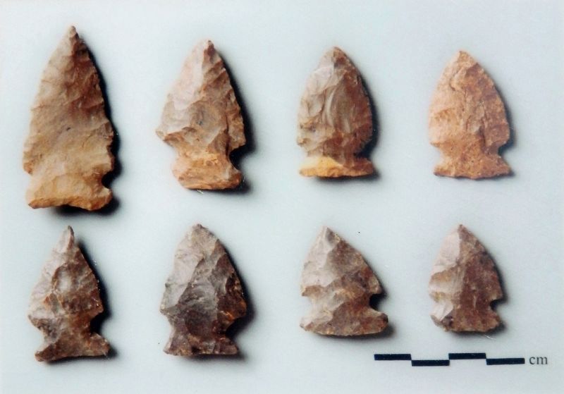
Brewerton side-notched projectile points
ca. 3000-2500 BC
Projectile points, also known as arrow or spear points, come in a variety of shapes and styles. When certain styles come from sites with radiocarbon dates, archaeologists are able to link them to specific time periods. This is another way archaeologists can date a site.
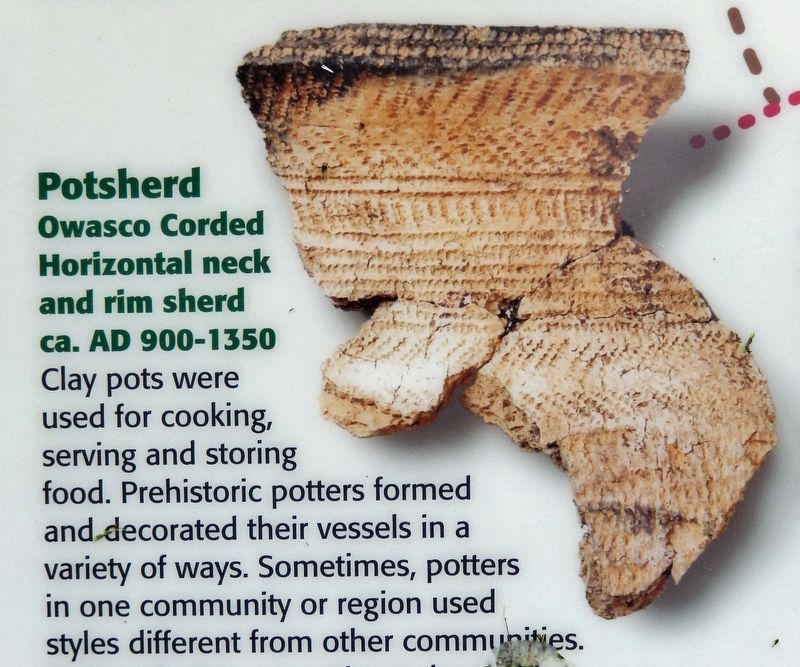
Potsherd
Owasco Corded Horizontal neck and rim sherd ca. AD 900-1350
Clay pots were used for cooking, serving and storing food. Prehistoric potters formed and decorated their vessels in a variety of ways. Sometimes, potters in one community or region used styles different from other communities. Archaeologists can estimate how old a site is and who the people were based on the pottery types recovered from excavations.
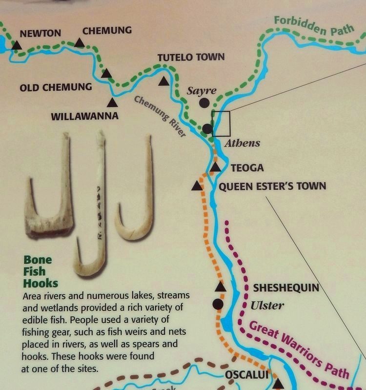
Bone Fish Hooks
Area rivers and numerous lakes, streams and wetlands provided a rich variety of edible fish. People used a variety of fishing gear, such as fish weirs and nets placed in rivers, as well as spears and hooks. These hooks were found at one of the sites.
Basket Making
Baskets were an important part of daily activities of prehistoric people. The archaeological record has very few examples of these since the organic materials, such as reeds and tree bark, were not durable enough to survive our acidic soils.
Erected by Pennsylvania Department of Conservation and Natural Resources; Borough of Sayre; and Borough of Athens.
Topics. This historical marker is listed in these topic lists: Anthropology & Archaeology • Native Americans • Parks & Recreational Areas • Waterways & Vessels.
Location. 41° 58.424′ N, 76° 30.739′ W. Marker is in Sayre, Pennsylvania, in Bradford County. Marker is on Shaw Road just east of Riverfront Park Road, on the left when traveling east. Marker is located on the east side of the ball fields at Riverfront Park, beside the walkway leading to the Susquehanna River. Touch for map. Marker is at or near this postal address: 100 Riverfront Park Road, Sayre PA 18840, United States of America. Touch for directions.
Other nearby markers. At least 8 other markers are within walking distance of this marker. Pvt. Lawrence L. Cabucci (approx. 0.4 miles away); Sayre-Built Caboose Returns to Museum (approx. half a mile away); The Lehigh and Early Sayre (approx. half a mile away); Parks, Canteen & Schools (approx. half a mile away); Passenger Station, Footbridge, and Black Diamond (approx. half a mile away); Sayre, A Boomtown (approx. half a mile away); Sayre Borough Hall (approx. half a mile away); The Lehigh Valley Railroad Comes to Sayre (approx. half a mile away). Touch for a list and map of all markers in Sayre.
Credits. This page was last revised on February 19, 2023. It was originally submitted on February 18, 2023, by Cosmos Mariner of Cape Canaveral, Florida. This page has been viewed 62 times since then and 7 times this year. Photos: 1, 2, 3, 4, 5, 6. submitted on February 19, 2023, by Cosmos Mariner of Cape Canaveral, Florida.
