South Bloomingville in Hocking County, Ohio — The American Midwest (Great Lakes)
Salt and Hunting Trails
Photographed by William Fischer, Jr., August 15, 2009
1. Salt and Hunting Trails Marker
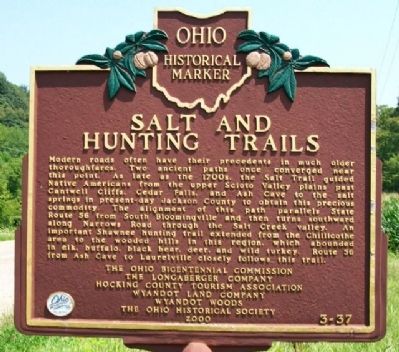
Modern roads often have their precedents in much older thoroughfares. Two ancient paths once converged near this point. As late as the 1700s, the Salt Trail guided Native Americans from the upper Scioto Valley plains past Cantwell Cliffs, Cedar Falls, and Ash Cave to the salt springs in present-day Jackson County to obtain this precious commodity. The alignment of this path parallels State Route 56 from South Bloomingville and then turns southward along Narrows Road through the Salt Creek valley. An important Shawnee hunting trail extended from the Chillicothe area to the wooded hills in this region, which abounded in elk, buffalo, black bear, deer, and wild turkey. Route 56 from Ash Cave to Laurelville closely follows this trail.
Erected 2000 by Ohio Bicentennial Commission, The Longaberger Company, Hocking County Tourism Association, Wyandot Land Company, Wyandot Woods, and The Ohio Historical Society. (Marker Number 3-37.)
Topics and series. This historical marker is listed in these topic lists: Anthropology & Archaeology • Colonial Era • Indigenous Peoples and Communities • Waterways & Vessels.
this page online
Location. Marker has been reported missing. It was located near 39° 24.789′ N, 82° 38.663′ W. Marker was in South Bloomingville, Ohio, in Hocking County. It was on Ohio Route 56, on the left when traveling west. Marker is about 300 feet west of Salt Creek and the intersection of Ohio Route 56 and County Road 184. Touch for map. Marker was in this post office area: South Bloomingville OH 43152, United States of America. Touch for directions.

Regionally, this marker was in Ohio’s Hocking Hills. It was also in the American Midwest, in the Corn Belt, in Appalachia, and specifically in Northern Appalachia. Globally, it was in North America, the Western Hemisphere, the Western World, and the Anglosphere. Historically, it found itself in what was once the Haudenosaunee (Iroquois) Confederacy, the territory of the Mississippian Culture, and the Northwest Territory.
Other nearby markers. At least 8 other markers are within 6 miles of this location, measured as the crow flies:
Photographed by William Fischer, Jr., August 15, 2009
2. Salt and Hunting Trails Marker
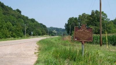
Looking east along OH 56 toward Salt Creek.
Regarding Salt and Hunting Trails. This marker is no longer present. It is also not listed on remarkableohio.org, Ohio’s official state marker page. This seems to imply that the marker was deliberately removed for some reason.
Also see . . . Salt Creek Township, Pickaway County, Ohio. This 1880s historical description of a neighboring township along the same Salt Creek in a neighboring county provides insightful information. (Submitted on November 23, 2009, by William Fischer, Jr. of Reynoldsburg, Ohio.)
Photographed by Joe Todd Fraker, March 3, 2010
3. Salt and Hunting Trails Marker
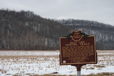
Winter view from different angle
Photographed by William Fischer, Jr., August 15, 2009
4. Salt Creek Valley
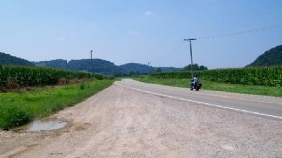
Looking west along Ohio Route 56.
Credits. This page was last revised on March 19, 2023. It was originally submitted on November 23, 2009, by William Fischer, Jr. of Reynoldsburg, Ohio. This page has been viewed 1,449 times since then and 33 times this year. Last updated on March 19, 2023, by Grant & Mary Ann Fish of Galloway, Ohio. Photos: 1, 2. submitted on November 23, 2009, by William Fischer, Jr. of Reynoldsburg, Ohio. 3. submitted on March 4, 2010, by Joe Todd Fraker of Lancaster, Ohio. 4. submitted on November 23, 2009, by William Fischer, Jr. of Reynoldsburg, Ohio. • Bill Pfingsten was the editor who published this page.
