College Park in Prince George's County, Maryland — The American Northeast (Mid-Atlantic)
A Colorful Past
Maryland Miletsones
| — | Anacostia Trails Heritage Area | — |

Today's Campus Drive, once known as Paint Branch Parkway, was previously named for the nearby "Paint Branch," a seventeen mile long tributary of the Anacostia River. The Parkway was built to replace Calvert Road which ran from Baltimore Avenue to Edmonston Road (today's Kenilworth Avenue). The reason for the name Paint Branch is unclear.
Archaeologists have found evidence of Native American settlements from the Anacostan tribe along the river banks dating to 1,000 B.C. Along with tools and other objects, they found that the river's colorful clays were used by these early inhabitants as ceremonial paints.
From the early 1700s to the 1900s, the power of water running downhill to the Anacostia River was harnessed to provide power to a number of thriving mills. These mills ground corn, sawed lumber, and finished local woo for making cloth. One mill, Fawcett's Woolen Mill, near Fairland Road, operated in the mid-19th century. The dyes used to color the wool were released into the river, coloring, or "painting" the waters. The remains of some of these mills can still be seen today along the river banks.
In July 2016,
this page online
Now, as to the origin of the name "Paint branch"…near the junction of Little Paint branch and Big Paint branch…are conspicuous deposits of red clay and there is also some blue clay. It has been used as paint, or as the coloring matter of paint, from immemorial times…shipments were made up to about ten years ago and that very recently a man in Branchville painted his barn with this clay…
The Rambler, The Washington Evening Star, November 22, 1914
Erected by City of College Park, Maryland; University of Maryland, Maryland Milestones/Anacostia Trails Heritage Area, Maryland Heritage Areas Authority; and the Maryland-National Capital Park and Planning Commission.
Topics. This historical marker is listed in these topic lists: Anthropology & Archaeology • Indigenous Peoples and Communities • Industry & Commerce • Roads & Vehicles • Settlements & Settlers • Waterways & Vessels. A significant historical month for this entry is July 2016.
Location. 38° 59.03′ N, 76° 55.845′ W.
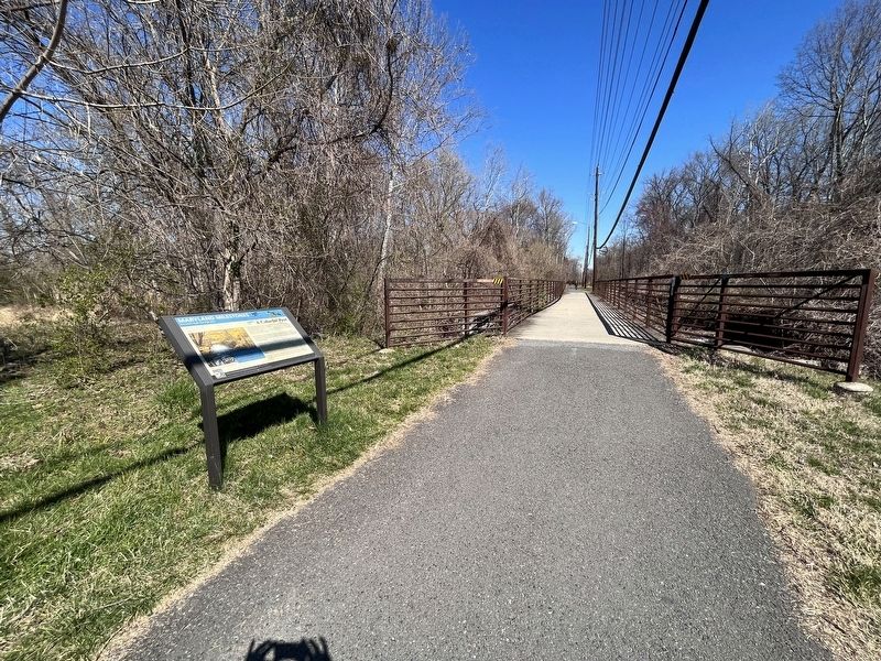

Regionally, this marker is in the Washington Metropolitan Area. It is also in the American South, specifically in the Upper South, in the Mid-Atlantic, and on the Eastern Seaboard. Globally, it is in the North Atlantic Region, North America, the Western Hemisphere, the Western World, and the Anglosphere. Historically, it finds itself in what was once one of the original Thirteen Colonies and also the Antebellum South.
Other nearby markers. At least 8 other markers are within walking distance of this marker: Rhode Island Ave Trolley Trail (a few steps from this marker); The Zeta Beta Chapter of Order of Omega (approx. 0.2 miles away); Harrison Store (approx. 0.2 miles away); Holbrook House (approx. ¼ mile away); Cory House (approx. ¼ mile away); Flying the Mail (approx. 0.3 miles away); America's Military Takes Flight (approx. 0.3 miles away); College Park Airport (approx. 0.3 miles away). Touch for a list and map of all markers in College Park.
Other markers no longer nearby. Airmail (was approx. 0.3 miles away but has been replaced with another marker now near it); Army Aviation School (was approx. 0.3 miles away but has been replaced with another marker now near it); General Aviation (was approx. 0.3 miles away but has been replaced with another marker now near it).
Credits. This page was last revised on March 19, 2023. It was originally submitted on March 19, 2023, by Devry Becker Jones of Washington, District of Columbia. This page has been viewed 481 times since then and 113 times this year. Photos: 1, 2. submitted on March 19, 2023, by Devry Becker Jones of Washington, District of Columbia.
