
Tzintzuntzan, Michoacán, Mexico — The Pacific Coast (and Central Highlands)
Grain Storage
Photographed by J. Makali Bruton, December 2, 2022
1. Grain Storage Marker

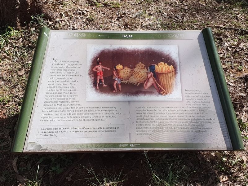
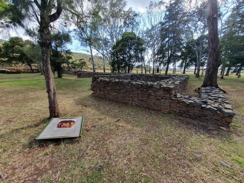
Se trata de un conjunto arquitectónico integrado por cinco cuartos alineados, que, vistos desde las alturas, forman una "L". Tienen un sistema constructivo similar al de los muros de otras estructuras, es decir, piedra laja sin cementante. No se encontró el acceso a estos cuartos, por lo que algunos arqueólogos piensan que se trata de almacenes de granos (trojes) mencionados en los documentos históricos, como la Relación de Michoacán, donde se mencionan espacios que tenían como función básica almacenar los bienes de los señores principales. Sin embargo, otros investigadores consideran que se trata de una construcción posterior a la llegada de los españoles, pues présenta la mezcla de lajas y janąmus en los muros, característica que está ausente en las obras prehispánicas. La arqueología es una disciplina científica en constante desarrollo, por lo que quizá en el futuro se tengan más respuestas e información de Tzintzuntzan.
Pie de dibujo: Reconstrucción hipotética
Arhi kungurikua iamindambe ukurhikala tsakapuecha kungurikua uxundi ma irepita ka jumu ekutsi kachukukua uandäshindi es kani iotarhaspti kushundi eski ma shakari uasurhukua, is uandanasandi shaxipka es ma ukurikua ambe, ma tsakapuri uiramuri tsikekata echeri nombe, exenantati shanoro inchakua, jimbo tsa jamanku iman mititiukuriuni tsa uandasshindi iukurikua unaspti paambe parsani tsirhambe, teecha is ionkitanapuichani tsanki kuiripuicha michoacani anapuecha tsatu jimi pa andi tsiri ka mamarhanbe, tsa uandashindi tsa ixu janoka jiakani tsa turisshicha, tsa mintsita shindi imani tsikekuanitsakapu pitsipiti ka shanamu ambe patsikenaritani jimanki tsaireka mitis pirhi ambe, ma kuinchikua imanki ma jukapapka jini unasandi mamarhambe kuinkikua jini ka tsa arhisandi atapitarhakua.
Grain Storage
This an architectural ensemble composed of five aligned rooms, which, seen from above, form an "L". They have a construction system similar to that of the walls of other structures, that is, slab stone without cement. An access to these rooms was not found, so some archaeologists think that they are grain warehouses (trojes) mentioned in historical documents, such as the Relación de Michoacán, where spaces are mentioned that had as their basic function to store the goods of the major leaders. However, other researchers consider that it is a construction made after the arrival of the Spaniards, because it presents the use of slabs and janąmus on the walls, a characteristic that is absent in pre-Hispanic works. Archaeology is a scientific discipline in constant development, so perhaps in the future we will have more answers and information from Tzintzuntzan.
Caption: Hypothetical reconstruction
Erected by Instituto
this page online
Topics. This historical marker is listed in these topic lists: Agriculture • Anthropology & Archaeology • Colonial Era • Indigenous Peoples and Communities.
Location. 19° 37.446′ N, 101° 34.341′ W. Marker is in Tzintzuntzan, Michoacán. It is on Avenida Las Yácatas, on the right when traveling east. The marker is on the grounds of the Tzintzuntzan Archeological Site. Touch for map. Marker is in this post office area: Tzintzuntzan MIC 58435, Mexico. Touch for directions.

Regionally, this marker is in Western Mexico, in the Bajío, and on the Pacific Coast. Globally, it is in North America, specifically in Mesoamerica, on the Ring of Fire, in the Pacific Rim, and in the Western Hemisphere. Historically, it finds itself in what was once New Spain, a Spanish colony, and the Aztec Empire.
Other nearby markers. At least 8 other markers are within walking distance of this marker: Tzintzuntzan: Politics and Government (within shouting distance of this marker); Tzintzuntzan: Space and Distribution (about 90 meters away, measured
Photographed by J. Makali Bruton, December 2, 2022
2. Grain Storage Marker
Credits. This page was last revised on April 4, 2025. It was originally submitted on March 19, 2023, by J. Makali Bruton of Washington, District of Columbia. This page has been viewed 138 times since then and 7 times this year. Photos: 1, 2. submitted on March 19, 2023, by J. Makali Bruton of Washington, District of Columbia.
