Elmwood Park in Detroit in Wayne County, Michigan — The American Midwest (Great Lakes)
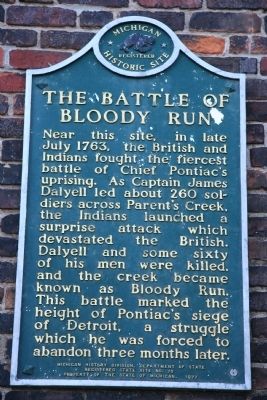
The Battle of Bloody Run
Michigan Registered Historic Site
Photographed by Dale K. Benington, August 13, 2009
1. The Battle of Bloody Run Marker
Erected 1977 by Michigan History Division, Department of State. (Marker Number 70.)
Topics and series. This historical marker is listed in these topic lists: Colonial Era • Indigenous Peoples and Communities • War, French and Indian • Wars, US Indian. In addition, it is included in the Michigan Historical Commission series list. A significant historical month for this entry is July 1763.
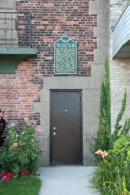
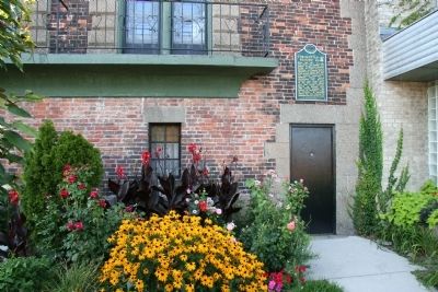
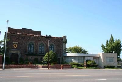
Location. 42° 20.522′ N, 83° 0.846′ W. Marker is in Detroit, Michigan, in Wayne County. It is in Elmwood Park. It is on East Jefferson Avenue 0 miles east of Adair Street, on the left when traveling east. This historical marker is located affixed to an outside wall, over one of the front entrance doors, of a building called the "Players Playhouse," situated on the north side of East Jefferson Avenue. Touch for map. Marker is at or near this postal address: 3321 East Jefferson Avenue, Detroit MI 48207, United States of America. Touch for directions.

Regionally, this marker is in Southeast Michigan. It is also in the American Midwest. Globally, it is in North America, on the Great Lakes, in the Western Hemisphere, in the Western World, and in the Anglosphere. Historically, it finds itself in what was once the Viceroyalty of New France and also the Northwest Territory.
Other nearby markers. At least 8 other markers are within walking distance
this page online
Also see . . .
1. Wikipedia entry for the Battle of Bloody Run. (Submitted on August 22, 2009, by Dale K. Benington of Toledo, Ohio.)
2. Wikipedia entry for the Siege of Fort Detroit. (Submitted on August 22, 2009, by Dale K. Benington of Toledo, Ohio.)
Photographed by Dale K. Benington, August 13, 2009
2. The Battle of Bloody Run Marker
View of the historic marker affixed to the outside of the building, over one of the front entrance doors.
Photographed by Dale K. Benington, August 13, 2009
3. The Battle of Bloody Run Marker
Another view of the historical marker, affixed to the outside wall of the "Players Playhouse" building, over one of the front entrances.
Photographed by Dale K. Benington, August 13, 2009
4. The Battle of Bloody Run Marker
View of the "Players Playhouse" from the south side of East Jefferson Avenue, looking north. The Detroit River is several blocks to the south (behind the camera) and the stream that came to be known as "Bloody Run" would have flowed south, through the present "Players Playhouse." The historical marker is affixed to the front, outside wall, just over the front entrance in the center of the picture.
Photographed by Dale K. Benington, August 13, 2009
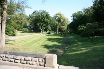
5. Bloody Run
View of the stream called "Bloody Run" which is the feature of the landscaping at Elmwood Cemetery, located some two blocks north of the historical marker.
Photographed by Dale K. Benington, August 13, 2009
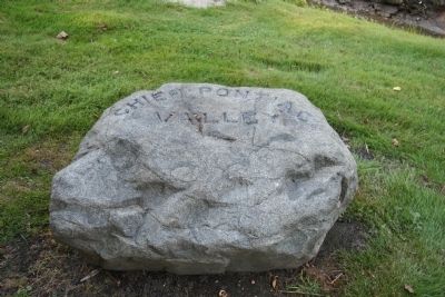
6. Chief Pontiac Valley
View of the large rock situated in Elmwood Cemetery, next to "Bloody Run," with the inscription, "Chief Pontiac Valley."
Photographed by Dale K. Benington, August 13, 2009
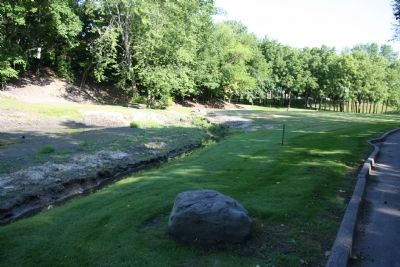
7. Bloody Run
View of the large rock with the "Chief Pontiac Valley" inscription, situated along the course of "Bloody Run," in Elmwood Cemetery, just two blocks north of the historical marker.
Credits. This page was last revised on July 9, 2025. It was originally submitted on August 22, 2009, by Dale K. Benington of Toledo, Ohio. This page has been viewed 7,134 times since then and 348 times this year. Photos: 1, 2, 3, 4, 5, 6, 7. submitted on August 22, 2009, by Dale K. Benington of Toledo, Ohio. • Kevin W. was the editor who published this page.
