Near Conconully in Okanogan County, Washington — The American West (Northwest)
Scotch Creek Basin
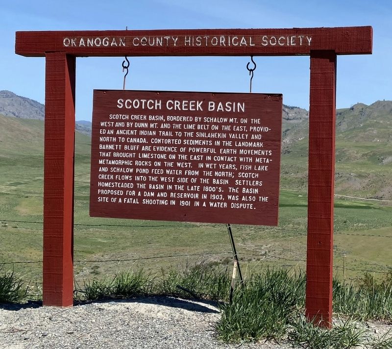
Photographed by Ann S., May 14, 2023
1. Scotch Creek Basin Marker
Scotch Creek Basin, bordered by Schalow Mt. on the west and by Dunn Mt. and the Lime belt on the east, provided an ancient Indian trail to the Sinlahekin valley and north to Canada. Contorted sediments in the landmark Barnett Bluff are evidence of powerful earth movements that brought limestone on the east in contact with metamorphic rocks on the west. In wet years, Fish Lake and Schalow Pond feed water from the north; Scotch Creek flows into the west side of the basin. Settlers homesteaded the basin in the late 1800's. The basin proposed for a dam and reservoir in 1903, was also the site of a fatal shooting in 1901 in a water dispute.
Erected by Okanogan County Historical Society.
Topics. This historical marker is listed in these topic lists: Environment • Indigenous Peoples and Communities • Roads & Vehicles • Waterways & Vessels. A significant historical year for this entry is 1903.
Location. 48° 30.31′ N, 119° 39.482′ W. Marker is near Conconully, Washington, in Okanogan County. It is on Conconully Road, on the right when traveling north. Touch for map. Marker is in this post office area: Okanogan
this page online

Regionally, this marker is in the Okanogan Highlands. It is also in the American Mountain West and in the Lewis & Clark Corridor. Globally, it is in North America, in the Cascade Range, on the Pacific Rim, in the Western Hemisphere, in the Western World, and in the Anglosphere.
Other nearby markers. At least 8 other markers are within 11 miles of this marker, measured as the crow flies: U Bar U Ranch (approx. 1.9 miles away); Ruby (approx. 3.1 miles away); First Okanogan County Courthouse (approx. 5.6 miles away); Conconully (approx. 5.7 miles away); Conconully Lake History (approx. 5.7 miles away); Riverside (approx. 6.9 miles away); Okanogan County World War I Memorial (approx. 10.3 miles away); 1919- Baines Building (approx. 10.4 miles away). Touch for a list and map of all markers in Conconully.

Photographed by Ann S., May 14, 2023
2. Scotch Creek Basin Marker
Credits. This page was last revised on May 25, 2023. It was originally submitted on May 14, 2023, by Ann S. of Bellingham, Washington. This page has been viewed 655 times since then and 61 times this year. Photos: 1. submitted on May 14, 2023, by Ann S. of Bellingham, Washington. 2. submitted on May 24, 2023, by Ann S. of Bellingham, Washington. • Devry Becker Jones was the editor who published this page.
