Williamsburg in James City County, Virginia — The American South (Mid-Atlantic)
Welcome to Freedom Park

Photographed by Brandon D Cross, June 21, 2023
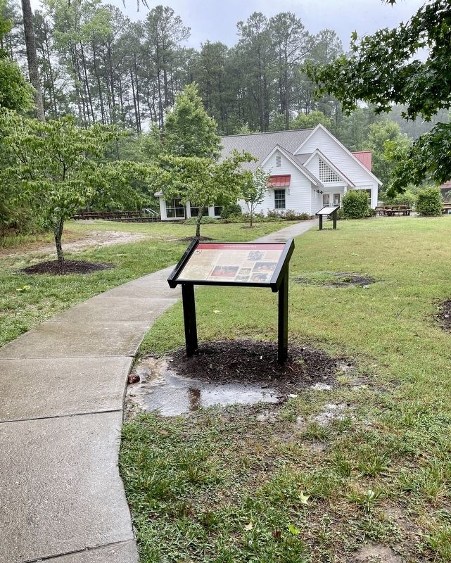
1. Freedom Park Marker
James City County website entry
Click for more information.
Click for more information.
Today, this historic land has been preserved as a park that also hosts the Williamsburg Botanical Garden, as well as many miles of mountain bike and multiuse trails.
The original 478 acres of Freedom Park were purchased by James City County in 1995 after citizens approved a 1994 bond referendum to fund the project. In 1996, adjacent parcels known as the Hot Water/Cole tract were added. In 1997, a Master Plan for the site was prepared. In September 2002, the park opened.
The name Freedom Park was inspired by the freedom granted to the slaves of William Ludwell Lee. It honors those who lived in this free black community.
The planning and design of Freedom Park was a community effort. A volunteer Historical Advisory Team comprised of representatives from the Colonial
this page online
(inserts)
Magazine illustrations and photographs of 19th-century homes, located here and elsewhere in Virginia, were studied to learn details of architecture and everyday living.
Seventeenth-century Virginia Governor William Berkeley lived at Green Spring, located about four miles south on Centerville Road. A descendant of Berkeley's second wife, William Ludwell Lee owned the home and land in the nineteenth century. Lee, who died in 1803, bequeathed freedom to his slaves upon his death. He also gave them a tract of his land and provided for them in his will. The land was called the Hot Water tract, today's Freedom Park. Some descendants still live in the Centerville Road area and other locations within the County.
(captions)
Enjoy recreation and nature at Freedom Park. Hike and ride on multipurpose and mountain bike trails, learn about historic sites, and watch seasonal beauty unfold at the Williamsburg Botanical Garden. Step inside the Interpretive Center to see archaeological fragments and displays about the park's natural environment.
“A Spring Scene Near Richmond, Virginia” Harper’s Weekly, May 21, 1870
Erected by Freedom
Photographed by Brandon D Cross, June 21, 2023
2. Freedom Park Marker
Topics. This historical marker is listed in these topic lists: Cemeteries & Burial Sites • Colonial Era • Parks & Recreational Areas • War, US Revolutionary.
Location. 37° 19.132′ N, 76° 48.04′ W. Marker is in Williamsburg, Virginia, in James City County. It can be reached from Hotwater Trail one mile west of Centerville Road (Virginia Route 614), on the right when traveling west. This marker is located in front of the Freedom Park Interpretive Center. Touch for map. Marker is at or near this postal address: 5537 Centerville Road, Williamsburg VA 23188, United States of America. Touch for directions.

Regionally, this marker is on Virginia’s Peninsula, in Coastal Virginia, and in the Hampton Roads Metropolitan Area. It is also in the American South, specifically in the Upper South, in the Tidewater, and on the Eastern Seaboard. Globally, it is in the North Atlantic Region, North America, the Western Hemisphere, the Western World, and the Anglosphere. Historically, it finds itself in what was once the territory of the Mississippian Culture, one of the original Thirteen Colonies, one of the Confederate States of America, and the Antebellum South.
Other nearby markers. At least 8 other markers are within walking distance of this marker: Engagement at Spencer's Ordinary (a few steps from this marker); Welcome to the Hot Water Tract (about 300 feet away, measured in a direct line); Free Black Settlement (about 500 feet away); Jackson Home (about 500 feet away); Archaeological Analysis of Hot Water Tract (about 600 feet away); Timeline of the Hot Water Tract (about 600 feet away); Brown Home (about 600 feet away); Lightfoot Home (about 800 feet away). Touch for a list and map of all markers in Williamsburg.
Another marker is no longer nearby. Early Settlement and Cemetery (was about 300 feet away but has been replaced with another marker now near it).
Credits. This page was last revised on August 23, 2023. It was originally submitted on June 21, 2023, by Brandon D Cross of Flagler Beach, Florida. This page has been viewed 791 times since then and 86 times this year. Last updated on August 22, 2023, by Carl Gordon Moore Jr. of North East, Maryland. Photos: 1, 2. submitted on June 21, 2023, by Brandon D Cross of Flagler Beach, Florida. • Bernard Fisher was the editor who published this page.
