Near Hot Springs in Custer County, South Dakota — The American Midwest (Upper Plains)
Vanishing Prairie
Wind Cave National Park
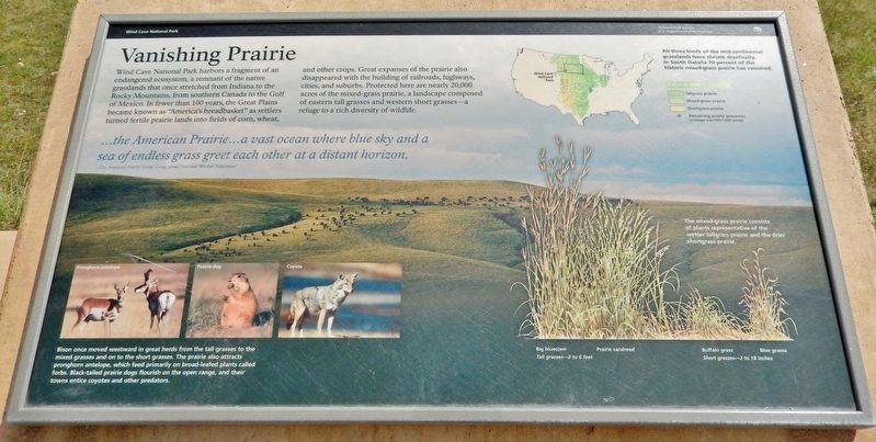
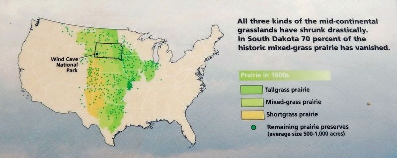
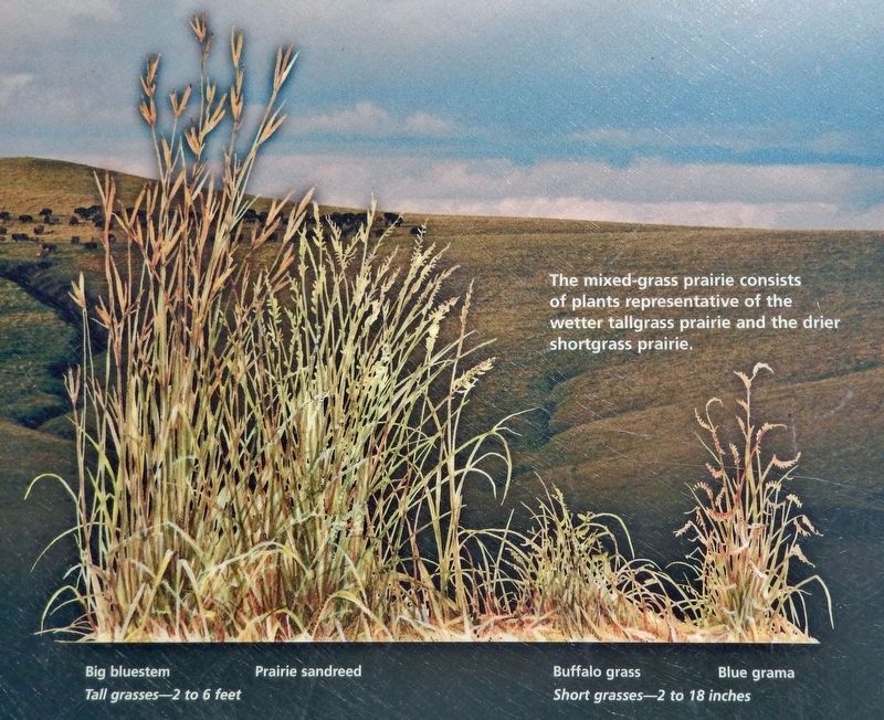
Wind Cave National Park harbors a fragment of an endangered ecosystem, a remnant of the native grasslands that once stretched from Indiana to the Rocky Mountains, from southern Canada to the Gulf of Mexico. In fewer than 100 years, the Great Plains became known as "America's breadbasket" as settlers turned fertile prairie lands into fields of corn, wheat, and other crops. Great expanses of the prairie also disappeared with the building of railroads, highways, cities, and suburbs. Protected here are nearly 20,000 acres of the mixed-grass prairie, a landscape composed of eastern tall grasses and western short grasses — a refuge to a rich diversity of wildlife.
…the American Prairie… a vast ocean where blue sky and a sea of endless grass greet each other at a distant horizon.
—The American Prairie: Going, Going, Gone? National Wildlife Federation
Erected by National Park Service, U.S. Department of the Interior.
Topics. This historical marker is listed in these topic lists: Agriculture • Environment • Parks & Recreational Areas • Settlements & Settlers.
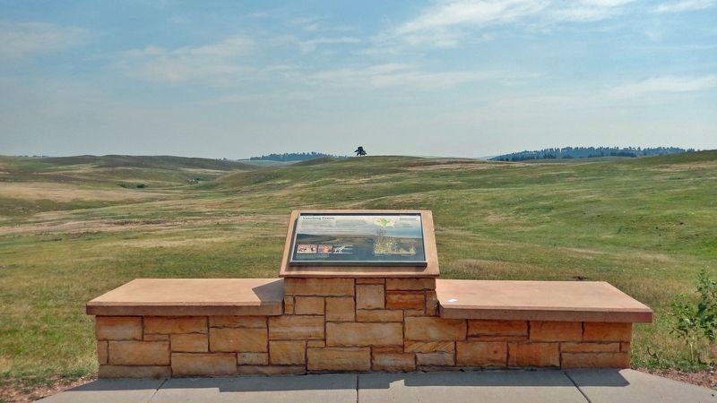
Location. 43° 32.194′ N, 103° 29.812′ W. Marker is near Hot Springs, South Dakota, in Custer County. Marker is on U.S. 385, 3.9 miles north of 7-11 Road (County Road 101), on the right when traveling north. The marker is located in a wayside parking lot on the east side of the highway. Touch for map. Marker is in this post office area: Hot Springs SD 57747, United States of America. Touch for directions.
Other nearby markers. At least 8 other markers are within 3 miles of this marker, measured as the crow flies. Bringing Back the Bison (approx. 0.4 miles away); Civilian Conservation Corps Camp (approx. 1˝ miles away); The CCC's Enduring Legacy (approx. 1.7 miles away); Home on the Range (approx. 1.7 miles away); Stephen Tyng Mather (approx. 1.7 miles away); Paha Sapa Limestone (approx. 1.7 miles away); Life in a Prairie Dog Town (approx. 2.6 miles away); Early Game Preserve (approx. 2.7 miles away). Touch for a list and map of all markers in Hot Springs.
Also see . . . Prairies and Grasslands (National Park Service). Excerpt:
At one time, a third of the North American continent was covered by grasslands. French explorers named it the “prairie” which translates from French to “meadow”. Many scientists estimate that there has been a 99% reduction in tallgrass prairie, and a 75% reduction in shortgrass prairie. Many native prairie plants and animals struggle to survive without the prairie. The first step to saving and rebuilding this ecosystem is to learn how to appreciate it. Wind Cave National Park is a great place to start. Today, it is one of the best places on the continent to experience the mixed-grass prairie.(Submitted on October 19, 2023, by Cosmos Mariner of Cape Canaveral, Florida.)

4. Marker detail: Pronghorn antelope, Prairie dog, and Coyote
Bison once moved westward in great herds from the tall grasses to the mixed grasses and on to the short grasses. The prairie also attracts pronghorn antelope, which feed primarily on broad-leafed plants called forbs. Black-tailed prairie dogs flourish on the open range, and their towns entice coyotes and other predators.
Credits. This page was last revised on October 19, 2023. It was originally submitted on October 19, 2023, by Cosmos Mariner of Cape Canaveral, Florida. This page has been viewed 79 times since then and 29 times this year. Photos: 1, 2, 3, 4, 5. submitted on October 19, 2023, by Cosmos Mariner of Cape Canaveral, Florida.


