Occoquan in Prince William County, Virginia — The American South (Mid-Atlantic)
Historic Occoquan
Center for the Processing of Grain
Inscription.
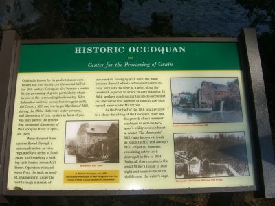
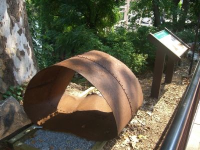
Originally known for its public tobacco warehouses and iron foundry, in the second half of the 18th century Occoquan also became a center for the processing of grain, particularly wheat farmed in the surrounding backcountry. John Ballendine built the town’s first two grist mills, the Country Mill and the larger Merchants’ Mill during the 1750s. Both were water powered, and the section of iron conduit in front of you was once part of the system that harnessed the energy of the Occoquan River to operate them.
Water diverted from upriver flowed through a man-made sluice, or race, regulated by a series of floodgates, until reaching a holding tank located across Mill Street. Operators released water from the tank as needed, channeling it under the road through a stretch of iron conduit. Emerging with force, the water powered the mill wheels before eventually tumbling back into the river at a point along the riverbank adjacent to where you are standing. In 2004, workers constructing the cul-de-sac behind you discovered this segment of conduit that once carried water under Mill Street.
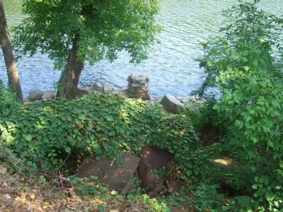
As the first half of the 19th century drew to a close, the silting of the Occoquan River and the growth of rail transport combined to reduce Occoquan’s utility as an industrial center. The Merchants’ Mill (later known variously as Ellicott’s Mill and Janney’s Mill) forged on, however, remaining active until destroyed by fire in 1924. Today all that remains is the small Miller’s House to your right and some stone ruins visible near the waters’ edge.
(Caption under small center picture) Merchants’ Mill – 1863
(Caption under picture in upper right) Artist’s Rendition of Merchants’ Mill
(Caption under picture in lower right) Merchants’ and Country Mills and 1878 Bridge
(Sidebar in yellow box, bottom center)
Historic Occoquan, Inc., 2007
This display was funded in part by a grant from the Prince William County Historical Commission.
Erected 2007 by Historic Occoquan, Inc.
Topics. This historical marker is listed in these topic lists: Agriculture • Bridges & Viaducts • Colonial Era • Industry & Commerce • Man-Made Features • Notable Events • Settlements & Settlers • Waterways & Vessels. A significant historical year for this entry is 2004.
Location. 38° 41.135′ N, 77° 15.732′ W. Marker is in Occoquan, Virginia, in Prince William County. Marker is on Mill Street, on the right when traveling east. Touch for map. Marker is in this post office area: Occoquan VA 22125, United States of America. Touch for directions.
Other nearby markers. At least 8 other markers are within walking distance of this marker.
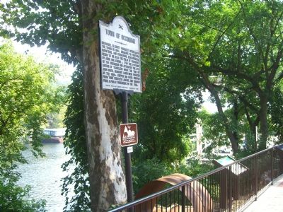
Occoquan (here, next to this marker); Gearwheel Assembly (here, next to this marker); Town of Occoquan (here, next to this marker); a different marker also named Historic Occoquan (here, next to this marker); Ellicott’s Mill (a few steps from this marker); The Dogue Indians (within shouting distance of this marker); Historic Carbide Bunker (within shouting distance of this marker); a different marker also named Historic Occoquan (within shouting distance of this marker). Touch for a list and map of all markers in Occoquan.
More about this marker. Dedication of the Mill Conduit display was held on August 25th to coincide with the Virginia 2007 theme for the month of August, “Agriculture and Industry Month.”
Also see . . . Mill House Museum, Government of Occoquan, Virginia. (Submitted on September 21, 2019.)
Credits. This page was last revised on September 25, 2019. It was originally submitted on September 7, 2007, by Kevin W. of Stafford, Virginia. This page has been viewed 1,714 times since then and 25 times this year. Photos: 1, 2, 3, 4, 5. submitted on September 7, 2007, by Kevin W. of Stafford, Virginia. • J. J. Prats was the editor who published this page.
