Shockoe Bottom in Richmond, Virginia — The American South (Mid-Atlantic)
Great Ship Lock
Captain John Smith’s Adventures on the James
— www.johnsmithtrail.org —
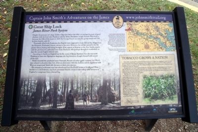
Despite the presence of a large Indian village just below the falls—or perhaps because of good relations with the local ruler Parahunt and his father Powhatan—Capt. Francis West built a fort near the Falls of the James in 1609. By George Percy’s account, his group numbered 140, by John Smith’s, only 20.
Nominally allied with Powhatan, the English were supposed to help defend the village from the Monacan, Powhatan’s historic enemy to the west. However, the settlers proved to be the greater threat, looting and taking hostages. After reports of disarray at the fort, Smith negotiated the purchase of a palisaded town from Parahunt, who perhaps thought it worthwhile to have the unruly English behind walls.
According to Smith, an English boy by the name of Henry Spelman was also sent with Parahunt to learn the Algonquian language; the boy, however, thought himself sold as part of the deal.
Smith renamed the town Nonsuch, because no other could compare, but West’s men refused to abandon their fort. After an altercation with the Indians and an argument with West, an exasperated Smith left the men to their own devices.
The attempted settlement was later abandoned, but the ill will between Smith and West, brother to Lord Delaware, may have prevented Smith’s return to the colony after he went to England to recuperate from a burned leg.
Capt. John Smith’s Trail
John Smith knew the James River by its Algonquian name: Powhatan, the same as the region’s paramount chief. Smith traveled the river many times between 1607 and 1609, trading with Virginia Indians to ensure survival at Jamestown. What he saw of Virginia’s verdant woodlands and pristine waters inspired him to explore the greater Chesapeake Bay, chronicling its natural wonders.
Capt John Smith’s Trail on the James is a 40-site water and auto tour for modern explorers.
(sidebar)
Tobacco Grows A Nation
John Rolfe introduced the commercial form of tobacco to Virginia by smuggling in seeds of a mild form of the plant from Spanish Trinidad in 1612. Slightly addictive, the plant was wildly popular in Europe, which encouraged the growth of huge plantations along the Tidewater parts of the James, and small farms along the Piedmont.
As agriculture overtook Virginia’s piedmont in the 17th and 18th centuries, Richmond’s Shockoe Slip became the point of origin for exported crops. In order to bypass the city’s rocky rapids, merchants had to have their tobacco products unloaded, hauled, and reloaded for downstream travel. Most of that grueling work was done by slaves.
The falls were a barrier to safe river travel, so in 1791, two small canals were completed around the biggest rapids (between the 14th Street Bridge and the Boulevard Bridge today). In the early 1800’s the canal was extended westward and named the Kanawha Canal. In 1882, it was extended eastward from its origin at the Turning Basin (where the James Center is today) to the docks at Rockett’s. Called the Tidewater Connection, it ended at the Great Ship Lock here.
Erected by Captain John Smith’s Trail, James River Association, Virginia Department of Conservation and Recreation, Chesapeake Bay Gateways Network. (Marker Number 6.)
Topics. This historical marker is listed in these topic lists: Colonial Era • Exploration • Forts and Castles • Native Americans • Settlements & Settlers • Waterways & Vessels. A significant historical year for this entry is 1609.
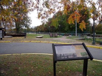
Location. 37° 31.562′ N, 77° 25.258′ W. Marker is in Richmond, Virginia. It is in Shockoe Bottom. Marker can be reached from the intersection of Dock Street and Pear Street. This panel is located at the east end of the parking lot in the Great Shiplock Park. Touch for map. Marker is at or near this postal address: 2806 Dock Street, Richmond VA 23223, United States of America. Touch for directions.
Other nearby markers. At least 8 other markers are within walking distance of this marker. A different marker also named Great Ship Lock (a few steps from this marker); Confederate Navy Yard (a few steps from this marker); Rocketts Landing (within shouting distance of this marker); a different marker also named Great Ship Lock (within shouting distance of this marker); 17 Feet (within shouting distance of this marker); Coffer Dams (within shouting distance of this marker); Welcome to Chapel Island (within shouting distance of this marker); 28th St Draw Bridge / Great Shiplock Canal (within shouting distance of this marker). Touch for a list and map of all markers in Richmond.
More about this marker. On the lower left is a depiction of a Native American village along the banks of the James River. The photo carries the caption, “The New World” © MMV, New Line Productions, Inc. All rights reserved. Photo by Merie Wallace. Photo appears courtesy of New Line Productions, Inc.
On the upper right is a map of Captain John Smith's Trail.
The sidebar shows a photo of a "Stand of a commercial form of tobacco (Nicotiana sp.)"
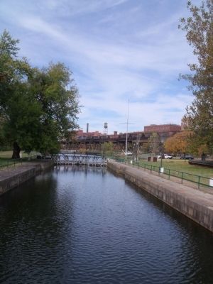
Regarding Great Ship Lock. The great lock, built between 1850-1854, connected the James River with the Richmond Dock, completing the James River and Kanawha Canal system that bypassed seven miles of falls and continued 197 miles through Virginia’s western mountain ranges.
Also see . . .
1. Great Shiplock Park and Chapel Island. Friends of the James River Park website entry (Submitted on October 27, 2009.)
2. James River and Kanawha Canal Historic District. Virginia Department of Historic Resources website entry (Submitted on September 23, 2022, by Larry Gertner of New York, New York.)
Credits. This page was last revised on February 1, 2023. It was originally submitted on October 27, 2009, by Bernard Fisher of Richmond, Virginia. This page has been viewed 1,679 times since then and 42 times this year. It was the Marker of the Week November 15, 2009. Photos: 1, 2, 3, 4. submitted on October 27, 2009, by Bernard Fisher of Richmond, Virginia.


