Smithfield in Isle of Wight County, Virginia — The American South (Mid-Atlantic)
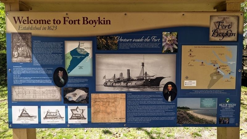
Welcome to Fort Boykin
Established 1623
— Historic Fort Boykin —
In the late 16th and early 17th centuries, a paramount chief, known by the English as Chief Powhatan, created a powerful organization by affiliating 30 tributary peoples whose territory was much of eastern Virginia. At the the time of English settlement at Jamestown, this collection of tribes inhabited the area, and along this portion of the James River shoreline were three villages of the Warraskoyack.
In 1608, Captain John Smith went in search of food for his fellow colonists at Jamestown. The Warraskoyack were a friendly tribe and provided 30 bushels of corn for the famished settlers. However, as the Virginia colony grew and as Indian lands, both north and south of the James River, were encroached upon, relations between the two grew increasingly fragile.
By 1621, there were two settlements on this side of the James River - Bennett's Welcome and Basse's Choice. On March 22, 1622, an Indian attack on the Virginia colony claimed the lives of hundreds of settlers, including 52 settlers at these two sites. Following the attack, colonists were instructed by the House of Burgesses in Jamestown to construct a protected fort to serve as a lookout for future attacks. The fort, a triangular-shaped earthen structure, took approximately six months to construct and was originally christened The Castle due to its deep natural ditches, high elevation and steep embankments fronting the James River.
The Warraskoyack were largely driven from their lands as part of the reprisals for the 1622 attack.
Revolutionary War
A succession of fort owners ensued. Growth and expansion of the colonies saw more activity along the James River, which became England's proverbial highway into Virginia during the colonial period.
As the Revolutionary War erupted in 1775, the decision was made to refortify The Castle. The moated, earthenwork fort expanded in shape and size by the local militia. Once refortified, it was renamed Fort Boykin for Major Francis Boykin, a local who served with General George Washington. No engagements took place at the fort.
War of 1812
During the War or 1812, cities and the shores or the counties along the rivers of Virginia were vulnerable. This created a need for a coastal defense system.
Fort Boykin was enlarged into an irregular five-pointed star shape, typical of the time period, to protect the James River from British gunboats. An attempt was made by the British to land near Fort Boykin. Local militia foiled the attempt, but for months, the British man-of-war HMS Plantagenent threateningly anchored near the fort.
Civil War
In 1861, Confederate State Engineer Andrew Talcott was assigned the task of surveying and designing potential defenses along the James River to protect against a Union naval assault upon the Confederate capital of Richmond, located 55 miles upriver.
This site was selected and designated suitable for gun batteries. Other fortifications along the James River included Fort Huger, Mulberry Island Point Battery, Jamestown and Drewry's Bluff Battery.
In addition, a series of trenches, earthworks and forts extending from Gloucester Point and across the Virginia Peninsula to this side of the James River - all of Confederate Major General John Magruder's defensive line against the Union - effectively blocked the Union's land approach to Richmond and closed the York and James Rivers as supply routes for their armies.
Between June 1861 and May 1862, the Confederate Army cleared, refurbished and refortified Fort Boykin under the supervision of Captain T.M.R. Talcott and Lt. W.G. Turpin. Under their command were slaves and free blacks who were described as "a force of at least 1000 hands." Free blacks manned and unloaded boats which brought in army stores, lime, bricks, lumber, timber, nails, paper, wagons and molasses. Wheelbarrows were in short supply, and the well was contaminated during this time.
On May 4, 1862, Magruder abandoned his defensive line in the face of the overwhelming
Union forces. With the land route to Richmond cleared, the Union focused their attention on the Confederate forts blocking the James River.
On May 8, the the USS Galena, USS Port Royal and USS Aroostook attacked both Fort Huger and Fort Boykin — with the worst of the fire directed at Fort Boykin. The Port Royal and Aroostook fired from the James River channel while the Galena moved in closer with raking shots. Both forts eventually ceased fire as their cannons were not powerful enough to damage the ironclad Galena or reach the two ships beyond her.
The bombardments convinced the Confederates that these forts were untenable, and they were abandoned. U.S. Marines landed and occupied Forts Boykin and Huger on May 17 and 18 to find most of the guns spiked, the carriages burned and structures within the forts destroyed. The reduction of both forts opened the James River for the Union fleet to head upriver to the strong Confederate position at Drewry's Bluff, just eight miles southeast of Richmond.
Venture inside the Fort to learn more about the fort's experience during the Civil War, several of the fort's private owners and its natural habitat. Plant and wildlife diversity within the fort reflects its natural setting, and visitors should be on the lookout for bald eagles, ducks, woodpeckers and Virginia's second largest black walnut tree. Additionally, visitors will find access to the beach at Burwell Bay along the northwest riverfront.
(captions)
Powhatan
HMS Plantagenent
Artist rendering of the 1623 fortification Courtesy of Floyd Painter
Artist rendering of the 1776 fortification Courtesy of Floyd Painter
Artist rendering of the 1812 fortification Courtesy of Floyd Painter
(above) Early settlements
(left) Francis Boykin, a native of Isle of Wight County, grew up on what is now known as Four Square Plantation. He took up arms in the American Revolution as a lieutenant in the 1st Virginia Regiment from March 1776 to June 1778 and later commanded militia troops when the British invaded Virginia from 1779 to 1781. Major Boykin was a delegate to the General Assembly in Richmond. From the collection of the Isle of Wight County Museum
(below) Pistol flint found at Fort Boykin. Members of the militia were provided with powder and shot but were required to provide their own weapons. This flint came from an English-made pistol. It was not unusual to find a variety of weapons among self-armed companies. From the collection of the Isle of Wight County Museum
USS Galena
Andrew Talcott (1797-1883) Confederate State Engineer
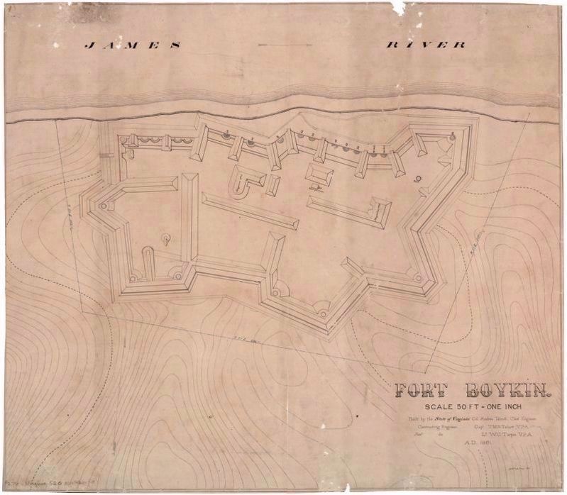
Fort Boykin, 1861 Confederate States of America, Army, Department of Northern Virginia, Chief of Engineer's Office
The Union fleet was stationed at Fort Monroe. After the March 1862 battle between the USS Monitor and the CSS Virginia, the James River was ceded to the Union. The forts along the James River became the last chance to protect the Confederate capital of Richmond. Sources: Esri Welcome, NAVTEQ, Tom Tom, Intermap, iPC, USGS, FAO, NPS, NRCAN, GeoBase, IGN, Kadas ter NL, Ordnance Survey, Esri Japan, METI, Esri China (Hong Kong) and the GIS User Community
Erected by Isle of Wight County.
Topics. This historical marker is listed in these topic lists: African Americans • Colonial Era • Forts and Castles • Native Americans • Parks & Recreational Areas • Settlements & Settlers • War of 1812 • War, US Civil • War, US Revolutionary • Waterways & Vessels. A significant historical date for this entry is March 22, 1622.
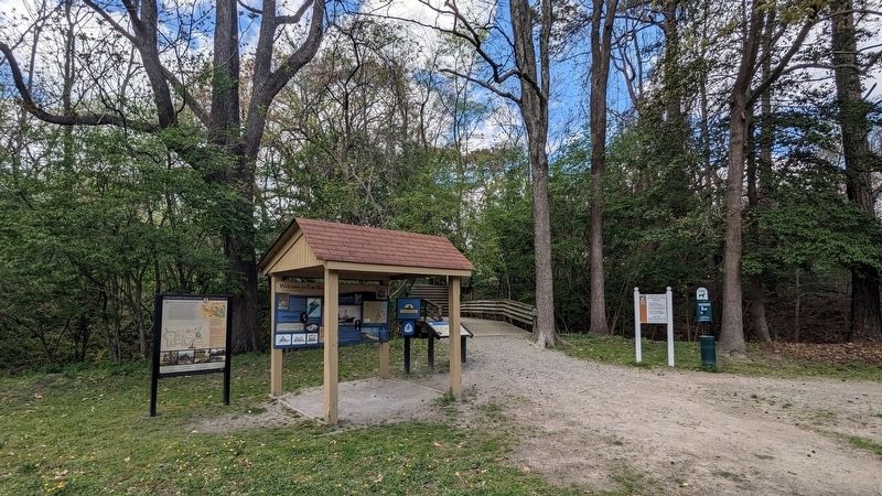
Location. 37° 2.032′ N, 76° 37.063′ W. Marker is in Smithfield, Virginia, in Isle of Wight County. Marker can be reached from the intersection of Fort Boykin Trail (Virginia Route 705) and Morgarts Beach Road (Virginia Route 673), on the left when traveling north. Touch for map. Marker is at or near this postal address: 7410 Fort Boykin Trail, Smithfield VA 23430, United States of America. Touch for directions.
Other nearby markers. At least 8 other markers are within walking distance of this marker. Fort Boykin (here, next to this marker); Welcome to Fort Boykin Historic Park (a few steps from this marker); Fort Boykin Memorial (within shouting distance of this marker); Camp Eustis Attacks Fort Boykin (within shouting distance of this marker); The Well (about 300 feet away, measured in a direct line); The Fort's Last Private Owners (about 400 feet away); Fort Boykin during the Civil War (about 600 feet away); The Historic James and its Tributaries (about 800 feet away). Touch for a list and map of all markers in Smithfield.
Also see . . . Fort Boykin. Isle of Wight County Museum (Submitted on April 6, 2024.)
Credits. This page was last revised on April 7, 2024. It was originally submitted on April 5, 2024, by Bernard Fisher of Richmond, Virginia. This page has been viewed 57 times since then. Photos: 1, 2. submitted on April 5, 2024, by Bernard Fisher of Richmond, Virginia. 3. submitted on April 7, 2024.


