Lower Macungie Township in Wescosville in Lehigh County, Pennsylvania — The American Northeast (Mid-Atlantic)
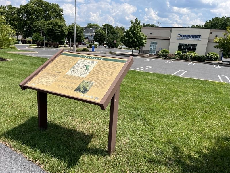
The First People

Before European settlement, the area that now includes Lower Macungie Township was inhabited by people who called themselves the Lenni-Lenape (Original People); English settlers called them the Delawares. The name "Macungie" is derived from a Native American word meaning "place of the bear," and is spelled phonetically with many variations in early records. The leading chief of the Minsi tribe of the Delaware Indians used a form of the word Macungie in his own name.
William Penn, the founder of the colony of Pennsylvania, purchased land along the Perkiomen Creek (Pahkehoma) in 1684 from the Minsi Delaware Indian Chief Sachem Maughaughsin (Macungie), giving Penn the right to make this land available to spectators and homesteaders.
The agreement between Penn and Maughaushsin reads as follows:
Upon my own desire and free offer, I Maughaughsin, in consideration of two Matchcoats, four pairs of stocking and four bottles of sider, do hereby grant, mae over all my land upon the Pahkehoma, to William Penn, Propr. and Govern'r of Pennsylvania and territories, his heirs and Assignees forever, with which I own myself satisfied and promise never to molest any Christian so call'd yt shall seat thereon by his orders.
Witness my hand and seal at Philadelphia ye third day ye fourth month 1684.
Themark of Maughaughsin
Click or scan to see
this page online
Many Indians left this area and moved north over the Blue Mountains after the 1684 treaty was signed. However, others continued to live and hunt in the Lehigh Valley; pioneer families have passed down stories of Indians living peacefully in seasonal villages for some time after European settlers had arrived and established their early farmsteads. One is known to have been in the Ancient Oak area, another was along Mill Race Road. Findings of jasper chips in several locations provide evidence of workshops where tools were fashioned from jasper taken from pits along South Mountain to the Macungie-Vera Cruz area—these almost definitely date from the pre-contact period, as jasper quarrying seems to have ended about 1680.
Hostilities between settlers and Indians increased during the French and Indian War (1754-1763), although the war was not fought in the Lehigh Valley area. A string of forts was built in the mid-1750s north of the Blue Mountain ridge along the frontier. Colonial authorities planned these forts; some early settlers in northern parts of today's Lehigh Valley also built a few small forts for protection,
A reconstruction of a frontier fort may be visited in Ontelaunee Park outside New Tripoli, not far from here.
Peace between the settlers and the Indians in the Lehigh Valley did not start until 1764, a year after the treaty that ended the French and Indian War. Instances have been recorded of behavior by some European settlers toward natives in 1763 that was so shameful and disrespectful that Indians quickly realized that they would not be treated fairly. Parties of raiding Indians burned houses and killed European settlers north and east of here, but no belligerent actions have been recorded in the Macungie area.
[Captions:]
At first, the Indians were friendly and hospitable, and traded with settlers. William Penn, the first Proprietor of Pennsylvania, was admired and respected by the leaders of the Delaware tribes but his sons have been described as the "cheating, landgrabbing offspring of an honorable father." After the fraudulent "Walking Purchase" of 1737, by which Penn's sons stole a large tract of land between the Delaware and Lehigh rivers that was inhabited by the Indians, trust in the white man changed to hatred.
Surveyor David Schultz drew this map of eastern Pennsylvania some time after 1752. The line of hills north of the Lehigh Valley is marked "blauen Berge" or Blue Hills. A line of forts was built along that frontier in the 1750s to protect European settlers from attacks by bands of Indians.
A large rock on Macungie Mountain is believed to have been worked by Indian stonemasons to closely resemble a bear's head. Many believe regular ceremonies were held here. The bear was sacred to the Lenni Lenape, and the name Macungie translates loosely as place of the bear.
Erected by TCH Development; The Goldenberg Group; Lower Macungie Township Historical Society. (Marker Number 3.)
Topics and series. This historical marker is listed in these topic lists: Anthropology & Archaeology • Colonial Era • Indigenous Peoples and Communities • War, French and Indian. In addition, it is included in the Pennsylvania, Lower Macungie Township Historic Walking Trail series list. A significant historical year for this entry is 1684.
Location. 40° 33.95′ N, 75° 33.423′ W. Marker is in Wescosville, Pennsylvania, in Lehigh County. It is in Lower Macungie Township. It can be reached from Hamilton Boulevard west of Brookside Road, on the right when traveling west. Touch for map. Marker is at or near this postal address: 833 N Krocks Rd, Allentown PA 18106, United States of America. Touch for directions.

Regionally, this marker is in Southeast Pennsylvania and in Lehigh Valley. It is also in the American Northeast and in the Mid-Atlantic. Globally, it is in North America, the Western Hemisphere, the Western World, and the Anglosphere. Historically, it finds itself in what was once the Haudenosaunee (Iroquois) Confederacy and also one of the original Thirteen Colonies.
Other nearby markers. At least 8 other markers are within walking distance of this marker: Log Haus (within shouting distance of this marker); What Is A Rain Garden? (about 500 feet away, measured in a direct line); Early Settlers (about 600 feet away); Early Roads & Highways (approx. 0.2 miles away); The Mining Industry (approx. ¼ mile away); A Farming Community (approx. ¼ mile away); Business & Industry (approx. 0.3 miles away); Barns, Decorative Art & Music (approx. 0.3 miles away). Touch for a list and map of all markers in Wescosville.
Credits. This page was last revised on July 24, 2024. It was originally submitted on July 24, 2024, by Devry Becker Jones of Washington, District of Columbia. This page has been viewed 331 times since then and 52 times this year. Photos: 1, 2. submitted on July 24, 2024, by Devry Becker Jones of Washington, District of Columbia.
