Liberty Grove in Ellison Bay in Door County, Wisconsin — The American Midwest (Great Lakes)
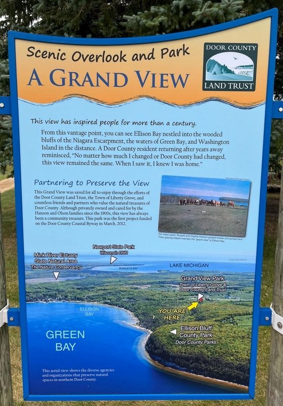
A Grand View
Scenic Overlook and Park
Photographed by Sean Flynn, August 10, 2024
1. A Grand View Marker
From this vantage point, you can see Ellison Bay nestled into the wooded bluffs of the Niagara Escarpment, the waters of Green Bay, and Washington Island in the distance. A Door County resident returning after years away reminisced, "No matter how much I changed or Door County had changed, this view remained the same. When I saw it, I knew I was home."
Partnering to Preserve the View
This Grand View was saved for all to enjoy through the efforts of the Door County Land Trust, the Town of Liberty Grove, and countless friends and partners who value the natural treasures of Door County. Although privately owned and cared for by the Hanson and Olson families since the 1900s, this view has always been a community treasure. This park was the first project funded on the Door County Coastal Byway in March, 2012.
[Caption beneath photo of cows:]
For
this page online
Erected by Door County Coastal Byway; Federal Highway Administration; Wisconsin Department of Transportation.
Topics and series. This historical marker is listed in these topic lists: Agriculture • Environment • Parks & Recreational Areas • Waterways & Vessels. In addition, it is included in the Door County Coastal Byway (Wisconsin) series list. A significant historical month for this entry is March 2012.
Location. 45° 14.881′ N, 87° 5.096′ W. Marker is in Ellison Bay, Wisconsin, in Door County. It is in Liberty Grove. It is on State Highway 42 near Humbug Road, on the left when traveling north. This set of markers is on the northeastern edge of the Liberty Grove Historical Society. Touch for map. Marker is at or near this postal address: 11831 Wisconsin 42, Ellison Bay WI 54210,

Photographed by Sean Flynn, August 9, 2024
2. A Grand View Marker
The "grand view" itself is off camera to the rear.

Regionally, this marker is on Wisconsin’s Door Peninsula. It is also in the American Midwest and in the Corn Belt. Globally, it is in North America, on the Great Lakes, in the Western Hemisphere, in the Western World, and in the Anglosphere. Historically, it finds itself in what was once the territory of the Mississippian Culture and also the Northwest Territory.
Other nearby markers. At least 8 other markers are within walking distance of this marker: This Is Karst Country (here, next to this marker); Ecological Treasures (here, next to this marker); Meet Gunnar (here, next to this marker); Bead Breaker and Tire Changer (a few steps from this marker); Outhouse (a few steps from this marker); Platform Swing (within shouting distance of this marker); Corn Crib (within shouting distance of this marker); Rowleys Bay Bell (within shouting distance of this

Photographed by Sean Flynn, August 9, 2024
3. Close-up of aerial photo on the marker
The aerial photo on the bottom of the marker shows the Liberty Grove Historical Society land in the context of other landmarks in northern Door County.
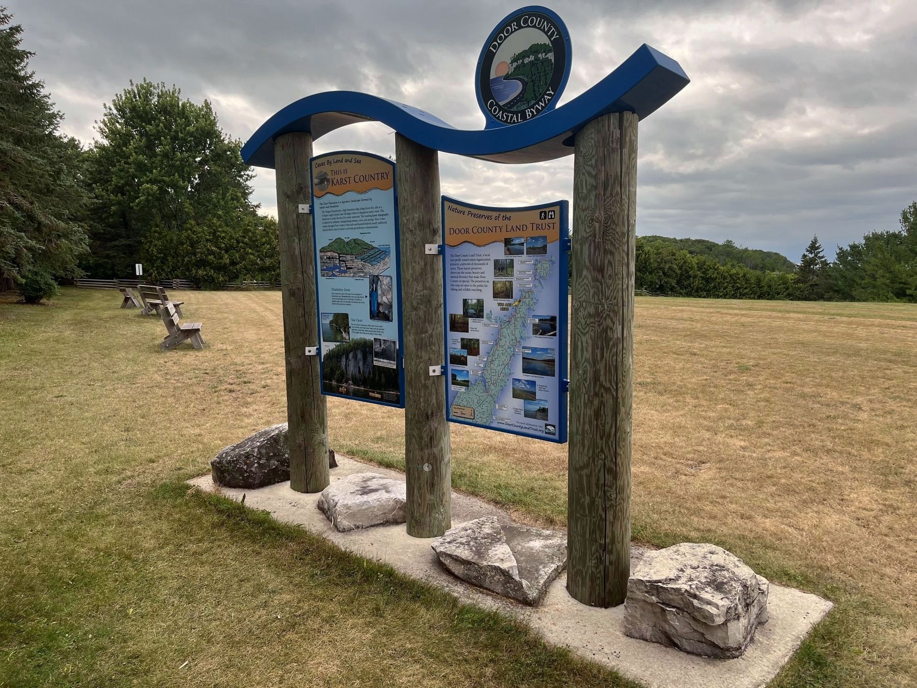
More about this marker. This marker is next to two others describing the history of the area and another about the Door County Land Trust, a local preservation group.
About 10 additional Coastal Byway "experience hubs" can be found across Door County along the 66-mile loop including highways 57 and 42. One more easily spotted set of markers can be found here at the Liberty Grove Historical Society, about a ¼ mile south of this marker, next to the driveway into the parking lot.
Regarding A Grand View. The "grand view" referenced on this sign is not exactly visible from here but is a short walk away.
Also see . . .
1. Door County Coastal Byway official site. (Submitted on August 14, 2024, by Sean P. Flynn of Oak Park, Illinois.)
2. Virginia Hanson: A View from the Top of the Hill. For more than 70 years, Virginia Hanson (who
Photographed by Sean Flynn, August 9, 2024
4. The "grand view"
The A Grand view Marker is on the rear side of the marker in this photo, which was taken facing the "grand view" itself overlooking Ellison Bay and Green Bay (but obscured in mid-August by foliage).
Peninsula Pulse: "A self-proclaimed Door County 'pioneer,' Virginia Grace Kramer was born to Melvin and Mabel Grasse Kramer on July 15, 1924. She and her siblings — older brother, Willard; and younger sister, Verna — were raised on the family farm, which was later the site of the Patio Drive-In and Motel in Sister Bay, built and operated by her brother after their parents sold him the property. The family primarily made its living raising dairy cows. Virginia’s father learned to make cheese at 16 and had owned his own cheese factory in Door County’s German Settlement, which was part of the Town of Liberty Grove among the villages of Ephraim, Sister Bay and Baileys Harbor. The school she attended for a year before enrolling in Sister Bay still stands at the corner of German Road and Highway 57, now a private(Submitted on August 14, 2024, by Sean P. Flynn of Oak Park, Illinois.)residence."Photographed by Sean Flynn, August 9, 20245. Door County Land TrustThe experience hub at Liberty Grove includes a sign about the Door County Land Trust and the properties in Door County that it has preserved.

Credits. This page was last revised on August 14, 2024. It was originally submitted on August 14, 2024, by Sean P. Flynn of Oak Park, Illinois. This page has been viewed 1,019 times since then and 364 times this year. Photos: 1, 2, 3, 4, 5. submitted on August 14, 2024, by Sean P. Flynn of Oak Park, Illinois.
