Parowan in Iron County, Utah — The American Mountains (Southwest)
Life on the High Plateau

Photographed by Tom Bosse, July 29, 2024
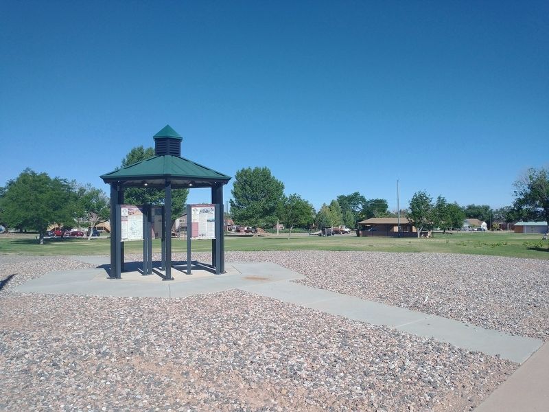
1. Life on the High Plateau Marker
[Caption]: Utah’s Patchwork Parkway offers travelers a diverse patchwork of colors, cultures, and climates.
[Caption]: Photo below: Sheep Grazing Photo above: Utah’s Patchwork Parkway
For centuries people and animals have traveled from the valley to the high-elevation plateau to utilize seasonal resources. The Southern Paiutes and later pioneers journeyed up the mountain each summer to utilize natural resources, returning to the valley when winter arrived. The route up the mountain (Utah’s Patchwork Parkway) and many trails in Brian Head and the expansive Dixie National Forest were originated by the Southern Paiutes, explorers, pioneers, ranchers, loggers, and other early inhabitants.
The Ever-Changing Brian Head Landscape
Brian Head’s unparalleled natural beauty and landscapes are a result of geological forces of uplift and erosion. These set the stage for Brian Head’s unique high-elevation terrain, providing a home to numerous plants, wildlife, and diverse cultural groups.
Part of the Markagunt Plateau, Brian Head’s high-elevation landscape (9,300 ft – 11,300 ft) has been impacted by the people and animals
this page online
As travelers, Southern Paiutes moved seasonally to the Brian Head area to hunt, fish, gather plants and herbs for food and medicines, celebrate friendships, heal, and share stories.
After the nearby communities of Parowan and Panguitch were settled by pioneers in the mid-1800s, ranchers from these communities drove their sheep and cattle up the mountain for summer grazing in the high plateau meadows. Pioneer women and children also traveled to the high plateau to make cheese and butter each summer, helping sustain their families through the winter. In the late 1800s and early 1900s, loggers established sawmills and logging trails for harvesting trees. Steam Engine Meadow and the Old Sorrel Trail, the route used to haul timber from Brian Head to Cedar City, are a reminder of the history of logging in Brian Head. In the 1960s, the landscape once again changed with the beginnings of Brian Head’s ski resort community.
Today, people come to Brian Head from all over to enjoy year-round outdoor recreational opportunities, including skiing, snowmobiling, tubing,

Photographed by Tom Bosse, July 29, 2024
2. Utah’s Patchwork Parkway
Brian Head Peak
The Brian Head Peak Overlook was built in 1934-1935 by the Civilian Conservation Corps (CCC), a work relief program developed by President Franklin Roosevelt to employ young men during the Great Depression. CCC projects were directed at conservation and the development of natural resources in rural areas.
Brian Head Peak Road, which is off Utah’s Patchwork Parkway (State Route 143), takes visitors to the Overlook.
From the Overlook, the amazing 360-degree view includes Nevada’s Wheeler and Highland Peaks, Arizona’s Mount Trumball and Navajo Mountain, Beaver County’s Tushar Range and the Paunsaugunt, Table Cliff and Aquarius plateaus, and other impressive mountain ranges.
One of the Oldest Living Organisms on Earth
Only found in six states including Utah, Bristlecone Pines are one of the oldest living organisms on earth. Many are dated to be thousands of years old. Bristlecones are found in high elevations, ranging from around 8,000 ft – 11,000 ft. These magnificent trees can be seen while hiking in Brian
Photographed by Tom Bosse, July 29, 2024
3. Life on the High Plateau Marker
Topics and series. This historical marker is listed in these topic lists: Environment • Indigenous Peoples and Communities • Natural Features • Parks & Recreational Areas • Settlements & Settlers. In addition, it is included in the Civilian Conservation Corps (CCC) series list.
Location. 37° 50.349′ N, 112° 49.218′ W. Marker is in Parowan, Utah, in Iron County. It is at the intersection of South Cyn Road (U.S. 143) and East 200 South Street, on the right when traveling south on South Cyn Road. Touch for map. Marker is in this post office area: Parowan UT 84761, United States of America. Touch for directions.

Regionally, this marker is in Color Country. It is also in the American Mountain West and on the Colorado Plateau. Globally, it is in North America, the Rocky Mountains, the Western Hemisphere, the Western World, and the Anglosphere. Historically, it finds itself in what was once New Spain and also Mexico’s Alta California.

Photographed by Tom Bosse, July 29, 2024
4. Life on the High Plateau Marker
Other nearby markers. At least 8 other markers are within walking distance of this marker: The “Mother Town” of Southern Utah (here, next to this marker); Following the Water (here, next to this marker); Welcome to Parowan, Utah (here, next to this marker); Paiute Indian Tribe of Utah (here, next to this marker); Establishing a Community (here, next to this marker); Explore Southern Utah (here, next to this marker); Public Works (approx. 0.3 miles away); William and Julia Lyman House (approx. 0.4 miles away). Touch for a list and map of all markers in Parowan.
Related markers. Click here for a list of markers that are related to this marker.
Credits. This page was last revised on November 26, 2024. It was originally submitted on November 23, 2024, by Tom Bosse of Jefferson City, Tennessee. This page has been viewed 181 times since then and 18 times this year. Photos: 1, 2, 3, 4. submitted on November 23, 2024, by Tom Bosse of Jefferson City, Tennessee. • Andrew Ruppenstein was the editor who published this page.
