Olivette in St. Louis County, Missouri — The American Midwest (Upper Plains)
Waterways Connect Us All
River des Peres Headwaters
| — | Centennial Greenway: Warson Park | — |
Photographed by Jason Voigt, December 28, 2024
1. Waterways Connect Us All Marker
River History
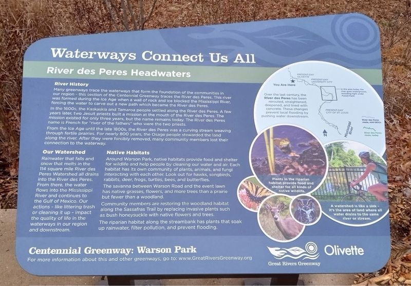
Many greenways trace the waterways that form the foundation of the communities in our region - this section of the Centennial Greenway traces the River des Peres. This river was formed during the Ice Age when a wall of rock and ice blocked the Mississippi River, forcing the water to carve out a new path which became the River des Peres.
In the 1600s, the Kaskaskia and Tamaroa people settled along the River des Peres. A few years later, two Jesuit priests built a mission at the mouth of the River des Peres. The mission existed for only three years, but the name remains today. The River des Peres name is French for "river of the fathers" who were the two priests.
From the Ice Age until the late 1800s, the River des Peres was a curving stream weaving through fertile prairies. For nearly 800 years, the Osage people stewarded the land along the river. After they were forcibly removed, many community members lost their connection to the waterway.
Our Watershed
Rainwater that falls and snow that melts in the 114 square mile River des Peres Watershed all drains into the River des Peres. From there, the
this page online
Native Habitats
Around Warson Park, native habitats provide food and shelter for wildlife and help people by cleaning our water and air. Each habitat has its own community of plants, animals, and fungi interacting with each other. Look out for hawks, songbirds, rabbits, deer, frogs, turtles, bees, and butterflies.
The savanna between Warson Road and the event lawn has native grasses, flowers, and more trees than a prairie but fewer than a woodland.
Community members are restoring the woodland habitat along the Sassafras Trail by replacing invasive plants such as bush honeysuckle with native flowers and trees.
The riparian habitat along the streambank has plants that soak up rainwater, filter pollution, and prevent flooding.
Erected by Great Rivers Greenway and City of Olivette.
Topics. This historical marker is listed in these topic lists: Environment • Indigenous Peoples and Communities • Parks & Recreational Areas
Photographed by Jason Voigt, December 28, 2024
2. Waterways Connect Us All Marker
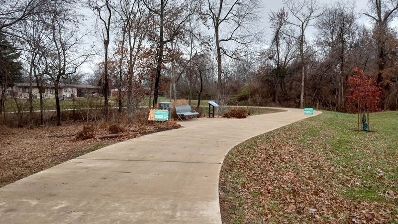
Marker is located at Warson Park, on the Centennial Greenway trail.
Location. 38° 40.916′ N, 90° 23.384′ W. Marker is in Olivette, Missouri, in St. Louis County. It can be reached from Warson Road. Marker is located at Warson Park, on the bike trail (within a short walk from the parking lot). Touch for map. Marker is at or near this postal address: 1200 North Warson Road, Saint Louis MO 63132, United States of America. Touch for directions.

Regionally, this marker is in Greater St. Louis. It is also in the American Midwest, in the Lewis & Clark Corridor, in the Corn Belt, and in the Great River Road Region. Globally, it is in North America, the Western Hemisphere, the Western World, and the Anglosphere. Historically, it finds itself in what was once the Viceroyalty of New France, the territory of the Mississippian Culture, the Louisiana Purchase, and the Antebellum South.
Other nearby markers. At least 8 other markers are within 2 miles of this marker, measured as the crow flies: Gerald Gordon (approx. one mile away); Halsey C. Ives Mansion (approx. one mile away); The Rock House (approx. one mile away); Lackland / Baker Mansion (approx. one mile away); Site of Appel House (approx. 1.2 miles away); Site of Lackland Avenue School (approx. 1.4 miles away); Holy Family Cemetery (approx. 1.4 miles away); William Campbell House (approx. 1½ miles away).
Another marker is no longer nearby. Wildwood Estate (was approx. 1½ miles away but has been confirmed missing).
Credits. This page was last revised on December 30, 2024. It was originally submitted on December 30, 2024, by Jason Voigt of Glen Carbon, Illinois. This page has been viewed 154 times since then and 13 times this year. Photos: 1, 2. submitted on December 30, 2024, by Jason Voigt of Glen Carbon, Illinois.
