Enon in Chesterfield County, Virginia — The American South (Mid-Atlantic)
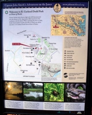
Welcome to R. Garland Dodd Park at Point of Rocks
Captain John Smith's Adventures on the James
| — | www.johnsmithtrail.org | — |
Photographed by Bernard Fisher, November 27, 2009
1. Welcome to R. Garland Dodd Park at Point of Rocks Marker
Gabriel Archer wrote about a high rock cliff that projected into the channel of the Appomattox River upstream of its confluence with the James. When exploring the river in 1608, Smith found verdant marshes the likes of which can still be seen here at R. Garland Dodd Park at Point of Rocks.
Capt. John Smith’s Trail
John Smith knew the James River by its Algonquian name: Powhatan, the same as the region’s paramount chief. Smith traveled the river many times between 1607 and 1609, trading with Virginia Indians to ensure survival at Jamestown. What he saw of Virginia’s verdant woodlands and pristine waters inspired him to explore the greater Chesapeake Bay, chronicling its natural wonders.
(sidebar)
Trail Walking
This short, well-trod loop passes diverse terrain: hillsides forested in mature hardwoods, the cattail-and-cordgrass marsh along Ashton Creek, and the wide Appomattox River.
Over Looking.
Search for wildlife in the wild rice marsh as you walk along Ashton Creek boardwalk. Virginia Indians relied on these fresh water marshes for some of their food supply.
Bird Watching.
A Common Moorhen (Gallinula chloropus)
this page online
Snakes.
A Black Rat Snake (Elaphe obsoleta obsoleta) is coiled in the grass. Most of the snakes that live in the marsh are not poisonous and serve an important role in maintaining a balanced food chain.
Erected by Captain John Smith’s Trail, James River Association, Virginia Department of Conservation and Recreation, Chesapeake Bay Gateways Network. (Marker Number 15.)
Topics. This historical marker is listed in these topic lists: Colonial Era • Indigenous Peoples and Communities • War, US Civil • Waterways & Vessels. A significant historical year for this entry is 1608.
Location. 37° 19.302′ N, 77° 21.359′ W. Marker is in Enon, Virginia, in Chesterfield County. It can be reached from Enon Church Road (Virginia Route 746) near Ramblewood Drive. Touch for map. Marker is at or near this postal address: 201 Enon Church Road, Chester VA 23836, United States of America. Touch for directions.

Regionally, this marker is in Virginia’s Piedmont, in Central Virginia,
Photographed by Bernard Fisher, November 27, 2009
2. Earthworks at Point of Rocks
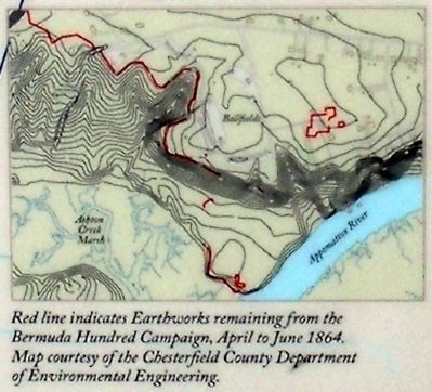
Red line indicates Earthworks remaining from the Bermuda Hundred Campaign, April to June 1864. Map courtesy of the Chesterfield County Department of Environmental Engineering.
Other nearby markers. At least 8 other markers are within walking distance of this marker: The Bermuda Hundred Campaign Begins (here, next to this marker); Point of Rocks (here, next to this marker); Confederate Leaders (here, next to this marker); The Bermuda Hundred Campaign-Federal Leaders (here, next to this marker); Actions in the East 1861-1863 (approx. 0.2 miles away); Federal War Plans for 1864 (approx. 0.2 miles away); Marsh Boardwalk (approx. 0.2 miles away); Opening Actions of the Bermuda Hundred Campaign (approx. 0.2 miles away). Touch for a list and map of all markers in Enon.
More about this marker. On the left is a map of the park layout.
On the upper
Photographed by Bernard Fisher, November 27, 2009
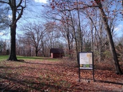
3. R. Garland Dodd Park at Point of Rocks
Chesterfield Parks and Recreation website entry:
Click for more information.
Click for more information.
On the center right is map of Civil War Earthworks in the park.
On the bottom are photos of the park flora and fauna.
Also see . . .
1. Chesterfield's Role in the Civil War - The Bermuda Hundred Campaign. Chesterfield website entry (Submitted on November 29, 2009.)
2. Point of Rocks - National Register of Historic Places. Virginia Department of Historic Resources website entry (Submitted on December 9, 2009.)
Photographed by Bernard Fisher, November 29, 2009
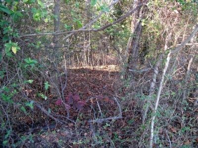
4. Civil War Earthworks at Point of Rocks
Photographed by Bernard Fisher, November 27, 2009
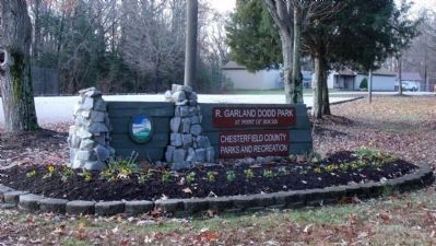
5. R. Garland Dodd Park at Point of Rocks entrance
Photographed by Bernard Fisher, November 29, 2009
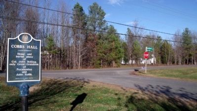
6. Cobbs Hall at Point of Rocks
Home and burial place of Col. John Bolling, only Great-Grandson of Pocahontas and John Rolfe. Erected by Ft. Henry Chapter 1966
Photographed by Bernard Fisher, November 29, 2009
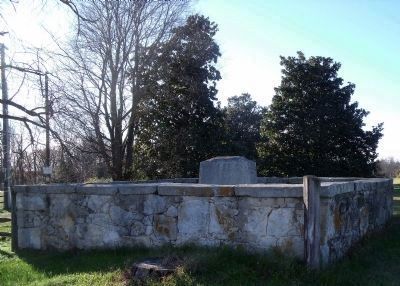
7. Cobbs Hall Cemetery
Site of the Union army signal tower at Point of Rocks.
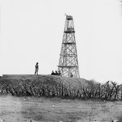
1864
8. Point of Rocks, Virginia (vicinity). Signal tower
Library of Congress [LC-B811- 2568]]
![[Point of Rocks, Virginia (vicinity).] View along river. Butler's signal tower in distance image. Click for full size.](Photos/87/Photo87791.jpg?11252005 "[Point of Rocks, Virginia (vicinity).] View along river. Butler's signal tower in distance. Click for full size.")
circa 1864
9. [Point of Rocks, Virginia (vicinity).] View along river. Butler's signal tower in distance
Library of Congress [LC-B811- 2618]

Photographed by Evan Dwyer, March 1, 2025
10. Welcome to R. Garland Dodd Park at Point of Rocks Marker
Credits. This page was last revised on April 25, 2025. It was originally submitted on November 27, 2009, by Bernard Fisher of Richmond, Virginia. This page has been viewed 3,308 times since then and 88 times this year. Last updated on April 24, 2025, by Evan Dwyer of Richmond, Virginia. Photos: 1, 2, 3. submitted on November 27, 2009, by Bernard Fisher of Richmond, Virginia. 4. submitted on November 29, 2009, by Bernard Fisher of Richmond, Virginia. 5. submitted on November 27, 2009, by Bernard Fisher of Richmond, Virginia. 6, 7, 8, 9. submitted on November 29, 2009, by Bernard Fisher of Richmond, Virginia. 10. submitted on April 24, 2025, by Evan Dwyer of Richmond, Virginia.
