Scotia in Schenectady County, New York — The American Northeast (Mid-Atlantic)
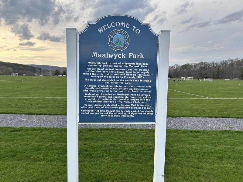
Welcome to Maalwyck Park
Photographed by Steve Stoessel, April 24, 2025
1. Welcome to Maalwyck Park Marker
Maalwyck Park is part of a dynamic landscape shaped by glaciers and by the Mohawk River.
Though flood control measures and the creation of the New York State Barge Canal have largely tamed the river today, seasonal flooding continuously reshaped the river up to the early 1900's.
The river cut channels into the south bank including one across the park.
A terrace overlooking this former river channel was heavily used around 1000 BC by Early Woodland people, who were attracted to the areas rich biotic resources.
Archeological studies at Maalwyck Park discovered numerous hearths and roasting platforms, as well as a variety of artifacts that provide insights into the rich cultural lifeways of the Native inhabitants.
The river channel slowly silted up between 1000 BC and 0 AD, after which use of the current parkland decreased sharply.
Continued flooding through the historic period has deeply buried and preserved the archeological signature of these Early Woodland occupants.
Topics. This historical marker is listed in these topic lists: Anthropology & Archaeology • Environment • Indigenous Peoples and Communities
this page online
Location. 42° 49.936′ N, 73° 59.218′ W. Marker is in Scotia, New York, in Schenectady County. It is on Maalwyck Park Road south of New York State Route 5, on the right when traveling south. Touch for map. Marker is in this post office area: Schenectady NY 12302, United States of America. Touch for directions.

Regionally, this marker is in Upstate New York, in the Capital District, and in the Albany Metropolitan Area. It is also in the American Northeast and in the Mid-Atlantic. Globally, it is in North America, the Western Hemisphere, the Western World, and the Anglosphere. Historically, it finds itself in what was once New Netherland and also one of the original Thirteen Colonies.
Other nearby markers. At least 8 other markers are within 2 miles of this marker, measured as the crow flies: Erie Canal Lock 8 (approx. 0.3 miles away); The Movable Dam at Lock 8 (approx. 0.3 miles away); Maalwyck (approx. 0.6 miles away); Enlarged Lock 23 (approx. 0.7 miles away); Enlarged Double Lock 23, Old Erie Canal (approx. ¾ mile away); Robert Allen Deitcher
Photographed by Steve Stoessel, April 24, 2025
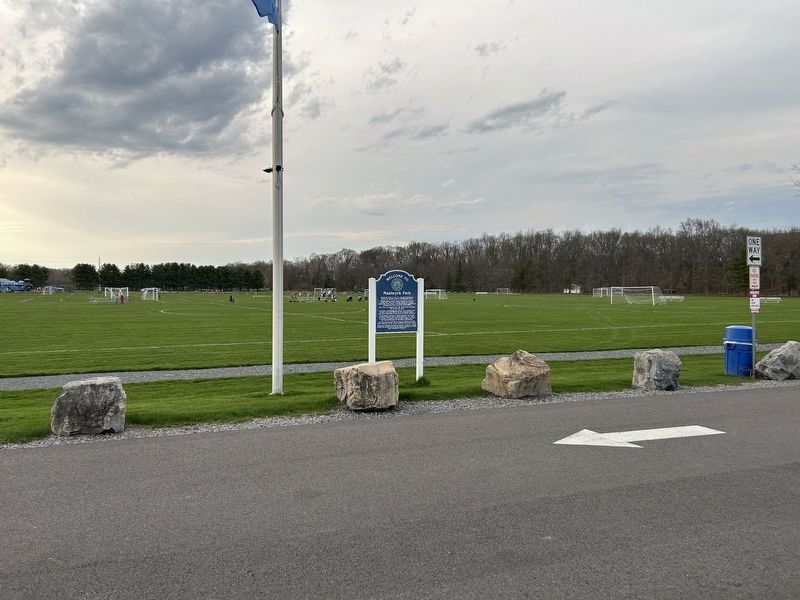
2. Welcome to Maalwyck Park Marker
Another marker is no longer nearby. Enlarged Erie Canal Lock 23 (was approx. ¾ mile away).
Credits. This page was last revised on April 24, 2025. It was originally submitted on April 24, 2025, by Steve Stoessel of Niskayuna, New York. This page has been viewed 225 times since then and 58 times this year. Photos: 1, 2. submitted on April 24, 2025, by Steve Stoessel of Niskayuna, New York.
