Queenston in Niagara-on-the-Lake in Niagara Region, Ontario — Central Canada (North America)
Chloe Cooley
Photographed by Kevin Westell, July 3, 2025
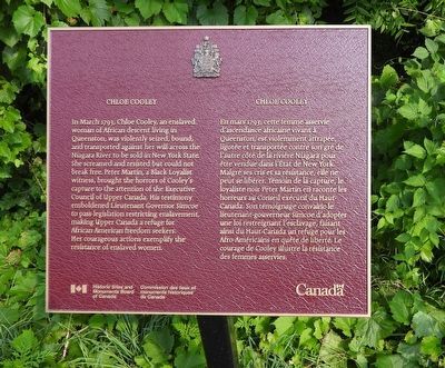
1. Chloe Cooley Marker

In March 1793 Chloe Cooley, an enslaved woman of African descent living in Queenston, was violently seized, bound, and transported against her will across the Niagara River to be sold in New York State. She screamed and resisted but could not break free. Peter Martin, a Black Loyalist witness, brought the horrors of Cooley's capture to the attention of the Executive Council of Upper Canada. His testimony emboldened Lieutenant Governor Simcoe to pass legislation restricting enslavement, making Upper Canada a refuge for African American freedom seekers. Her courageous actions exemplify the resistance of enslaved women.
En mars 1793, cette femme asservie d'ascendance africaine vivant à Queenston, est violemment attrapée, ligotée et transportée contre son gré de l'autre côté de la rivière Niagara pour être vendue dans l'Etat de New York. Malgré ses cris et sa résistance, elle ne peut se libérer. Témoin de la capture, le loyaliste noir Peter Martin en raconte les horreurs au Conseil exécutif du Haut- Canada. Son témoignage convainc le lieutenant-gouverneur Simcoe d'adopter une
this page online
Erected by Historic Sites and Monuments Board of Canada.
Topics and series. This historical marker is listed in these topic lists: Abolition & Underground RR • African Americans • Civil Rights • Law Enforcement. In addition, it is included in the Canada, Historic Sites and Monuments Board series list. A significant historical year for this entry is 1793.
Location. 43° 9.7′ N, 79° 3.019′ W. Marker is in Niagara-on-the-Lake, Ontario, in Niagara Region. It is in Queenston. It is on Niagara River Parkway, on the right when traveling south. The marker is adjacent to a roadside viewing area, part-way down the slope of the Niagara River Parkway as it descends the escarpment. Touch for map. Marker is at or near this postal address: 14340 Niagara River Parkway, Niagara-on-the-Lake ON L0S 1L0, Canada. Touch for directions.

Regionally, this marker is on the Golden Horseshoe and in Niagara Canada. It is also in Central Canada. Globally,
Photographed by Kevin Westell, July 3, 2025
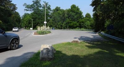
2. Chloe Cooley - Marker in context
This maroon marker is visible over the back fence of the parking lot, to the right of the black and blue garbage pails.
Other nearby markers. At least 8 other markers are within walking distance of this marker: Site of Redan Battery (within shouting distance of this marker); The Capture of the Redan and the Death of Brock (within shouting distance of this marker); The Niagara Escarpment (within shouting distance of this marker); Laura Ingersoll Secord (about 150 meters away, measured in a direct line); Roy Terrace (about 150 meters away); Attack / L'attaque (about 180 meters away); The Treacherous River Cliff / La falaise traîtresse (about 180 meters away); The Decisive Battle / La bataille décisive (about 240 meters away). Touch for a list and map of all markers in Niagara-on-the-Lake.
Another marker is no longer nearby. The Counter-Offensive Takes Shape / La contre-offensive prend forme (was about 180 meters away but has been confirmed missing).
Credits. This page was last revised on July 8, 2025. It was originally submitted on July 4, 2025, by Kevin Westell of St. Catharines, Ontario. This page has been viewed 94 times since then and 19 times this year. Photos: 1, 2. submitted on July 4, 2025, by Kevin Westell of St. Catharines, Ontario. • Andrew Ruppenstein was the editor who published this page.
