
Queenston near Niagara-on-the-Lake in Niagara Region, Ontario — Central Canada (North America)
Southern Terminus of The Bruce Trail
Photographed by J. J. Prats, October 15, 2014
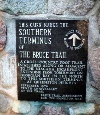
1. Southern Terminus of The Bruce Trail Marker
This cairn marks the southern terminus of the Bruce Trail, a cross-country foot trail established along or adjacent to the Niagara Escarpment extending from Tobermory on Georgian Bay in the north to this southern terminus at Queenston Heights.
Bruce Trail, Niagara to Tobermory.
September 1970
Tenth Anniversary of the trail
Bruce Trail Association, Box 722, Hamilton, Ont.
Erected 1970 by Bruce Trail Association.
Topics. This historical marker is listed in these topic lists: Environment • Natural Features • Parks & Recreational Areas. A significant historical year for this entry is 1960.
Location. 43° 9.48′ N, 79° 3.076′ W. Marker is near Niagara-on-the-Lake, Ontario, in Niagara Region. It is in Queenston. It can be reached from the intersection of Portage Road (Local Route 61) and Niagara River Parkway, on the right when traveling west. The marker is 10 metres west of Portage Road, 20 metres south-east of the traffic roundabout, near the north-east corner of the parking for Queenston Heights Park. Touch for map. Marker is at or near this postal address: Portage Road, Niagara-on-the-Lake ON L0S 1J0,
this page online

Regionally, this marker is on Ontario’s Golden Horseshoe and in Niagara Canada. It is also in Central Canada. Globally, it is in North America, on the Great Lakes, in the Western Hemisphere, in the Western World, and in the Anglosphere. Historically, it finds itself in what was once a British colony, the Viceroyalty of New France, the Haudenosaunee (Iroquois) Confederacy, and Rupert’s Land.
Other nearby markers. At least 8 other markers are within walking distance of this marker: Brock's Monument (within shouting distance of this marker); Attack / L'attaque (approx. 0.2 kilometers away); Landscape Of Nations - Six Nations & Native Allies Commemorative Memorial (approx. 0.3 kilometers away); Teyoninhokarawen (John Norton) (1770-1827) (approx. 0.3 kilometers away); Laura Ingersoll Secord (approx. 0.3 kilometers away); The Battle of Queenston Heights (approx. 0.3 kilometers away); Brock's Monument - Queenston Heights Battlefield (approx. 0.3 kilometers away); Black Militia Units In Upper Canada, 1812-1850 (approx. 0.3 kilometers away). Touch for a list and map of all markers in Niagara-on-the-Lake.
More about this marker.
Photographed by J. J. Prats, October 15, 2014
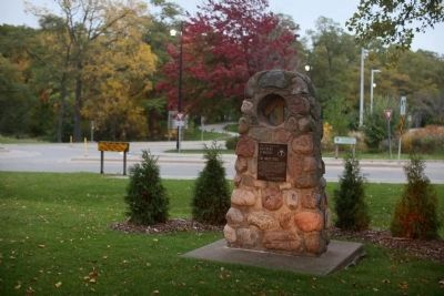
2. Southern Terminus of The Bruce Trail Cairn
When you are standing in front of this monument, you are facing south. The trail runs north, behind you.
Regarding Southern Terminus of The Bruce Trail. The trail is an approximately 900 kilometer-long marked footpath between this location and the northernmost point on the peninsula between Lake Huron proper and the lake’s Georgian Bay. It travels along perhaps ⅓ private land, ⅓ public roadways, ⅓ government land (conservation areas, provincial parks, road-allowances...) . The land it crosses is a mix of urban, farmland and forest. Unlike some long trails (like the Appalachian trail), the Bruce trail has very limited camping opportunities. While people do travel end-to-end, it is most popular for short hikes and day-trips, with side-trails often facilitating loops. Excellent maps are collected in a guide-book and also individual maps online.
Also see . . .
1. Bruce Trail Conservancy Website. “The Bruce Trail, Canada’s oldest and longest marked footpath, provides the only continuous public access to the magnificent Niagara Escarpment, a UNESCO World Biosphere Reserve. Running along the Escarpment from Niagara to Tobermory, it spans more than 890
Photographed by Jason L Miller, July 3, 2021
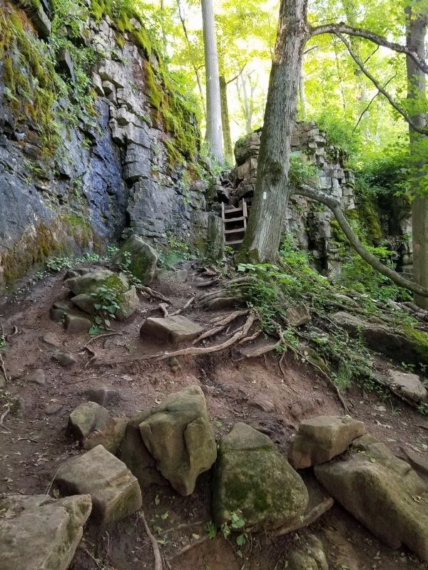
3. The Bruce Trail at Mount Nemo (Iroquoia Section)
The Bruce Trail as it climbs the Niagara Escarpment at Mount Nemo, Burlington Ontario.
2. Wikipedia entry for Bruce Trail. “There are many waterfalls along the Bruce trail, where streams or rivers flow over the Niagara Escarpment. Niagara Falls, by far the most famous watercourse in the area, can be reached by a side trail of the Bruce Trail proper. There is also a wide range of plant and wildlife along the trail, including slow-growing centuries-old coniferous trees right on the limestone lip of the escarpment itself. ” (Submitted on November 21, 2014.)
Photographed by Jason L Miller, July 23, 2020
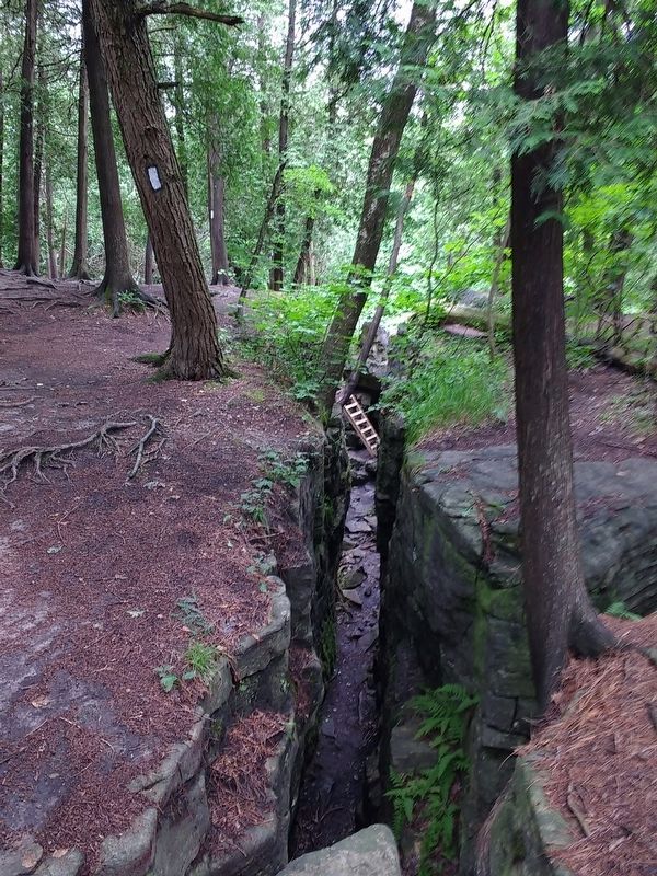
4. The Bruce Trail at Limehouse (Toronto Section)
The trail follows along a large crack in the Niagara Escarpment before descending on the ladder visible in the distance, and through a narrow passage knows as "The Hole in the Wall".
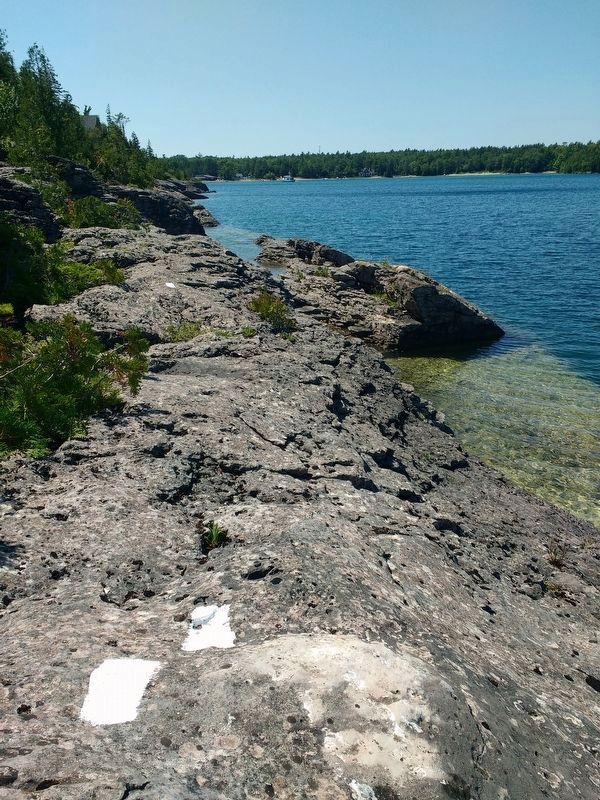
Photographed by Jason L Miller, August 11, 2019
5. The Bruce Trail at Dunks Bay (Peninsula Section)
The trail follows the rugged Georgian Bay shoreline as it approaches Dunks Bay near Tobermory
Credits. This page was last revised on October 13, 2025. It was originally submitted on November 21, 2014, by J. J. Prats of Powell, Ohio. This page has been viewed 2,083 times since then and 60 times this year. Last updated on September 6, 2025, by Kevin Westell of St. Catharines, Ontario. Photos: 1, 2. submitted on November 21, 2014, by J. J. Prats of Powell, Ohio. 3, 4, 5. submitted on December 30, 2021, by Jason L Miller of Hamilton, Ontario. • Andrew Ruppenstein was the editor who published this page.
