
Near Blacksburg in York County, South Carolina — The American South (South Atlantic)
A Kings Mountain Farm Family

Photographed by Mark Parker, October 7, 2025
1. A Kings Mountain Farm Family Marker
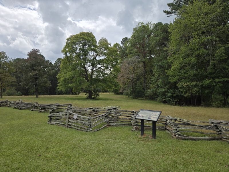
Through a war that formed this country and a war that divided it, the McElwee-Oates family owned land and worked in this area.
William McElwee, a Scotch-Irish immigrant, settled here around 1765. Neither a wealthy plantation owner nor a poor worker, he was a "yeoman farmer". Yeoman farmers owned their land—usually fewer than 150 acres—and few slaves. William's descendants prospered as the community grew. But like many Kings Mountain farm families, they struggled after the Civil War. The family gradually left the farm they had owned for more than 130 years. In 1935, the government purchased the property for what would become this state park.
[Captions:]
An 1843 inventory of John McElwee's possessions—including a 12 enslaved peoples—shows how much the family's wealth had grown. familysearch.org and South Carolina Department of Archives and History
The two-story log home—now gone—was located about 2 mi from here. The two people in this 1895 photograph may be William and Janet McElwee-Oates. Historic American Building Survey Collection, Library of Congress
Though the construction date of the house is not definite,
this page online
Erected by South Carolina State Park Service.
Topics. This historical marker is listed in these topic lists: Agriculture • Immigration • Parks & Recreational Areas • Settlements & Settlers • War, US Civil • War, US Revolutionary. A significant historical year for this entry is 1765.
Location. 35° 8.581′ N, 81° 20.141′ W. Marker is near Blacksburg, South Carolina, in York County. It can be reached from Camp Cherokee Road 0.2 miles south of Park Road (South Carolina Road 705), on the left when traveling south. The marker is located a short walking distance south of the Kings Mountain State Park Living History Farm parking area. Touch for map. Marker is in this post office area: Clover SC 29710, United States of America. Touch for directions.

Regionally,
Photographed by Mark Parker, October 7, 2025
2. Wide view A Kings Mountain Farm Family Marker
Other nearby markers. At least 8 other markers are within walking distance of this marker: Artisan With Fire (a few steps from this marker); That's So Sweet! (within shouting distance of this marker); A Looming Mystery (within shouting distance of this marker); A Valuable Resource that Grows on Trees (within shouting distance of this marker); King of Cotton / Fascinating Facts About Cotton (within shouting distance of this marker); Home Sweet Homeplace (within shouting distance of this marker); Welcome to Kings Mountain State Park (about 400 feet away, measured in a direct line); Dickey / Sherer Home (approx. 0.3 miles away). Touch for a list and map of all markers in Blacksburg.
Also see . . . Kings Mountain State Park. South Carolina Department of Parks, Recreation & Tourism (Submitted on October 10, 2025.)
Credits. This page was last revised on October 23, 2025. It was originally submitted on October 8, 2025, by Mark Parker of Hickory, North Carolina. This page has been viewed 254 times since then and 182 times this year. Photos: 1, 2. submitted on October 8, 2025, by Mark Parker of Hickory, North Carolina. • Bernard Fisher was the editor who published this page.
