Padre Island near Corpus Christi in Kleberg County, Texas — The American South (West South Central)
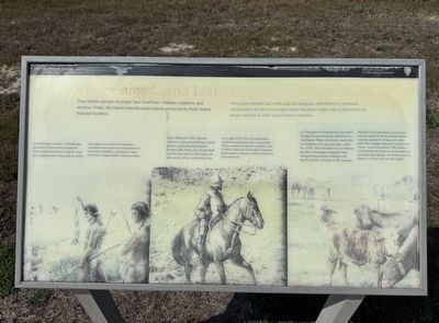
They Came ... and Left
Photographed by Dave W, February 27, 2026
1. They Came ... and Left Marker

Three distinct groups of people have lived here - Indians, explorers, and ranchers. Today, this island is mostly undeveloped, preserved by Padre Island National Shore.
Centuries ago, nomadic Coahuiltecans lived here in short-term settlements. They hunted and fished along the coast and Laguna Madres using dugout canoes.
In the 1600s and 1700s, Spanish explorers ventured north from central Mexico, expanding their empire. Around 1804, Padre José Nicolas Balli built the first ranch on this island, 26 miles north of the southern tip.
As Texas grew in population, this island changed from an isolated wilderness to ranch lands. Water on all sides made this an ideal place for open grazing - until the 1970s. Then the discovery of natural gas drew oil and gas companies here. Add growing tourism coming to the beach, and the old ways of life changed.
Spanish Translation
Hace siglos los nómadas denominados
this page online
En los siglos XVII y XVIII, los exploradores españoles se aventuraron hacia el norte desde México central para expandir su imperio. Cerca de 1804, el Padre José Nicolás Balli construyó el primer rancho en esta isla, a 42 km al norte de la punta más al sur.
Mientras Texas aumentaba en población, esta isla cambió de un despoblado aislado a ranchos ganaderos. El agua por todos lados hizo un lugar ideal para el pastoreo sin cercas – hasta la década de 1970. Entonces el descubrimiento de gas suscitó las empresas petroleras aquí. Agregue un creciente turismo playero y el viejo modo de vida cambió.
Erected by Padre Island National Seashore / National Park Service.
Topics. This historical marker is listed in these topic lists: Agriculture • Environment • Hispanic Americans • Indigenous Peoples and Communities. A significant historical year for this entry is 1804.
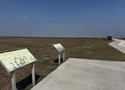
Location. 27° 29.457′ N, 97° 16.808′ W. Marker is near Corpus Christi, Texas, in Kleberg County. It is on Padre Island. It
Photographed by Dave W, February 27, 2026
2. They Came ... and Left Marker

Regionally, this marker is on the American Gulf Coast. Globally, it is in North America, a Gulf of Mexico state, the Western Hemisphere, the Western World, and the Anglosphere. Historically, it finds itself in what was once New Spain, the Republic of Texas, and one of the Confederate States of America.
Other nearby markers. At least 8 other markers are within 11 miles of this marker, measured as the crow flies: One of a Kind (here, next to this marker); Padre Island National Seashore (within shouting distance of this marker); Novillo Line Camp (approx. 2 miles away); Padre Island and Padre Nicolas Balli (approx. 7.6 miles away); The Pat Dunn Ranch (approx. 10 miles away); Coastal Hide, Tallow and Packing Industries (approx. 10 miles away); Skirmish at Corpus Christi Pass (approx. 10 miles away); Duncan Cemetery (approx. 10.6 miles away). Touch for a list and map of all markers in Corpus Christi.
Credits. This page was last revised on March 2, 2026. It was originally submitted on February 28, 2026, by Dave W of Co, Colorado. This page has been viewed 43 times since then. Photos: 1, 2. submitted on February 28, 2026, by Dave W of Co, Colorado. • James Hulse was the editor who published this page.
