Bethel Township in Berks County, Pennsylvania — The American Northeast (Mid-Atlantic)
Fort Henry
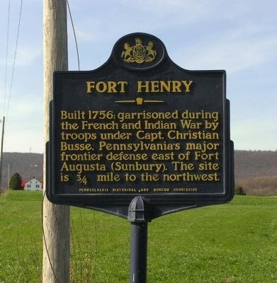
Photographed by Paul Crumlish, April 2, 2010
1. Fort Henry Marker
Erected 1959 by Pennsylvania Historical and Museum Commission.
Topics and series. This historical marker is listed in these topic lists: Colonial Era • Forts and Castles • Indigenous Peoples and Communities • Settlements & Settlers • War, French and Indian. In addition, it is included in the Pennsylvania Historical and Museum Commission (PHMC) series list. A significant historical year for this entry is 1756.
Location. 40° 29.507′ N, 76° 18.987′ W. Marker is near Bethel, Pennsylvania, in Berks County. It is in Bethel Township. It is at the intersection of Lancaster Avenue (Pennsylvania Route 501) and Fort Henry Road (Local Road 956), on the left when traveling north on Lancaster Avenue. Touch for map. Marker is in this post office area: Bethel PA 19507, United States of America. Touch for directions.

Regionally, this marker is in Southeast Pennsylvania and specifically in Pennsylvania Dutch Country.
this page online
Other nearby markers. At least 8 other markers are within 3 miles of this marker, measured as the crow flies: A different marker also named Fort Henry (approx. 0.9 miles away); Tulpehocken Path (approx. 1.4 miles away); a different marker also named Tulpehocken Path (approx. 1.4 miles away); Bethel (approx. 1.7 miles away); Pilger Ruh (approx. 1.8 miles away); a different marker also named Pilger Ruh (approx. 1.9 miles away); In Honor of (approx. 2.1 miles away); a different marker also named Bethel (approx. 2.4 miles away). Touch for a list and map of all markers in Bethel.
More about this marker. The site has been reported to be about a mile away, not the ¾ miles the marker indicates.
Related markers. Click here for a list of markers that are related to this marker.
Also see . . . Dietrich Six: Six's Fort / Fort Henry...
Photographed by Paul Crumlish, April 2, 2010
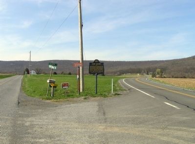
2. Wide view of the Fort Henry Marker
The Tulpehocken Path continues to the left of the sign to site of Fort Henry then up and over Blue Mountain (visible in the distance).
Photographed by Paul Crumlish, April 2, 2010
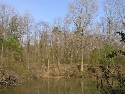
3. The site of Fort Henry
The site of Fort Henry is believed to be in the general location of this modern-day farm pond.
Photographed by Paul Crumlish, April 2, 2010
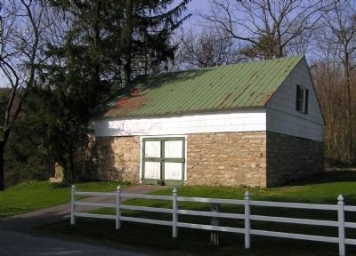
4. Modern Farm Building at Fort Henry site
Local legend indicates that this farm building was built with stone from Fort Henry
Credits. This page was last revised on February 7, 2023. It was originally submitted on April 6, 2010, by PaulwC3 of Northern, Virginia. This page has been viewed 3,249 times since then and 121 times this year. Photos: 1, 2, 3, 4. submitted on April 6, 2010, by PaulwC3 of Northern, Virginia. • Kevin W. was the editor who published this page.
