Derwood in Montgomery County, Maryland — The American Northeast (Mid-Atlantic)
Native Farming
Remarkable Montgomery: Untold Stories
⎯⎯⎯
Agricultura nativa
Montgomery Extraordinario: Historias sin contrar
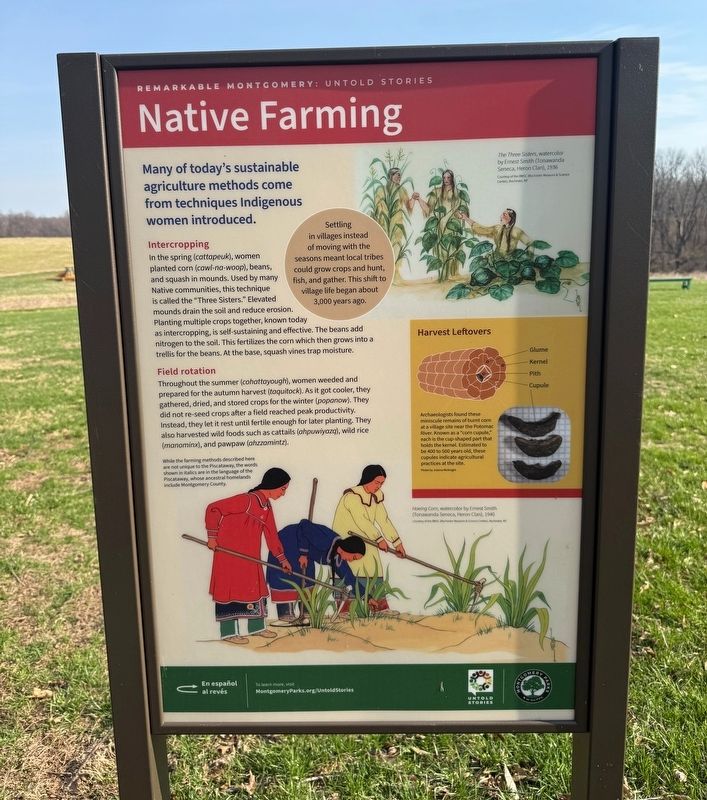

Many of today's sustainable agriculture methods come from techniques Indigenous women introduced.
Intercropping
In the spring (cattapeuk), women planted corn (cawl-na-woop), beans, and squash in mounds. Used by many Native communities, this technique is called the "Three Sisters." Elevated mounds drain the soil and reduce erosion. Planting multiple crops together, known today as intercropping, is self-sustaining and effective. The beans add nitrogen to the soil. This fertilizes the corn which then grows into a trellis for the beans. At the base, squash vines trap moisture.
Field rotation
Throughout the summer (cohattayough), women weeded and prepared for the autumn harvest (taquitock). As it got cooler, they gathered, dried, and stored crops for the winter (popanow). They did not re-seed crops after a field reached peak productivity. Instead, they let it rest until fertile enough for later planting. They also harvested wild foods such as cattails (ahpuwiyazq), wild rice (manominx), and pawpaw (ahzzamintz).
Settling in villages instead of moving with the seasons meant local tribes could grow crops and
this page online
Harvest Leftovers
Archaeologists found these miniscule remains of burnt corn at a village site near the Potomac River. Known as a "corn copule," each is the cup-shaped part that holds the kernel. Estimated to be 400 to 500 years old, these cupules indicate agricultural practices at the site.
[Captions:]
The Three Sisters, watercolor by Ernest Smith (Tonawanda Seneca, Heron Clan), 1936
While the farming methods described here are not unique to the Piscataway, the words shown in italics are in the language of the Piscataway, whose ancetral homelands include Montgomery County.
Hoeing Corn, watercolor by Ernest Smith (Tonawanda Seneca, Heron Clan), 1940
Intercultivo
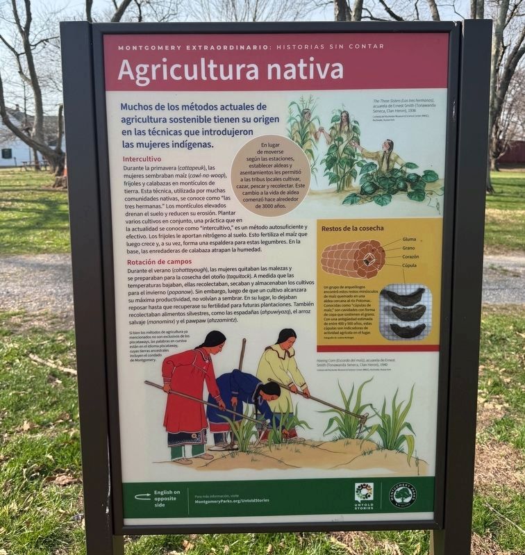
Durante la primavera (cattapeuk), las mujeres sembraban maíz (cawl-na-woop), frijoles y calabazas en montículos de tierra. Esta técnica, utilizada por muchas comunidades nativas, se conoce como "las tres hermanas." Los montículos elevados drenan
Rotación de campos
Durante el verano (cohattayough), las mujeres quitaban las malezas y se preparaban para la cosecha del otoño (taquitock). A medida que las temperaturas bajaban, ellas recolectaban, secaban y almacenaban los cultivos para el invierno (popanow). Sin embargo, luego de que un cultivo alcanzara su máxima productividad, no volvían a sembrar. En su lugar, lo dejeban reposar hasta que recuperase su fertilidad para futuras plantaciones. También recolectaban alimentos silvestres, como las espadañas (ahpuwiyazq), el arroz slavaje (manominx) y el pawpaw (ahzzamintz).
En lugar de moverse según las estaciones, establecer aldeas y asentaminetos les permitió a las tribus locales cultivar, cazar, pescar, y recolectar. Este cambio a la vida de aldea comenzó hace
Photographed by Devry Becker Jones (CC0), March 26, 2026
3. Native Farming / Agricultura nativa Marker
Restos de la cosecha
Un grupo de arqueólogos encontró estos restos minúsculos de maíz quemado en una aldea cercana al río Potomac. Conocidas como "cúpulas de maíz," son cavidades con forma de copa que sostienen el grano. Con una antigüedad estimada de entre 400 y 500 años, estas cúpulas son indicadoras de actividad agrícola en el lugar.
[Notas al calce:]
The Three Sisters (Las tres hermanas), acuarela de Ernest Smith (Tonawanda Seneca, Clan Heron), 1936
Si bien los métodos de agricultura ya mencionados no son exlusivos de los piscataways, las palabras en cursiva están en el idioma piscataway, cuyas tierras ancestrales incluyen el condado de Montgomery.
Hoeing Corn (Escarda del maíz), acuarela de Ernest Smith (Tonawanda Seneca, Clan Heron), 1940
Erected by Montgomery Parks.
Topics and series. This historical marker is listed in these topic lists: Agriculture • Anthropology & Archaeology • Indigenous Peoples and Communities • Women. In addition, it is included in the Maryland, Montgomery Parks series list. A significant historical year for this entry is 1936.
Location. 39° 9.876′ N, 77° 7.821′ W.
Photographed by Devry Becker Jones (CC0), March 26, 2026
4. Native Farming / Agricultura nativa Marker

Regionally, this marker is in the Washington Metropolitan Area. It is also in the American Mid-Atlantic. Globally, it is in North America, the Western Hemisphere, the Western World, and the Anglosphere. Historically, it finds itself in what was once one of the original Thirteen Colonies and also the Antebellum South.
Other nearby markers. At least 8 other markers are within walking distance of this marker: Agricultural Crops and Labor (within shouting distance of this marker); Hay Barracks (within shouting distance of this marker); Woodshed (within shouting distance of this marker); Broody House (within shouting distance of this marker); Chicken Coop (within shouting distance of this marker); Water Tank House (within shouting distance of this marker); Smoke House (within shouting distance of this marker); Dinner Bell (within shouting distance of this marker).
Credits. This page was last revised on March 26, 2026. It was originally submitted on March 26, 2026, by Devry Becker Jones of Washington, District of Columbia. This page has been viewed 19 times since then. Photos: 1, 2, 3, 4. submitted on March 26, 2026, by Devry Becker Jones of Washington, District of Columbia.
